Post Summary: The Best Scenic Drives In Washington State, What To See, And How To Get There
I think you can agree with us when we say…the road trip possibilities are endless in Washington State!
From the temperate rainforests of the Olympic Peninsula to the high desert in the east, there is so much to see and do in Washington State! The problem is – with so many routes to take, how do you know which ones are the best?
We joined forces with some of Washington’s brightest and well-traveled bloggers to bring you the best scenic drives in Washington State! We’re covering everything from food tours to photo spots, hikes to historic landmarks, and so much more. Now, grab your car keys, and let’s take an adventure!

What To Pack In Your Car For A Washington Scenic Drive
In order to make the most of your scenic drives in Washington, it’s important to pack your car with all the road trip essentials. Here’s what we suggest taking with you:
Snacks and Water. To cut down on unnecessary stops, pack your car with your favorite snacks, and fill up some reusable water bottles to stay hydrated on the road. If it’s an early drive, we like to brew coffee and carry it with us in a thermos to stay warm all morning.
Navigation Apps. Is there anything worse than getting lost and not having cell service to get you back on track? Download these essential road trip apps to help you find your way, with and without service. Oh, and pack a paper map, too!
Feeling like you want to stay overnight instead? Download the app The Dyrt. With The Dyrt Pro membership, you can easily run campground searches offline and find free spots on BLM and National Park land for easy camping. Try the app for free for 30 days using our code Mandagies!
Phone Chargers. Berty and I purchased phone chargers that permanently live in our car. Along with phone cords, we put this inverter in the middle console to charge phones as well as laptops on longer drives!
Road Trip Entertainment. Being in the car is part of the fun when driving these Washington scenic byways! Download our list of 101 road trip questions and save episodes from these epic road trip podcasts for some in-car entertainment.

The Best Scenic Drives In Washington State Picked By Local Experts
Some of these Washington State scenic drives have been submitted by local experts and Washington natives. We’ve linked the authors below in their excerpts, so if you’re interested in learning more, check out their websites!
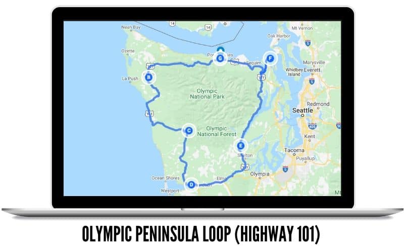
Olympic National Park Loop (Highway 101)
- Route Length: 350 – 600 miles (Depending on side trips)
- Best Time To Drive: Spring, Summer
- Points of Interest: Washington Coast, Olympic National Park, Hoh Rainforest
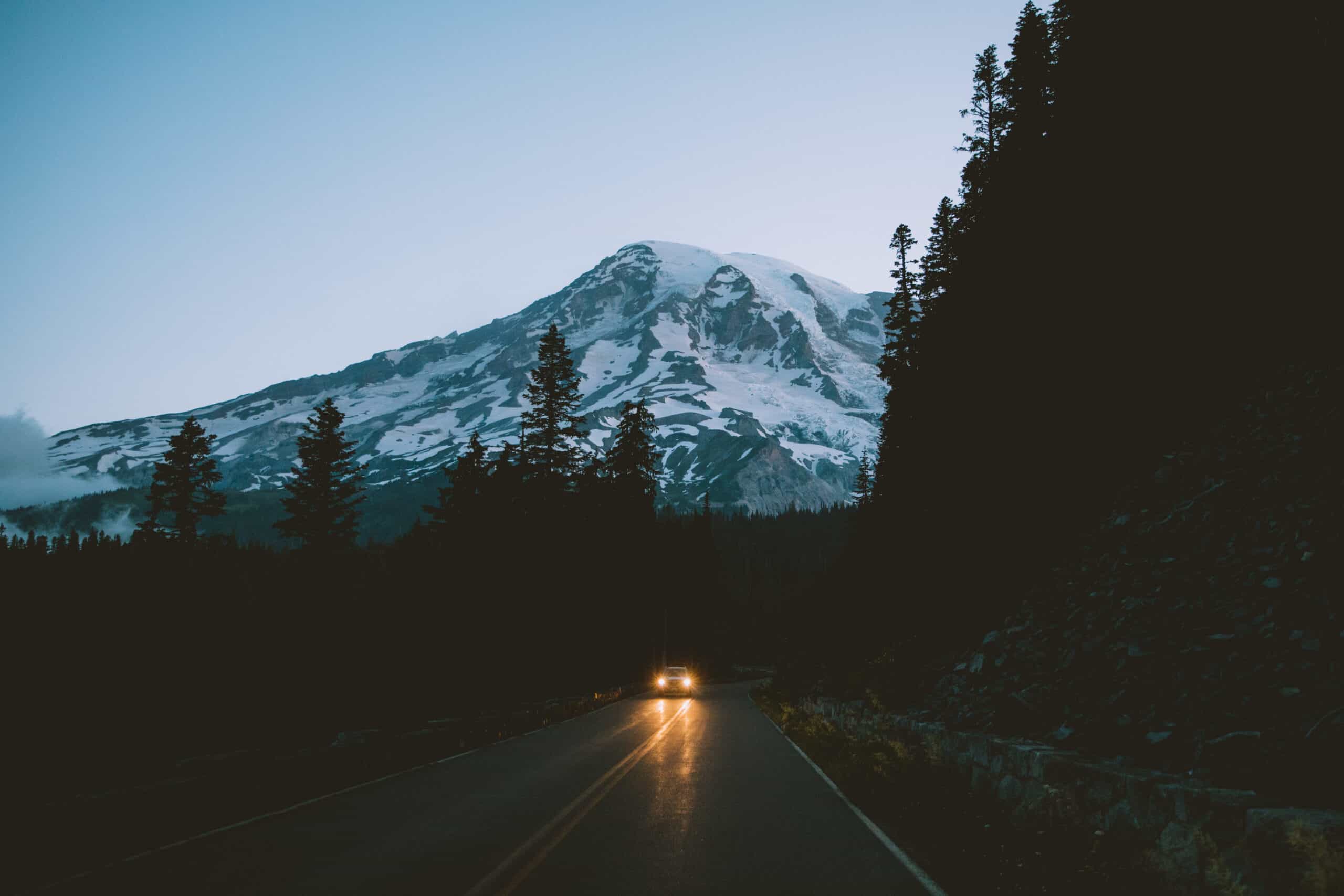
The Olympic Peninsula Road trip is a perfect Washington scenic drive to take if you love national parks, history, and lush green forest drives. It’s one of the most iconic west coast road trips in Washington state!
With this Washington scenic drive covering up to 600 miles, it’s surely not something you can feasibly do in a day.
This is why we’ve put together the best 4-5 day trip around the Olympic National Park, perfect to get your national park fix without venturing too far away from home.
The best time to drive Highway 101 in Washington is during the summer months.
The days will be mostly sunny, and you can enjoy the beaches in Washington without fear of getting completely soaked by the rain. You might also experience an amazing sunset on the Pacific Ocean – our favorite spot to witness it is at Rialto Beach!
Some side trips from Highway 101 include the beautiful Cape Flattery (the most NW corner of the lower 48 states), hiking around Hurricane Ridge, and maybe even trying an overnight camping trip on La Push Beach.
Of all the scenic drives in Washington, this one has some of the most diverse landscapes to discover!

Snoqualmie Pass (Interstate 90)
- Route Length: 298 miles total from Seattle to Spokane
- Best Time To Drive: Spring, Fall
- Points of Interest: Seattle, Snoqualmie Falls, Columbia River Bridge, Spokane
Interstate 90 in Washington may just seem like the quickest way to get from Seattle to Spokane, but there are actually quite a few stops to check out along the way!
It’s actually one of the most scenic drives in Washington, especially crossing the mountains.
The 97 mile stretch from Seattle to Ellensburg is also called the Mountains to Sound Greenway, because it’s lined with lush evergreen trees practically the whole way!
Most of the popular stops can be found near Snoqualmie Pass – there are Washington hiking trails in practically every direction!
Here are some of our favorite hiking trails near Seattle, and the mile markers you can find them:
- Poo Poo Point (Exit 17)
- Mount Si and Little Si (Exit 32 North)
- Rattlesnake Ledge Trail (Exit 32 South)
- Mailbox Peak (Exit 34)
- Snow Lake Trail (Exit 52)
- Kendall Katwalk (Exit 52)
- Franklin Falls (Exit 52)
- Gold Creek Pond (Exit 54)

Going all the way to Spokane? Make sure to stop by the Wild Horse Monument and Columbia River Overlook on the east side of the bridge from Vantage. These spots have some of the most spectacular views of the river, as well as the high desert of Washington State.
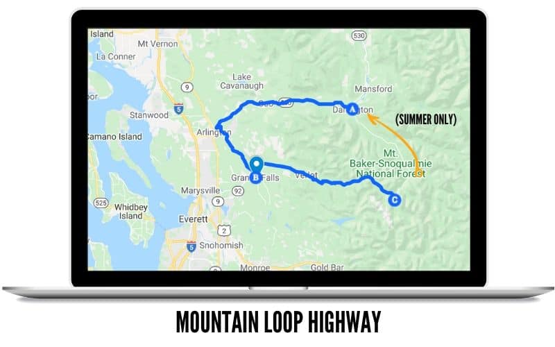
Mountain Loop Highway
- Route Length: 97-mile loop
- Best Time To Drive: Summer, Fall
- Points of Interest: Hikes, Ice Caves, Camping, Ghost Towns
Submitted by Angela Crampton of Angela Travels
The Mountain Loop Highway is a great option for a scenic day drive in Washington. The road connects Highway 530 and Mountain Loop Highway to make a loop, with a common start either at Granite Falls to the west or Darrington to the east.

Winding through the Cascades Mountain Range on Mountain Loop Highway, you won’t find lasting sweeping mountain views. What you’ll find instead is lush green trees and a chance to stretch your legs at Barlow Pass or Washington hiking trails like Mount Pilchuck, Heather Lake, Lake Twenty-Two, the Big Four Ice Caves, and Gothic Basin (a longer overnight backpacking option).
It’s one of the best scenic drives in Washington to take if you love hiking breaks!
Part of the road is paved and the other part isn’t. Having a car with some clearance will make the drive less stressful. Plan to drive the road in the late spring or early summer when it opens through the fall. The unpaved section of the road does close during the winter months.
Make it an overnight trip and disperse camp along the forest road, but don’t forget to Leave-No-Trace. If you don’t want to take the unpaved section, you can stop at the Gothic Basin Trailhead, and take the long (but worth it) side hike to Washington’s very own ghost town of Monte Cristo.

The direction of the drive doesn’t matter and this is a really great day trip from Seattle. It’s a great option even for rainy day adventures.
Off the Highway 530 section of the loop, you’ll drive through and see the remains of the 2014 Oso mudslide. Darrington is a small community where you’ll have big mountain views of Whitehorse Mountain or Three Fingers. Keep an eye out for climbers on some of the slab rock walls!
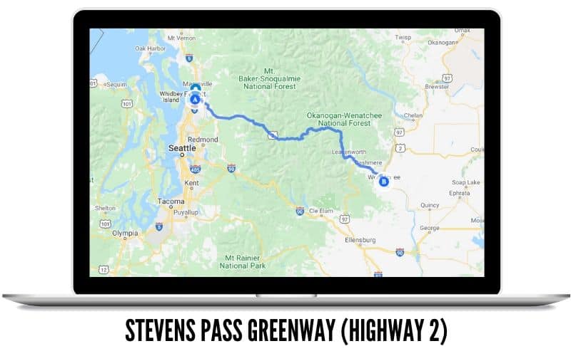
Stevens Pass (Highway 2)
- Route Length: 234 miles out and back from Seattle to Leavenworth
- Best Time To Drive: Autumn Season
- Points of Interest: Lake Wenatchee, Leavenworth, Cascade Hikes
Submitted by Tessa Pilz from PNW Fulfilled
If you’re anything like me, you look forward to the Autumn season not just for the sweaters and pumpkin-spiced goodies, but because you crave the fall foliage. That’s why every year, I hop in my car and make a day trip to drive along Highway 2. It’s one of the most popular scenic drives in Washington for the sheer beauty!
I have made this out-and-back drive from Seattle to Leavenworth since I was a child and it never gets old. Whether it’s the nostalgia and memories of driving with my parents or the ever-changing tree growth patterns that I recognize today, my heart falls a bit deeper in love with this drive as the years pass.

If you’re driving from Seattle straight to Leavenworth it will take you just over two hours. However, I recommend you make a few stops along the way.
Places like Wallace Falls, Lake Serene/Bridal Veil Falls, and Scenic Hot Springs can be enjoyed just with a quick turnoff from Highway 2.
Love fire lookouts? Check out the Heybrook Lookout in Index for a steep but quality hike for amazing views of the Cascade Mountains.

Worried about getting lost? You really can’t get lost; it’s a highway after all. So with that, make the trip your own.
Pull the car off the road and into the turnouts as many times as you want. Stop to take another photo of those gosh darn beautiful leaves. Not many people make this drive mid-October so you’ll have most of the road to yourself. But please, out of safety, only turn off the road if it’s onto your side of the road.
There is no need to cross traffic as you’ll be returning home on the exact same road. Just make a mental note of the mile marker and stop on your way back.

Once you get to Leavenworth, you can turn right back around or if you have some time, perhaps grab some lunch and make your way over to Waterfront Park.
Set on the river with over 3 miles of walking trails, Leavenworth’s Waterfront Park is overflowing with fall foliage photo opportunities. After a walk around town, hop back in the car and make your way back up and over Highway 2.
Want to stay longer? Here’s the Perfect Leavenworth 3-Day Itinerary
Once again, pull over into any and all possible turn-outs you see along the way, including a stop at Lake Wenatchee for kayaking or canoeing. Of all the scenic drives in Washington, there are so many random, beautiful viewpoints that are completely unmarked on this route. So when in doubt, make the stop to snap some shots!
Above all else, enjoy the colors, take a deep breath of fresh air, and drive safe!
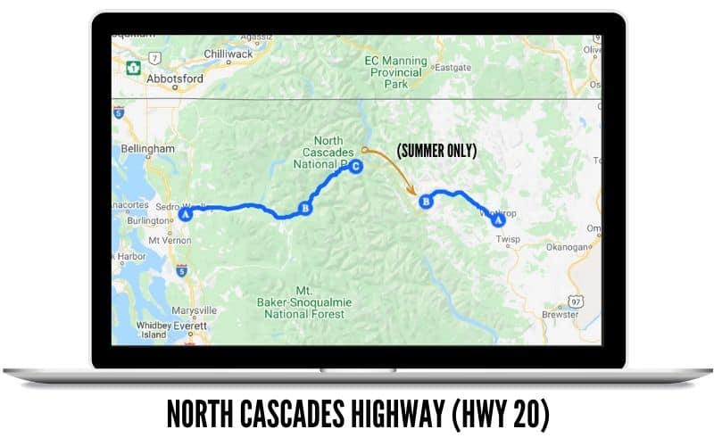
The North Cascades Highway (Highway 20)
- Route Length: 250 miles out and back from Sedro-Woolley to Winthrop
- Best Time To Drive: Late Summer (July, August, September)
- Points of Interest: North Cascades National Park, hikes, lakes
Love Washington National Parks but don’t particularly love the crowds? Take a drive through North Cascades National Park!
The iconic Highway 20 is often called the North Cascades Highway as it is the main road to nearly all the stops in the park. It was also the very first national scenic route in the United States, which means there is plenty for you to see!
You’ll begin your drive along the Skagit River, passing by farmland and orchards. The best time to take this scenic drive in Washington is in late summer when you can explore the park and pick some fresh produce like apples and blueberries.

Some of the most beautiful stops are at Diablo Lake Overlook, Washington Pass Observation Site, and the long (but worth it!) hiking trail to Heather/Maple Pass. For shorter trails, check out Happy Creek Nature Trail, Rainy Pass Picnic Area, and Gorge Creek Falls.
Begin your Washington scenic drive on Sedro-Woolley (Exit 230 off of Interstate 5) and drive east.
You’ll pass plenty of opportunities to enjoy the surrounding lakes, so pack a canoe or kayak if you have one! Shannon Lake, Baker Lake, Ross Lake, and Diablo Lake are all great choices for water recreation.
It’s one of the best scenic drives in Washington if you love the mountains, lakes, and forest!

From the small towns of Concrete, Rockport, and Marblemount, there are several roads off Highway 20 that bring you to epic hiking trails and even fire lookouts!
Hidden Lake Lookout and Park Butte Lookout are the most popular for day hikes and overnight trips. Make sure to fill up your tank with gas in one of these towns, because as you drive farther east, there isn’t another gas stop for 90 miles until near Winthrop!
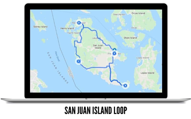
San Juan Islands (By Boat!)
- Route Length: 40-mile loop
- Best Time To Drive: Summer, Fall
- Points of Interest: Whale watching, farmland, historic sites
This awesome Washington State scenic drive can actually be experienced by car, bike, or even sailboat!
If you are driving your own car, the easiest way to reach San Juan Island is via the Anacortes ferry to Friday Harbor.
No car? No problem. Make a weekend out of it by walking by foot on the Victoria Clipper from downtown Seattle to Friday Harbor, and look for whales on your way up to Puget Sound.

Once on the island, your starting point will be in the town of Friday Harbor. You can either start clockwise or counterclockwise – it doesn’t matter! Before leaving town, stop by The Whale Museum and the San Juan Historical Museum.
On the opposite side of the island, get out and stretch your legs at Roche Harbor. Walk around the boardwalks, grab some ice cream, and enjoy the manicured lawns and gardens of this affluent yacht community.

Continuing on your journey, you can stop by English Camp and Lime Kiln Point State Parks. These are popular places to spot whales, so keep your eye on the water as you stroll the trails! It’s one of the most scenic drives in Washington if you are wanting to stop and watch for marine life.
On the southernmost point of your drive will be San Juan Island National Historical Park. This is a place to learn about the history of the war and the role the San Juan Islands played.
For even more fun stops, consider Krystal Acres Alpaca Farm, Pelindaba Lavender Farm, San Juan Ziplining, and Paula West Pottery to browse handmade gifts and one-of-a-kind experiences.
Can’t get enough of the San Juan Islands? Hope on an inter-island ferry and make your way over to Orcas Island to drive the popular Horseshoe Highway for more options for scenic drives in Washington.
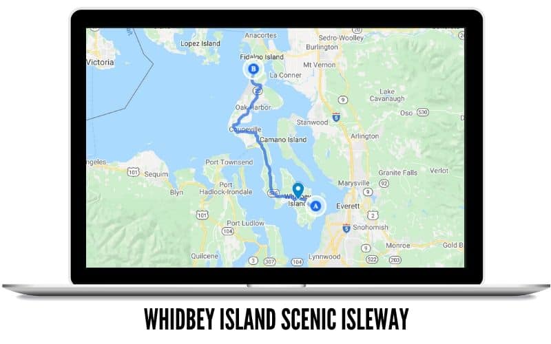
Whidbey Island Scenic Isle Way
- Route Length: 60 miles (With a ferry ride from Seattle)
- Best Time To Drive: Spring, Summer, Fall
- Points of Interest: Historic piers, Puget Sound adventures, fresh seafood
Submitted by Marissa Pedersen from Postcards To Seattle
For one of the easiest scenic drives in Washington for a day trip, head to Mukilteo to take the short ferry ride across to Whidbey Island.
Driving the length of the island only takes about an hour, but you can turn it into a longer drive by visiting several stops along the way. Spring through fall is the best time to visit, as you’ll have the most vibrant colors present on your drive.

When you get off the ferry, head to the nearby town of Langley. You’ll be able to sample local food at a dozen different restaurants, including freshly caught seafood. There are also plenty of boutique shops to pick up souvenirs.
After that, head up to the middle of the island to visit Coupeville. At one time, they painted all the downtown stores white for the film scenes in the movie Practical Magic!
You can go to nearby Ebey’s Landing, which is a moderate hike providing beautiful water views. History buffs will love stopping at Fort Casey to see old bunkers at this once active fort.

When you’re done, head north to visit the stunning Deception Pass State Park.
This is one of the most photographed spots in Washington State thanks to the beautiful blue-green water and whirlpools that swirl far below the bridge.
You can head back down Whidbey to take the Mukilteo ferry back home. Alternatively, you can cross over the Deception Pass bridge to head towards I-5 for an easy day trip from Seattle.
Of all the scenic drives in Washington, this route has a lot of diversity of landscape!

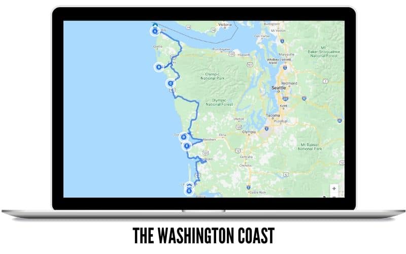
The Washington Coast
- Route Length: 260 miles
- Best Time To Drive: All Seasons
- Points of Interest: Beaches, Tide Pools, Sea Stacks
Love scenic drives in Washington by the water? If you’re itching to see the ocean, drive Highway 101 the entire length of the coast to experience ALL the most iconic Washington beaches.
Because of its distance from major cities, this Washington scenic route is probably best taken as a weekend trip from Seattle. You could also do a section of it as a day trip if you lived in a nearby city like Olympia.
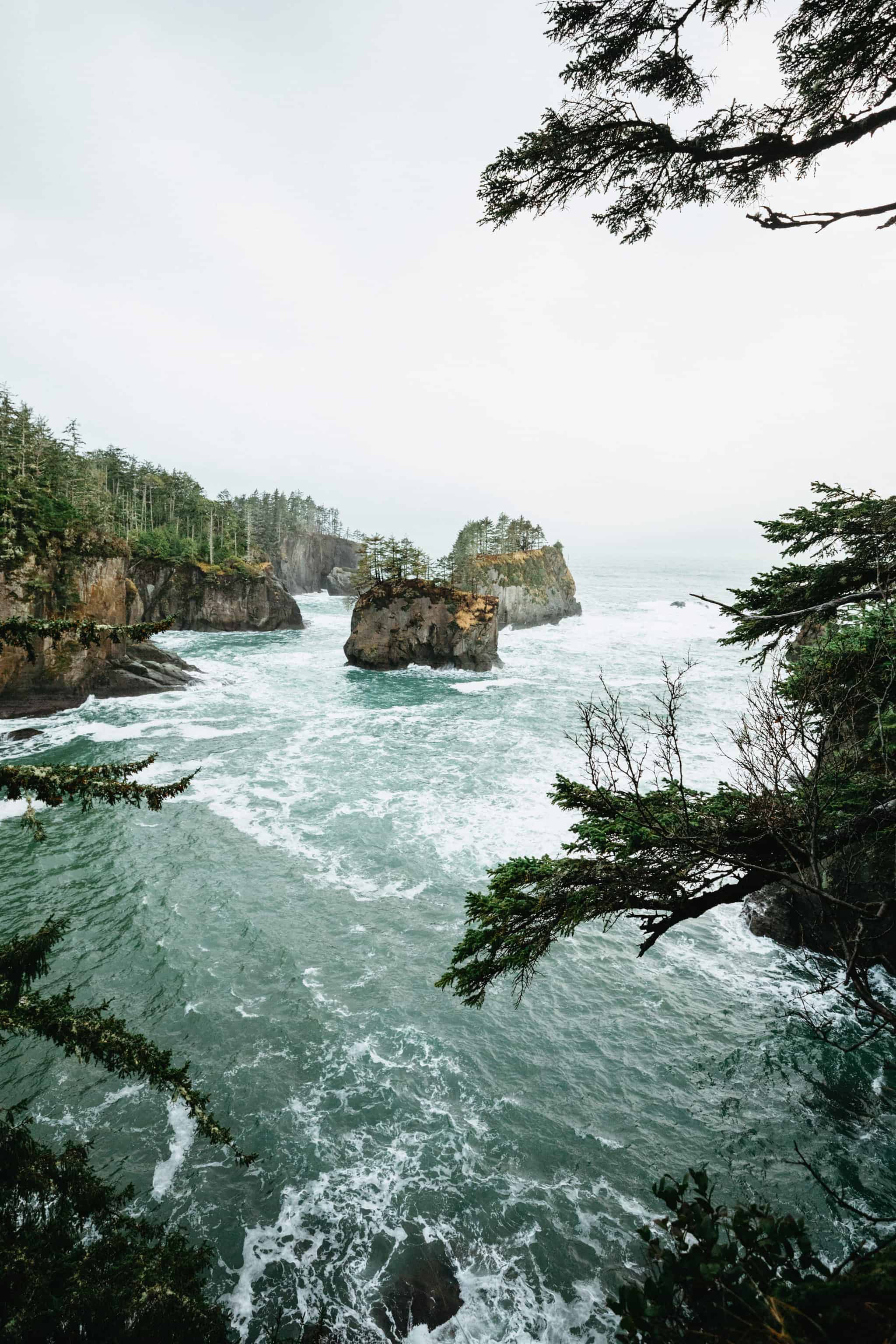
Start at the very northwest corner of Washington State, in Cape Flattery.
Cape Flattery is one of Washington’s most photogenic locations. All-inclusive with offshore sea stacks, hidden coves, and panoramic ocean views!
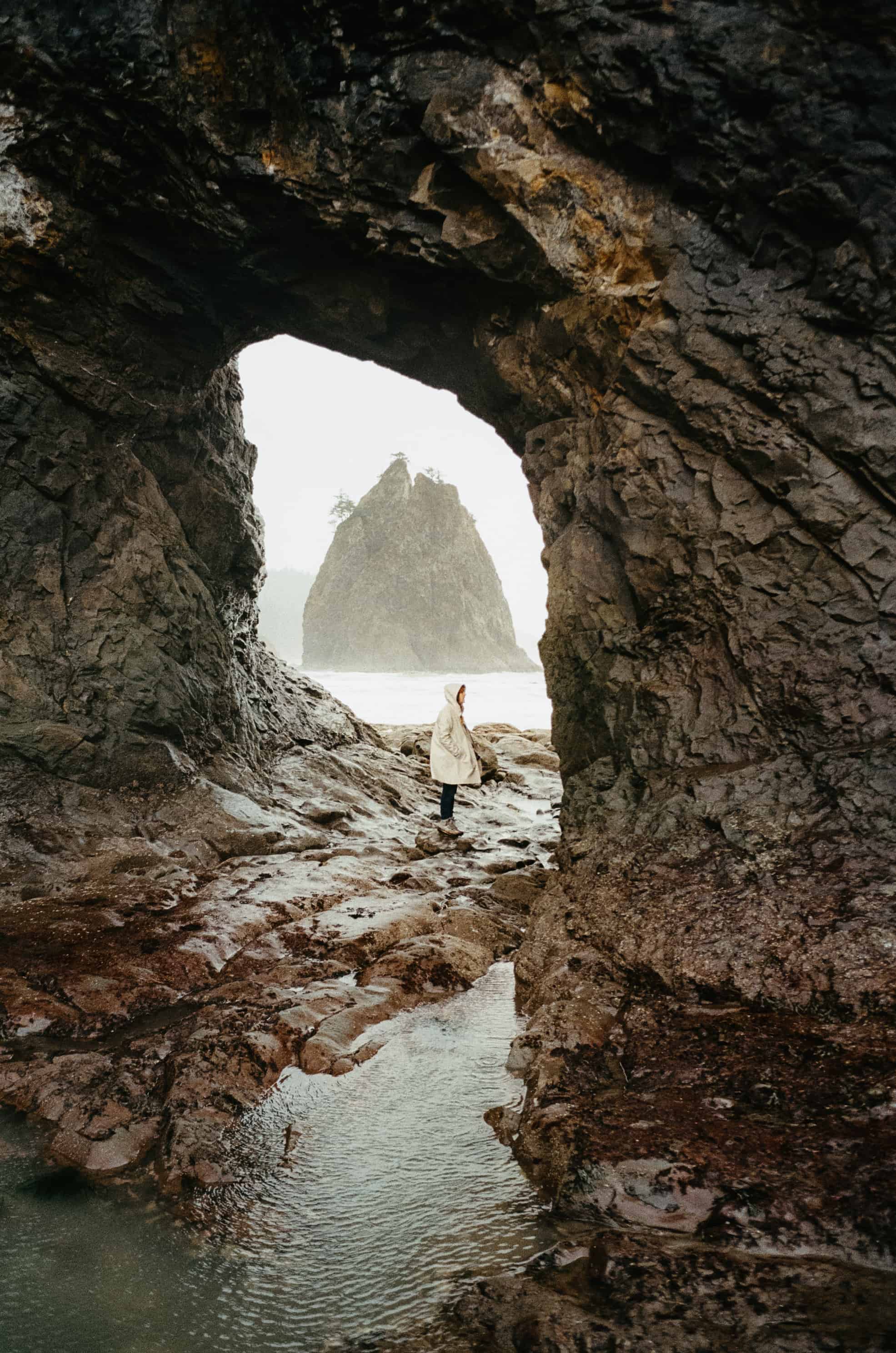
Continuing south, you’ll encounter Rialto Beach after going west from the small town of Forks, Washington.
Here, you can enjoy a picnic beside piles of sun-bleached driftwood logs, or venture up the beach to discover the jaw-dropping Hole-In-The-Wall.
Other great stops on this scenic drive in Washington include the easily accessible First Beach, Second Beach (with a 15-minute hike), and Ruby Beach.
At all three beaches, you can enjoy the iconic sea stacks that dot the Washington coast, climb over fallen driftwood, and explore tide pools teeming with marine life.
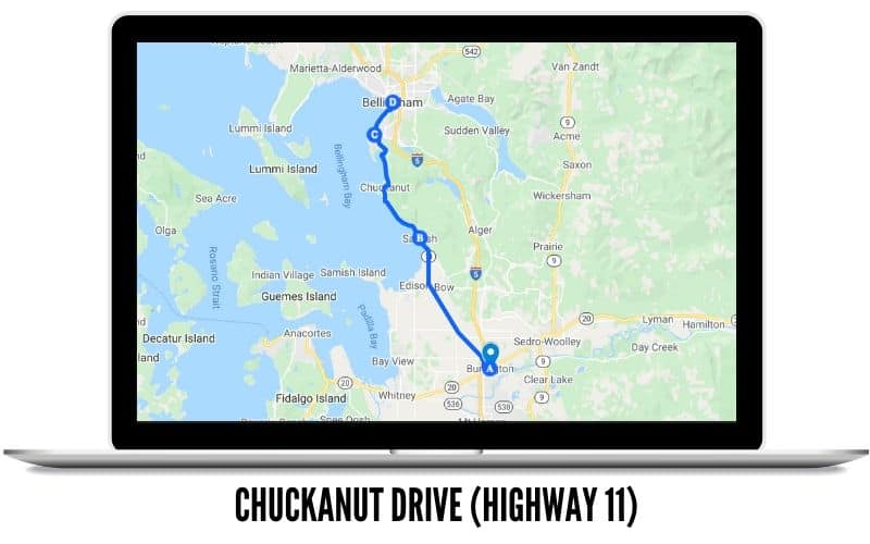
Chuckanut Drive (Highway 11)
- Route Length: 25-miles from Burlington to Bellingham
- Best Time To Drive: Spring, Fall
- Points of Interest: Flower Fields, Farms, Breweries
Submitted by Adria Saracino from The Emerald Palate
Chuckanut Drive is a 20-mile, out-and-back scenic drive through an agricultural area of Washington that’s known for its natural beauty and food producers.
Sometimes referred to as WA State Highway 11, it starts off I-5 exit 231 and runs north-to-south between Burlington and Bellingham. Since it starts about 1.5 hours north from Seattle and only takes about 40 minutes to drive without stops, it makes for a great Seattle day trip.
Expect to see breathtaking views of the San Juan Islands from this two-lane road that hugs the cliffs of Samish Bay.
The best views are between late spring and fall, as the winter months in Washington tend to be gray. April is a great time to visit if you want to add the popular Skagit Valley Tulip Festival to your itinerary.
In the fall, you can plan to see maple trees dotting the road with vibrant yellow, orange, and red leaves.

While Chuckanut Drive is relatively quick and beautiful from the car, it can also be the perfect jumping-off point for exploring lesser-known areas.
If you like hiking near Seattle, there are plenty of options for all skill levels. Larrabee State Park has easy trails for exploring forests, beaches, and tide pools. Or if you prefer more exertion, check out the Oyster Dome Trail (sometimes called Bat Caves Trailhead).
Chuckanut Drive weaves through an area that’s perfect for a food-lover’s retreat in Washington.
Make sure to stop for oysters during your journey, as Samish Bay is a popular spot for oyster farming. The most famous is Taylor Shellfish Farms, but a more off-the-beaten-path experience is visiting Blau Oyster Farm to enjoy a bottle of wine alongside raw and grilled oysters in a more casual setting.
Or if beer is more your thing, visit about 15 breweries in the area, many of which source malts from within Skagit County.

Shoppers should stop in the town of Edison for a small street with boutiques and galleries featuring goods from local artists. Or get out to stretch your legs at the end of Chuckanut Drive in the Historic Fairhaven District, which is known for its Victorian-style architecture and quaint shops.
Whether you prefer adventure, food, or shopping, Chuckanut Drive is one of the best Washington scenic drives because it has a little something for everyone.
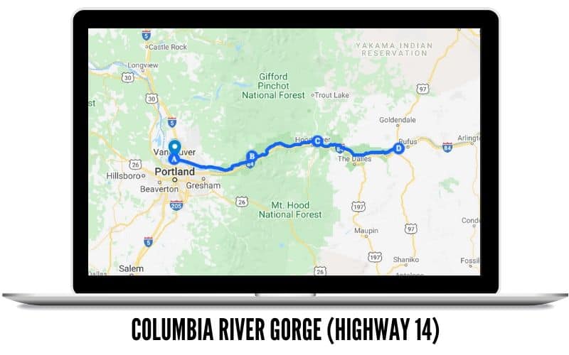
Columbia River Gorge (Highway 14)
- Route Length: 109 miles (Vancouver, WA to Maryhill, WA)
- Best Time To Drive: Spring, Fall
- Points of Interest: Columbia River, Washington waterfalls, historic sites
The Columbia River Gorge Drive, also called the Lewis and Clark Memorial Highway was carved out millions of years ago by the Ice Age, Missoula floods, and the surrounding Cascade mountains.
This scenic drive in Washington follows the Columbia River the entire way, with panoramic views and pullouts scattering the route’s length.
Without stopping, the drive would take you about 4 hours total, from Vancouver, WA to Maryhill, WA, and back. However, there are plenty of attractions to see on the way, so plan to give yourself a whole day to explore the route.
From Vancouver, your first stops would be Fort Vancouver National Historic Site (covered by the America the Beautiful Pass) and Beacon Rock State Park. Here is a great place for history buffs to explore stories from the past, and walk a bit in Lewis and Clark’s shoes!
You can also take the wildly popular Dog Mountain trail to see sweeping fields of spring wildflowers. That’s just one of the many things to do in the Columbia River Gorge.
If you’re into Columbia River Gorge waterfalls, Dog Creek Falls, Rodney Falls, and Hardy Falls are all on the Washington side.

You may think that the Oregon side has all the awesome waterfalls, but think again!
Washington has its fair share of gorgeous waterfalls too, like Oregon! Washington’s are just more tucked away in the old-growth forest in the Cascade Mountains.
Some of the most popular falls to visit on the Washington side include Falls Creek Falls, Panther Falls, and Lower Lewis Falls.
Rounding out the end of one of the prettiest scenic drives in Washington, take some time to stretch your legs at Crawford Oaks Trail for gorgeous spring wildflowers.
Finally, end your day at Maryhill Stonehenge to catch an epic sunset!
Don’t want to drive home? Cross the Bridge of The Gods and stay overnight in Hood River. In the morning drive the Oregon side of the Columbia River Gorge on the way home!

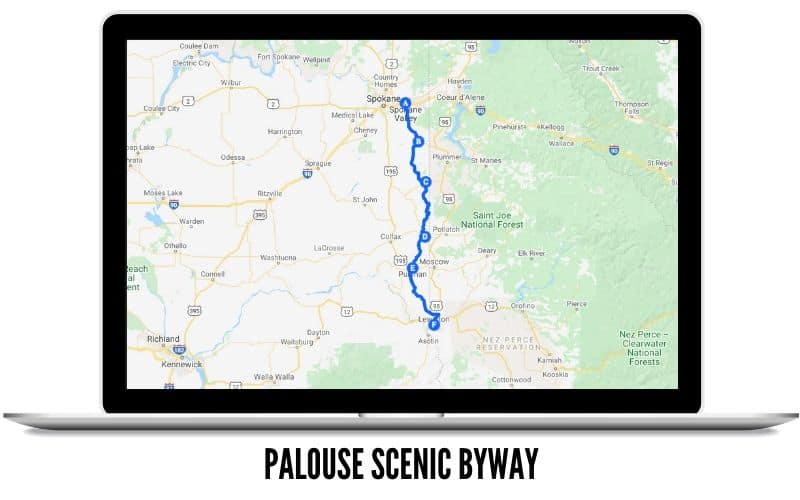
The Palouse Highway (Highway 195)
- Route Length: 120 miles (from Spokane,WA to Lewiston, ID)
- Best Time To Drive: Spring, Summer, Fall
- Points of Interest: Farmland, small towns, rolling hills
Probably one of the most scenic drives in Washington state is the Palouse Scenic Byway.
The rolling hills and farmland of southeast Washington are unlike any other in the state. Here, there are plenty of opportunities to explore these areas and support local businesses along the way!
This route goes through US Highways 27, 95, and 195, but can even be extended along more state routes too!

Similar to many other scenic drives in Washington state, there are many small towns to stop at, although pay attention because you might miss them!
Some have just one single main street, while others have several blocks to explore. You’ll pass through the towns of Freeman, Opportunity, Tekoa, Oakesdale, Palouse, and Colfax.

If you’re itching to get out of the car and move your body, check out Steptoe Butte State Park for great views of the rolling hills from above.
Kamiak Butte has similar views, and these are popular Washington State photo locations for those landscape shots of expansive farmland.
If you come in the fall, there are countless farms open for u-pick harvesting, including apple orchards, pears, pumpkins, and more! Make sure to stop in Pullman for a grounds tour of Washington State University as well.
The fall colors that surround the campus will make for a relaxing and gorgeous drive! Pullman is the largest town along the Palouse Scenic Highway, so this is a great stop for a meal along your route.

On your way down US-195, you’ll take the steep grade hill into Lewiston, Idaho.
For a more adrenaline-packed drive, opt for the old Spiral Highway, the windiest (and likely most dangerous) road in the state!
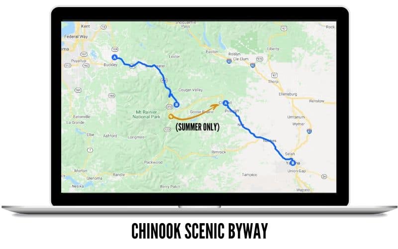
Chinook Scenic Byway (Highway 410)
- Route Length: 96 miles from Enumclaw to Yakima
- Best Time To Drive: Summer, Fall
- Points of Interest: Mount Rainier National Park, wineries, hikes, farmland
Submitted by Jennie Flaming of Ordinary Adventures
Looking for one of Washington’s best scenic drives through temperate rainforest to sunny desert wine country? If so the Chinook Scenic Byway is a must-do trip for you! Photo opportunities, Washington hiking opportunities, fruit stands bursting with local fruits and vegetables, and wine tasting meet you on this epic road trip from Seattle.
Drive south and east from Seattle towards Enumclaw and through the east side of Mt Rainier National Park. This will take you over Chinook Pass and along the Naches River to Yakima.
This drive is accessible from late May when Chinook Pass opens until November when it closes for the winter. The best time for this drive is late July and early August for wildflowers and September for fall colors.
The types of fruit you’ll find for sale in the Yakima Valley range from cherries (May and June) to Peaches (late July and August) to Apples (August through October) to name a few. Wineries are open all year!
If you want to make this drive a loop, from Yakima, you’ll go north on Canyon Road to Ellensburg and then meet up with I-90 to return west to Seattle.
The total loop drive is about 300 miles and about 6 hours of driving time.
Do you want to break it up into a weekend trip? Try dispersed camping along the Naches River between Chinook Pass and Naches, or staying overnight in Yakima.
Highlights along this Washington scenic drive include:
- Chinook Pass – Hiking the Naches Peak Loop Trail for great views and wildflowers! (late July and early August) If you don’t hike, stop here anyway to see the great view of Mt Rainier and wildflowers in season.
- Stop along the scenic Naches River – several trailheads and campgrounds are along Highway 410 between Chinook Pass and the small town of Naches.
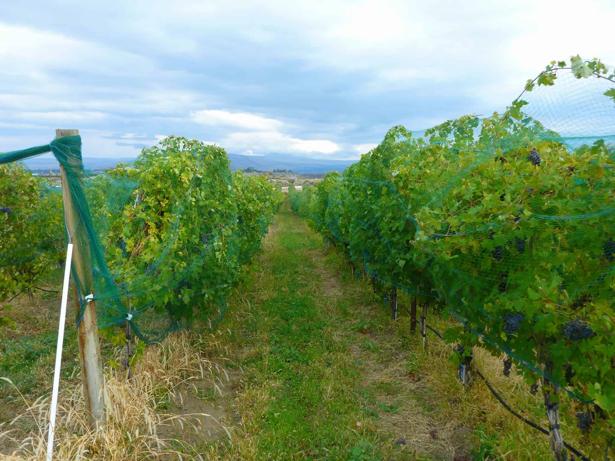
- Wine Tasting – The heart of Washington’s wine country is the Yakima Valley. Stop at one of the many wineries you pass along this route. You can even hike to one in Cowiche Canyon!
- Drive Canyon Road between Yakima and Ellensburg and look for sheep. You can also enjoy a hike here in Umtanum Canyon.

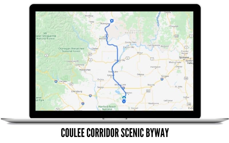
Coulee Corridor National Scenic Byway
- Route Length: 150 miles from Omak to Othello
- Best Time To Travel: Summer, Fall
- Points of Interest:Basalt cliffs, geological rock formations, caves, lakes, birds and wildlife, Grand Coulee Dam
Submitted by Gayle Picken from Day Trips In Washington
Carved by massive ice age floods, the Coulee Corridor National Scenic Byway is a 150-mile route from Othello to Omak in Central Washington.
The drive feels like a different world. It takes you past huge basalt cliffs, a chain of large blue and turquoise lakes, ancient caves in high cliffs, and an enormous former waterfall site four times the size of Niagara Falls.
The Coulee Corridor is one of the best scenic drives in Washington if you love geology!

Pack a picnic, bring binoculars and a Washington Discover Pass, and make sure your camera batteries are charged—the views are breathtaking and there are many pullouts along the way.
Although the entire drive takes 3.5 hours one-way, you can explore shorter sections to make a nice day trip.
The Grand Coulee section is nothing short of awe-inspiring. From I-90, take Hwy 283 to Ephrata and Soap Lake then follow Hwy 17 north. Highlights include:
- Soap Lake – Known for its rich mineral waters and muds–early natives called it Smokiam which means “healing waters”. The town was a booming spa resort in the early 1900s. Stop at the park for a picnic and dip your toes in the water.
- Lenore Lake Caves is a great place to stretch your legs and explore the ancient caves that you can see high up in the cliffs. Follow the trail (1.5 miles round trip) that leads to seven caves and experience what early natives used for shelter.
- Sun Lakes/Dry Falls State Park offers picnic spots, swimming, boating, hiking, camping and golf. If you have time, you can drive down to Dry Falls Lake created by the old Dry Falls plunge pools.
- Dry Falls Visitor Center is a must-see. The overlook gives you a spectacular panoramic view of the 400 ft. deep chasm created by the massive floods and waterfall. Check out the Visitor’s Center to learn more about this geological wonder.
- Steamboat Rock State Park showcases the 800 ft. high Steamboat Rock that spans 600 acres surrounded by the vast desert skies reflected in the waters of Banks Lake. Watch for wildlife and birds and wildflowers in the Spring.
- Grand Coulee Dam – Check the website to see if tours are available for this historic Washington site.


There is plenty to do if you want a multi-day getaway in Coulee Country! The best time to visit is Spring through Fall and Summer brings many outdoor recreationists to the area.
Map of The Best Scenic Drives In Washington State
To better help you wade through all the places to drive in Washington State, we’re breaking down the drives into two regions. Western Washington scenic drives, and Eastern/Southern Drives.
Many of the best road trips in Washington state are scattered in the Cascade Mountain.
However, we wanted to make sure the eastern part of the state got some love too!
Not ready to decide which of these scenic drives in Washington State to take first? Save these maps on your phone, and you can choose on the fly!
Scenic Drives in Western Washington
Scenic Drives in Eastern/Southern Washington
What is one of your favorite scenic drives in Washington? Any that you’ve now added to your bucket list? Let us know in the comments below!
MORE WASHINGTON ADVENTURES
Best Washington Winter Hikes To Take In The Snow
The Most Instagrammable Photo Spots In Washington State
The Complete Olympic National Park Itinerary (10 Days!)
10 Washington Beaches You Need To Explore This Season!
The Best Places To See When Planning A Trip To Washington State