Post Summary: Guide to the Palouse Scenic Byway – routes, stops + more!
Are you planning an Eastern Washington drive from Spokane to Walla Walla (or vice versa)?
There are many routes you can take, but chances are you’ll be driving on some, if not all of, The Palouse Scenic Byway.
The Palouse Highway is one of the coolest scenic drives in Washington, filled with local history, striking vistas, and rolling hills.
In this post, we’re sharing all the best stops along the Palouse Highway in Washington, so you can plan an epic day trip along your journey!

First off, how long is the Palouse Scenic Byway? Where is it?
I actually had trouble locating it myself (there are many variations of this drive), so we made a handy dandy map to show you OUR route of the Palouse Highway. (Scroll to the bottom of this post to see it!)
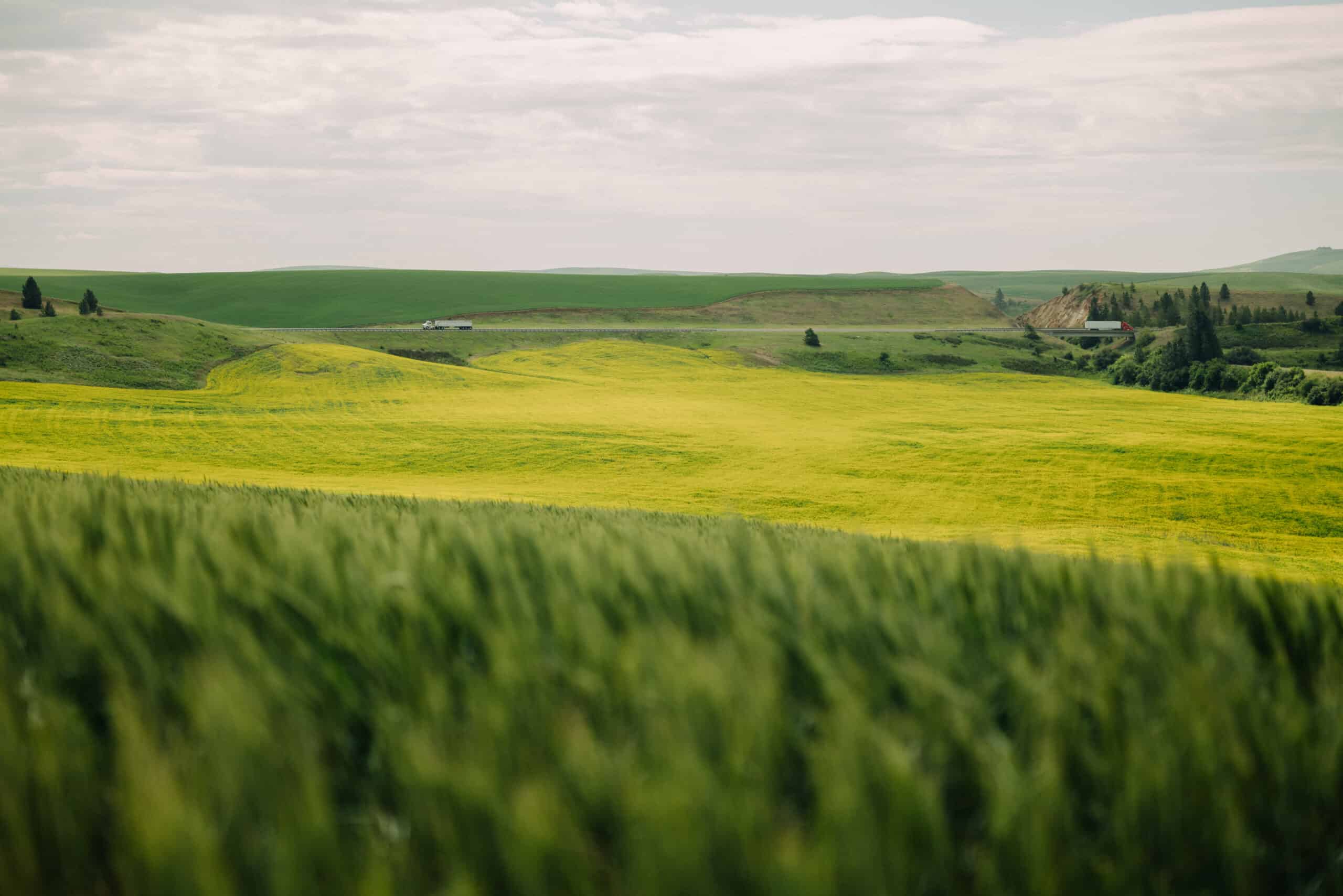
This driving route through Southeast Washington takes you through wheat fields, adorable small towns, campgrounds, parks, rolling hills, and picturesque views!
The Palouse Scenic Byway interconnects seven different highways in Whitman County, taking you through the most beautiful parts of each route.
Here’s the route we suggest, but you can add or subtract stops as you see fit:
- SR 27 From Spokane to Tekoa (passing through Rockford and Fairfield)
- WA 271-S to Rosalia (Steptoe Battlefield)
- WA 271 to Steptoe Butte State Park
- SR 27 to Palouse
- State Route 272 Between Palouse and Colfax
- SR 26/127/12 from Colfax to Patit Creek Campsite
- SR 12 to Walla Walla OR Highway 195 from Colfax to Pullman
This route will essentially ping-pongs you through small towns like Garfield, Oaksdale, Tekoa, Freeman, Palouse, and Fairfield. It’s a great way to get a feel for each place!
Going to Walla Walla? For an extended trip to Walla Walla instead of Pullman, you will pass through Dusty, Dayton, Waitsburg, and Dixie via Highway 26 and 12 on your way south.
What is the best time to visit the Palouse?
Personally, we think the best time to drive the Palouse Scenic Byway is in the spring!
This is when the rolling hills and wheat fields are exploding with green, lush plants. The weather isn’t too hot or cold either, so the days temperatures remain pleasant and stable.
Best Stops Along The Palouse Highway


Steptoe Butte Battlefield State Park
Steptoe Battlefield State Park is a new Washington heritage site.
Located in Rosalia, this park is small, only 4 acres big. It commemorates the historic battle here, between Colonel Edward Steptoe and several Eastern Washington native tribes that happened in 1858.
This is a great stop to have lunch or a snack. It’s a small park with 2 parking spots. There are picnic tables under a shady tree and a place for children to run around.
It can be a windy spot, so bring a windbreaker just in case!

Steptoe Butte State Park
Steptoe Butte State Park is a quartzite bluff that commands the attention of anyone driving around the rolling Palouse hills.
Standing at 3,612 feet at the summit, you have 360-degree views of the rolling hills of the Palouse. The farmlands below look like a natural quilt!
When you read the interpretive signs at the top, you’ll learn that Steptoe Butte has some of the oldest rock in the Pacific Northwest!
This area has taken many forms. It’s been a wagon road, site of a hotel, and naturally, an observatory site. It’s a must-stop on any road trip through the Palouse Scenic Byway!
Read More: 34 Impressive and Fun Facts About Washington State

Patit Creek Campsite
A stop easily missed along the Palouse Scenic Byway is Patit Creek Campsite. It’s the site of a group camp of the Lewis and Clark Corps of Discovery, as they were passing through Dayton, Washington.
As part of the celebration of the Lewis and Clark Bicentennial (200 years!) Dayton residents recreated a full-scale model of the campsite, displaying the figures and events that would have happened around camp.
These figures included people, animals and structures. They are silhouettes frozen in various tasks, showcasing all the roles and chores involved in setting up camp. They used Lewis and Clark’s journals for reference material.
To see Patit Creek Campsite, drive two miles east of Dayton on Patit Road. From the turn on Highway 12, look out for the statues of Lewis, Clark, and their horses!
Read More: The 30+ Most Fun Things To Do In Washington State

Jolly Green Giant on the Hill Viewpoint
One of the largest roadside attractions at 300 feet is Dayton’s Jolly Green Giant!
It’s a quick and easy pullout on Highway 12, perfect for getting out of the car and stretching your legs. From the sign, look out in the distance on the hillside to spot him!
The original employees of the Green Giant Vegetable Company planted the original Giant in the 1970s with colored grass. In the 1990s, employees then used colors paving bricks in another location on the hillside, to ensure view-ability all year long.
Can’t see it in the distance? You can still snap a photo with the 5-foot version of the mascot right on the side of the road!


Lewis and Clark Trail State Park
Lewis and Clark Trail State Park is situated in a lush, green oasis. A stark contrast from the surround rolling hills of brown wheat!
Here, there is a campsite (where you can rent teepees to sleep in!) and shaded trails to stretch your legs. It runs along the Touchet River so you can dip your toes in on a hot day.
It’s a great place for nature lovers and bird-watchers.
Here you’ll find Ponderosa Pines, Maples, Alders, Cottonwood Trees and more. Frequent bird sightings include Mergansers, Orange-crowned warblers, and Red-tailed hawks.
Palouse Scenic Byway Route Map


Want to continue your journey?
The fun doesn’t have to stop here! There are so many other cool things to see in Whitman Country.
Here are some ideas for extending your trip:
Walla Walla: Around the “end” of the Palouse Highway you can stay longer and plan an incredible 3 days in Walla Walla. Here, you can enjoy plenty of fresh produce, local wine, and delicious local eats!
Palouse Falls State Park: Located in Franklin County, WA, Palouse Falls is one of the most magnificent waterfalls in Washington! Come to wander the cliff’s edge (carefully!) and see stunning examples of the Missoula Flood aftermath.
Even further? If you want to see even more beautiful spots in the Inland Northwest, consider planning a 5 day Eastern Washington road trip. Our route hits all the major stops and highlights!
More Inland Northwest Adventures
The Best Places To Live In The Pacific Northwest
The Perfect Eastern Oregon Road Trip Itinerary
How To Reach Leslie Gulch in Eastern Oregon
The 11 Most Haunted Places in Oregon
35 Fun Facts About Oregon You Probably Didn’t Know


