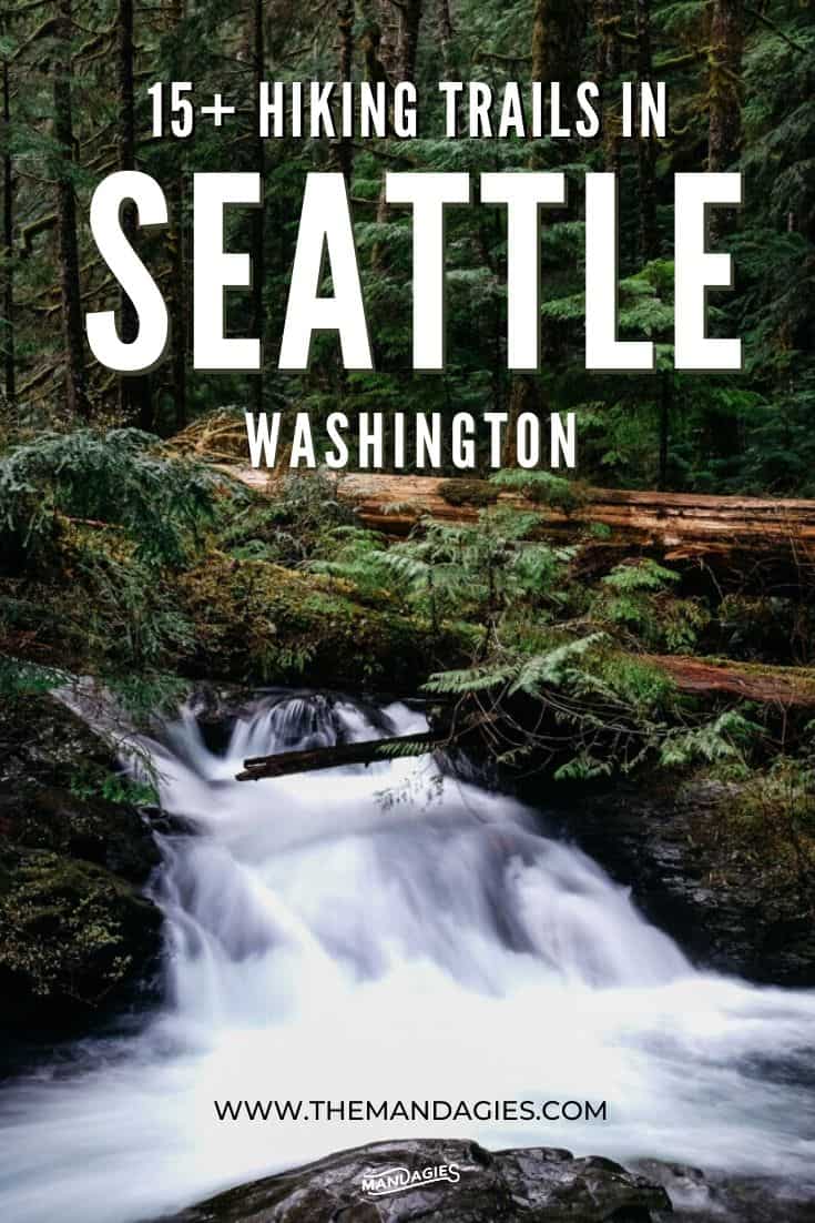
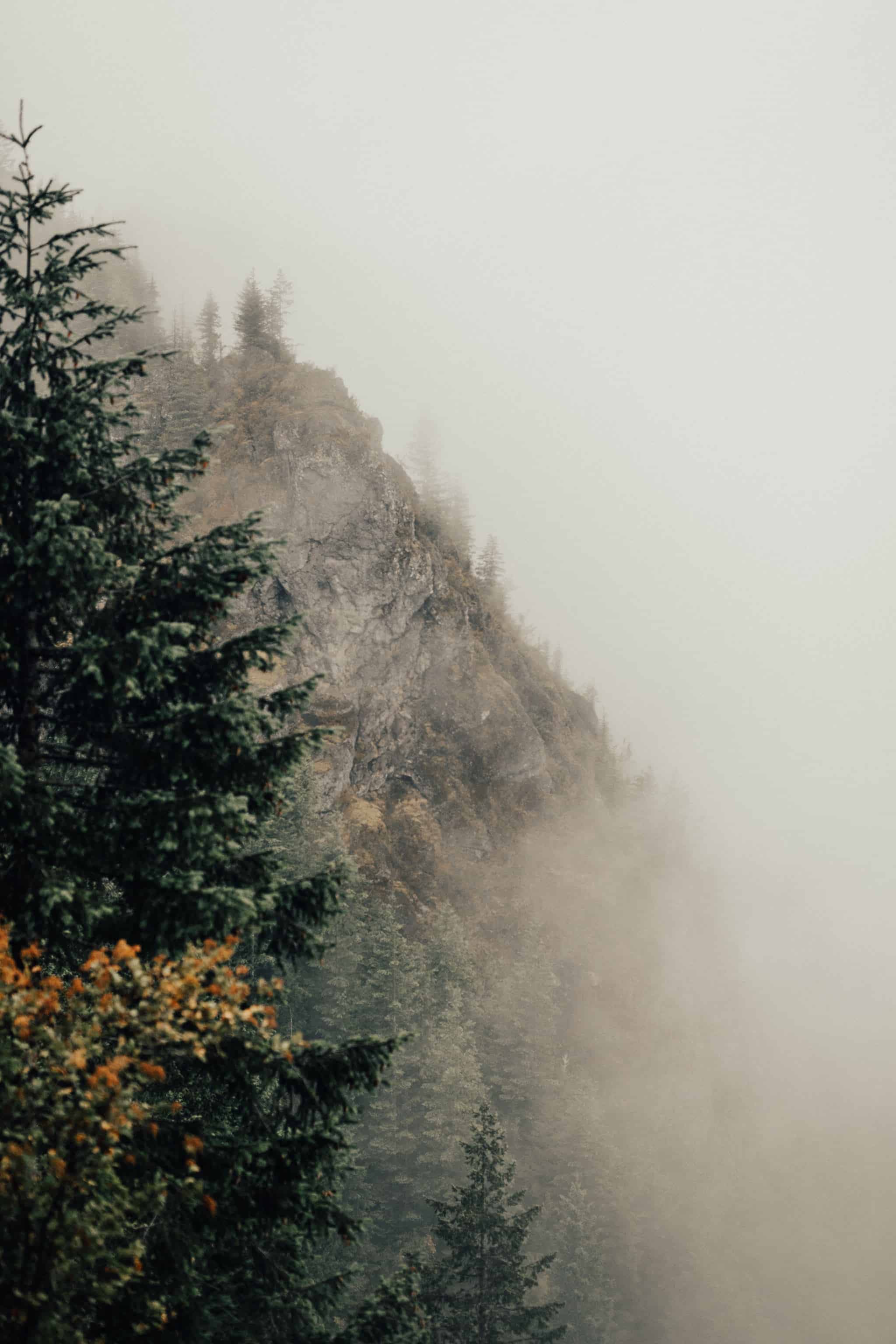
Post Summary: Amazing Hikes Near Seattle
We may be biased, but living in the Pacific Northwest has some pretty rad perks.
Seattle is just a quick drive away from gorgeous mountains, epic trailheads, and there are so many opportunities to get out in nature – even out on the water!
It’s no surprise then, that hikes near Seattle are a popular recreational activity for locals and visitors alike.
When places like the powerful Snoqualmie Falls or the jaw-dropping Rattlesnake Ledge are just on the outskirts of the city, these amazing hikes in Washington can’t be missed!

In this post, we’re sharing our favorite Seattle hiking trails, Washington, and what you can expect outside on these amazing trails.
We’ll be giving important information like trail distances, elevation gain, and tips on how to make the most of your time hiking in the Pacific Northwest.
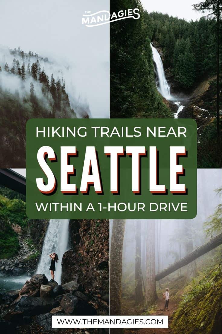
For this post, we’re also going to try and share places to hike near Seattle that require a 1-hour’s drive from the city or less.
Any longer than that, we would consider it a weekend getaway from Seattle, so we’re just covering things you can do in one day in this blog post! (But we’re still including our longer favorites at the bottom of the post too!)
Amazing Hikes Near Seattle For A Fresh Dose Of The Outdoors
- Amazing Hikes Near Seattle For A Fresh Dose Of The Outdoors
- What To Bring When Hiking Near Seattle
- What Types of Permits or Passes Do I Need To Go Hiking In Seattle?
- Hiking Trails IN Seattle
- Hikes Near Seattle ( Less Than a 1 Hour Drive)
- Hiking Trails Near Seattle ( 1 Hour+ Drive Away)
- MORE ADVENTURES NEAR SEATTLE

What To Bring When Hiking Near Seattle
You don’t need to pack much for these Seattle hikes, but there are some very important items that you shouldn’t leave home without when hiking in the Pacific Northwest. Here’s our list below:
Boots – Choose a pair of hiking boots that are comfortable, and ideally waterproof (you’ll be hiking in Washington, after all). We really love the Danner Mountain 600 Boots, as they are lightweight, waterproof (Gor-tex) and stylish!
Layers – When planning your Seattle hikes, it’s important to know that the mornings start out very cool, and warm up quickly during the day. Make sure you are wearing all your layers when beginning your hike, as they are much easier to peel off than put on when you’re on the trail!
Day Pack – We like this Luzon 24L Day Pack from Cotopaxi because it holds a lot of gear, and packs down really small when in storage.
Water – Fill a water bottle and place it in the side pocket of your day pack for easy access. You can’t go wrong with one of these classic Nalgene bottles!
Sunscreen/Bug Spray – If you are taking hikes near Seattle during the summer season, you’re going to want to pack bug spray to ward off those pesky mosquitos. Even more important, however, is sunscreen. Those high elevation hikes can expose you to the sun a lot more than you might realize!
Optional: Hiking Poles, a Camera, and extra friends!
Staying longer in Seattle? Download our free Seattle packing list to check off everything you need for indoor AND outdoor adventures in the city!

What Types of Permits or Passes Do I Need To Go Hiking In Seattle?
One of the best things to do in Washington is to get outside and explore the endless forests that surround the cities.
In order to take advantage of this, you’ll need to get the right recreation passes! Forest pass requirements vary per trailhead, and it depends on where you go hiking near Seattle.
We’ve included whether you need a pass (and which one) in the information below each of the trail titles. However, if you’re looking for more information on Pacific Northwest forest passes and where they can be used, here’s an overview:
- Washington Discover Pass – Entry to all the state park day-use areas
- Northwest Forest Pass – Recreation sites in Washington and Oregon that require a day-use fee. You can find these places in National Forests.
- National Park Pass – Entry to National Parks, including the national parks near Seattle (Mount Rainier, Olympic National Park, and North Cascades National Park)
Hiking Trails IN Seattle
Not ready to leave the city? Most of these Seattle hiking trails you can reach via public transportation, for a quick and easy trail adventure after work!
1. Discovery Park

- Trail Length: Varies up to 5 miles
- Elevation Gain: 0-350 feet
- Difficulty: Easy
- Seattle Hiking Features: Lighthouse, Urban Hike, historic buildings, a network of trails
- Trailhead Location: 47.6629562, -122.4230805
- Pass Required: None
Discovery Park is a super convenient place to go hiking in Seattle if you don’t have access to a car. With over 500 acres to explore, you can return again and again to find a new trail!
You can reach Discovery Park by the King County Metro Bus System (on the 19, 24, and 33 lines), or if you live close to the park, like in the Magnolia Neighborhood, you can even walk!
At Discovery Park there is a huge network of trails to explore, so arm yourself with Google Maps and set out to discover new places! The most popular trail is the Main Loop Trail, which includes the North Beach Trail and a stop at the lighthouse.
Some great features to check out at Discovery Park include the West Point Lighthouse, Fort Lawton Homes, Magnolia Bluff, and the Fort Lawton Beach.
2. Seward Park Perimeter Loop
- Trail Length: 2.4 mile loop
- Elevation Gain: 39 feet
- Difficulty: Easy
- Seattle Hiking Features: city views, waterfront trail
- Trailhead Location: 47.5491938, -122.2550918
- Pass Required: None
Located in the Seattle city limits, Seward Park has 300 acres of forest land sitting right on a peninsula that juts into Lake Washington. It has a walking path around the perimeter of the park, as well as a network of trails that spider-web into the old-growth forest.
The most common trail to take is the Seward Park perimeter loop. This loop takes you all the way to the North Beach with glittering views of Lake Washington and Bellevue.
If you need a more accessible Seattle hiking trail, or have baby strollers, this is a perfect place to get outside!
3. Washington Park Arboretum Loop Trail

- Trail Length: 2.3 mile loop
- Elevation Gain: 147 feet
- Difficulty: Easy
- Seattle Hiking Features: garden views, trees, manicured gardens
- Trailhead Location: 47.6364162, -122.2983895
- Pass Required: None
The Washington Park Arboretum is a botanical garden located right in the center of the city. It has quite a large network of trails, and is beautiful and unique in every season.
This 230-acre space enjoys constant improvements, and is well-cared for by groundskeepers. It’s very easy for University of Washington students to access.
Fall is our favorite time to visit, because the surrounding trees and landscape is bursting with color! The most popular route to take is the Washington Arboretum Loop, but you can really choose your own adventure.
Come with a picnic blanket, some friends, and stay awhile on one of the easiest urban hikes in Seattle!
Hikes Near Seattle ( Less Than a 1 Hour Drive)
4. Heather Lake

- Trail Length: 4.2 miles out and back
- Elevation Gain: 1,200 feet
- Difficulty: Moderate
- Heather Lake Features: Old-growth forest, alpine lake
- Trailhead Location: On the Mountain Loop Highway 48.0754456, -121.7967351
- Pass Required: Northwest Forest Pass
Heather Lake is an all-around great hike for a fun day trip from Seattle.
The trail starts out on an old logging road and then quickly becomes root-tangled and rocky for some challenging steep parts. You’ll find yourself deep in the Pacific Northwest vegetation on this trail, with everything from little stream crossings to moss-covered trees lining your path.
At the top, you’ll come to a peaceful lake, perfect for a snack break and a lake jump (if you dare – it’s cold!).
This is a great hike to take children or first-time hikers. The diversity of scenery encountered on the trail paired with a relatively short distance makes this a very friendly adventure for everyone!
Read More: A Quick Morning Hike To Heather Lake on the Mountain Loop Highway
5. Lake Twenty-Two


- Trail Length: 5.4 miles out and back
- Elevation Gain: 1,500
- Difficulty: Moderate
- Lake 22 Features: Alpine lake, old-growth forest, some switchbacks
- Trailhead Location: On the Mountain Loop Highway 48.0757859, -121.7677752
- Pass Required: Northwest Forest Pass
Lake Twenty-Two was one of the first day hikes near Seattle that Berty and I took together!
Located in the same area of the Mountain Loop Highway (which is one of the most scenic drives in Washington state!) as Heather Lake and Mount Pilchuck Lake, this is an easy option as far as day hikes in Seattle go because it’s only a 1-hour drive from Seattle.
This trail includes a handful of switchbacks and a boulder field crossing for some interesting mountain terrain.
Once at the top, you’ll be greeted with one of Seattle’s most iconic alpine lake views – bonus points if you see an avalanche on the other side of the lake (but keep your distance please!).
Trail Tip: Pack a picnic to eat up at the top! If you are considering hiking Lake 22 in the shoulder season (late fall or early spring) consider bringing a pair of microspikes too to keep steady footing. This is a popular Seattle day hike, so the snow will likely be packed into ice in certain areas.
6. Poo Poo Point
- Trail Length: 3.2 miles (or 7.2 miles)
- Elevation Gain: 2,000 feet
- Difficulty: Moderate
- Seattle Hiking Features: Easy accessibility, city views, rolling hills
- Trailhead Location: 47.4999743, -122.0241684
- Pass Required: None
Located on Tiger Mountain in Issaquah, this is one of the nearest hikes in Seattle, It’s just a quick 25-minute drive east on Interstate-90.
It is said to be named for the sounds the loggers working on the mountains would hear as the train chugged along. “…Poo-poo!”
Once at the top, you will be rewarded with gorgeous views of Lake Washington and the hills that surround the area. There is also a composting toilet at the summit.
Considered an ‘urban-hike’, you won’t find jagged mountain views or pristine alpine lakes, but rather gorgeous rolling hills and the glimmer of the city in the evening. It even has the nickname the “Issaquah Alps”!
This is also a really popular spot for paragliders, so if you’re lucky you can spot some leaping off the hill on a sunny day!
Take one of these two trail options for day hikes near Seattle:
- Chirico Trail (Shorter Route): 3.2 miles out and back, but a much steeper climb.
- High School Trail (Longer Route): 7.2 miles out and back, extending your Washington hike for a longer, more relaxing trail experience.
7. Wallace Falls


- Trail Length: 5.6 miles out and back
- Elevation Gain: 1,300 feet
- Difficulty: Moderate
- Wallace Falls Features: Waterfall views, picnic tables, riverside benches, interpretive signs
- Trailhead Location: 47.8671635, -121.6808345
- Pass Required: Discover Pass
Wallace Falls Trail is a Washington waterfall day hike that can’t be missed. This gorgeous Pacific Northwest trail has a little bit of everything – moss-covered trees, riverside views up the Wallace River, old-growth forest, and of course, Washington photo ops!
The trail will bring you to three tiers of the Wallace Falls waterfall, each with their own viewing platform.
This is a popular trail for hikers of all skill levels. The elevation gain is good enough to work up a good sweat for training, but the frequent benches (and picnic area) also make this a great spot to bring the whole family for plenty of breaks.
If you’re looking for hikes near Seattle with waterfalls, consider checking out Wallace Falls on your next getaway from Seattle!
Note: A Washington Discover Pass is required to park at the trailhead. Read our Pacific Northwest forest passes guide to find out about what kind of passes you need for certain hikes near Seattle!
8. Mount Si and Little Si

- Trail Length: 8 miles out-and-back
- Elevation Gain: 3, 150 feet
- Difficulty: Challenging
- Mount Si Features: Switchbacks, Views of Mt Rainier (on a clear day), Bragging Rights
- Trailhead Location: 47.4880474, -121.7253526
- Pass Required: Discover Pass
Climbing Mount Si is like checking off a classic Seattle bucket list item. During someone’s time living in the city, nearly everyone makes it out to this popular hike near Seattle to conquer its intimidating elevation and distance for themselves!
It’s one of the few Seattle hikes you can take year-round, which makes it a great choice for people who want a good outdoor workout no matter the time of year.
Drive to the Mount Si trailhead in North Bend, just a 30-minute drive east on Interstate-90 from Seattle. The Mount Si trail takes you into the dense woods of the Cascade Mountains and almost immediately you will start to gain elevation. After a series of grueling switchbacks, you’ll reach the top which will be worth all the sweat and water breaks!
Don’t let the popularity fool you, however. It’s a challenge to climb over 3,000 feet in just 4 short miles, let alone a chore to save your knees on the trek back down to the car. Arm yourself with plenty of hiking snacks, water, and time as you conquer this day hike in Seattle once and for all!
Whether you are coming for training or bragging rights, this is one of the best hikes near Seattle for beginning hikers and experienced ones alike!
Read More: 30 Of The Best Hikes In Washington State You Need To Experience This Season!
9. Rattlesnake Ledge

- Trail Length: 4 miles out and back
- Elevation Gain: 1,000 feet
- Difficulty: Moderate
- Seattle Hiking Features: Gorgeous Mountain views, lake access, big parking lot, optional trail extensions
- Trailhead Location: 47.4330876, -121.7693054
- Pass Required: None
Rattlesnake Ledge is one of the most popular hiking trails near Seattle. This is because of its short distance, dog-friendly trek, and accessible trailhead.
The big parking lot can hold a ton of cars, and there are also plenty of signs to guide you to the start of the trailhead.
Along the trail, you’ll weave your way up through the tall trees and encounter a number of switchbacks for a fun sweat session.
Once you arrive at the top, you can climb around on the rocky cliff edge to find a spot to rest. Here, enjoy panoramic views of the Cedar River Watershed, lake, and surrounding mountains.
Be cautious around the edge – there are no guard rails!
Rattlesnake Ledge can get extremely busy on a nice spring or summer season weekend in Seattle. If you have the ability to come during the weekdays we would suggest coming then!
10. Mailbox Peak

- Trail Length: 9.6 miles
- Elevation Gain: 4,000 Feet
- Difficulty: More Challenging
- Seattle Hike Features: Mailbox photo op, sweeping views (and maybe Mt Rainier on a clear day!)
- Trailhead Location: 47.4669573, -121.6774378
- Pass Required: Discover Pass
Mailbox Peak is located in North Bend, Washington like the Mount Si trails. It’s considered is one of the hardest hikes near Seattle.
This 9.6-mile out and back trek gains 4,000 feet over a series of switchbacks to reach the iconic mailbox at the very top.
The mailbox is said to be brought up by a daring mail carrier in the 1960s and is a popular place to snap a photo of your victory at the top! Here, you can enjoy sweeping views of Mount Rainier and the Middle Fork Valley below.
The trail was rebuilt in 2014 by the Washington Trails Association. Now, the path is clear and wide all the way to the end.
Read More: 20 Energizing Hikes In The Pacific Northwest
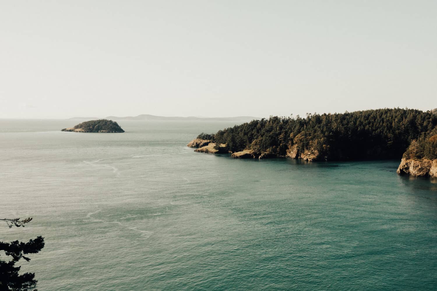
9. Deception Pass (Lighthouse Point Loop)

- Trail Length: 2.6 miles
- Elevation Gain: 300 feet
- Difficulty: Easy to Moderate
- Deception Pass Features: Bridge, water access, camping
- Trailhead Location: 48.4156723, -122.6511274
- Pass Required: Discover Pass
Deception Pass State Park is located on the north side of Whidbey Island in the Puget Sound.
With over 4,000 square acres of recreation land (most alongside the water!) this is an excellent place to discover new hikes near Seattle – there are more than 30 major trails here!
Some of the most popular hiking trails in Deception Pass include the Lighthouse Point Loop (2.6 miles) which is great for photographers and wildlife viewers.
Another great trail is Hoypus Point Loop, a 5.1-mile loop with low elevation gain, which is great for hikers who want to choose more endurance than effort!
Finally, don’t forget to stop on either side of the Deception Pass Bridge and experience walking across it! Berty and I had a lot of luck spotting some bald eagles flying overhead, as well as sea lions playing in the water below. Don’t forget to bring your binoculars for some whale watching too!
Deception Pass State Park is a great place for day hikes from Seattle for the many unique trails and scenery available to visitors.

Want to stay overnight at Deception Pass?
The Dyrt PRO, our favorite way to find camping, recently launched some new great features.
Get reservations at sold out campgrounds, access 5000+ free camping locations, 1000+ discounted campgrounds, and pay $0 extra booking fees – all with The Dyrt PRO.
You can try PRO for free, no strings attached — use our code “mandagies” to get 30 days free.
10. Gold Creek Pond Loop

- Trail Length: 1-mile loop
- Elevation Gain: 100 feet
- Difficulty: Easy
- Seattle Hiking Features: Picturesque lake, easy access, great photoshoot location
- Trailhead Location: 47.3971411, -121.3817235
- Pass Required: Northwest Forest Pass
Gold Creek Pond is the perfect option for Seattle hikers who are just beginning their outdoor journey, folks who have small children, and people who would like an ADA-accessible trail.
It is a gorgeous and simple 1-mile loop around this man-made lake, located near the top of Snoqualmie Pass.
This short and sweet trail is one of the easiest hikes near Seattle. It features a paved walkway, sections of boardwalk, and a photogenic bridge. You’ll often find groups of people taking family photos or PNW engagements sessions here!
The glassy lake and lush surrounding forest make this an incredible place to soak in the scenery.
Read More: 15+ Top PNW Engagement Photos Locations
11. Snow Lake Trail

- Trail Length: 7.2-mile round trip
- Elevation Gain: 1,700 feet
- Difficulty: Moderate to Challenging
- Snow Lake Features: Alpine lake, waterfalls
- Trailhead Location: 47.4454196, -121.4257127
- Pass Required: Northwest Forest Pass
Snow Lake is one of the most popular day hikes near Seattle – this one with a little bit more elevation gain. Located just across from the Alpental Ski Resort (near Snoqualmie Pass), Snow Lake is a great option if you’re looking to seek out a fun summer lake jumping spot!
Want a little more challenge? Keep going to Gem Lake! (And you can even camp overnight for a perfect Washington backpacking trip for beginners!)
Note: While Snow Lake may seem like an invitation to take this trail in the snow, is it NOT recommended to take it as a winter hike in Washington, for its high avalanche danger area. Save these hikes near Seattle for a late spring or summer adventure!
12. Mount Pilchuck
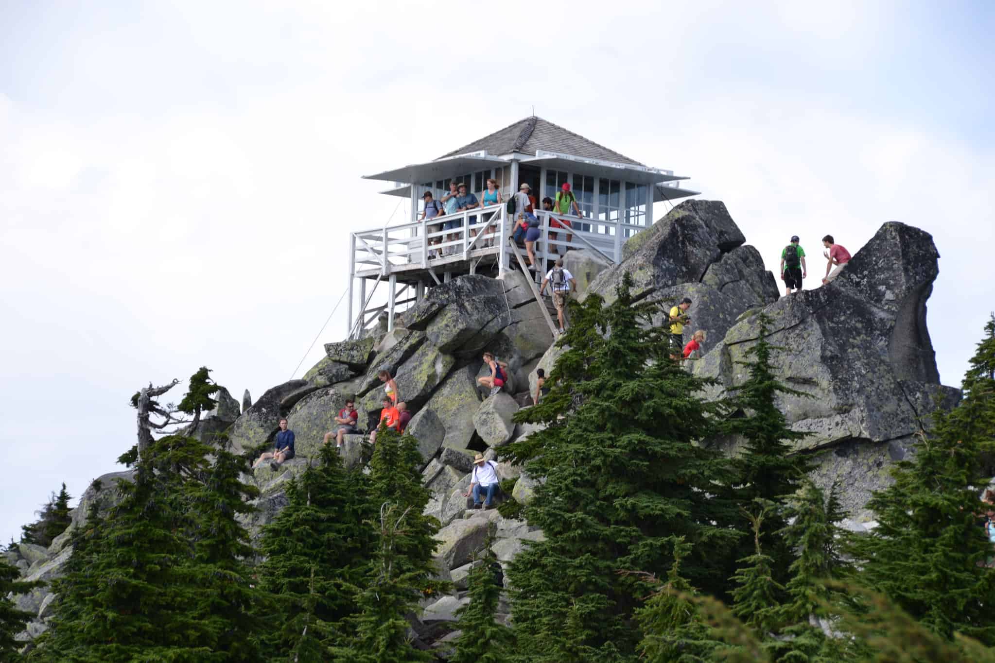
- Trail Length: 5.4 miles out and back
- Elevation Gain: 2,300 feet
- Difficulty: Moderate to Difficult (Very Steep)
- Mount Pilchuck Features: Historic Washington fire lookout, mountain views
- Trailhead Location: 48.0604971, -121.8150619
- Pass Required: Northwest Forest Pass
Do you like dramatic scenery and Instagram-worthy spots? You’re going to love this day hike from Seattle to Pilchuck Lookout.
This is one of the closest fire lookouts to the city, so you can expect it to be pretty busy on any given spring or summer weekend. However, don’t let the crowds deter you – the top’s 360-degree view of the surrounding mountains (including Mount Rainier, Mount Baker, and the Olympics) are worth it!
Located off the Mountain Loop Highway, this hike takes you through a portion of the old-growth forest near Granite, and across boulder fields to reach the top.
This is a challenging hike, but the views at the top are absolutely worth every step.
If you’re looking for a short weekend getaway from Seattle, you have the option of camping in the fire lookout! Be prepared though – staying in the building is on a first-come-first-serve basis, and there are crowds at the top nearly 99% of the time. Come with backup sleeping options like a tent or a hammock!
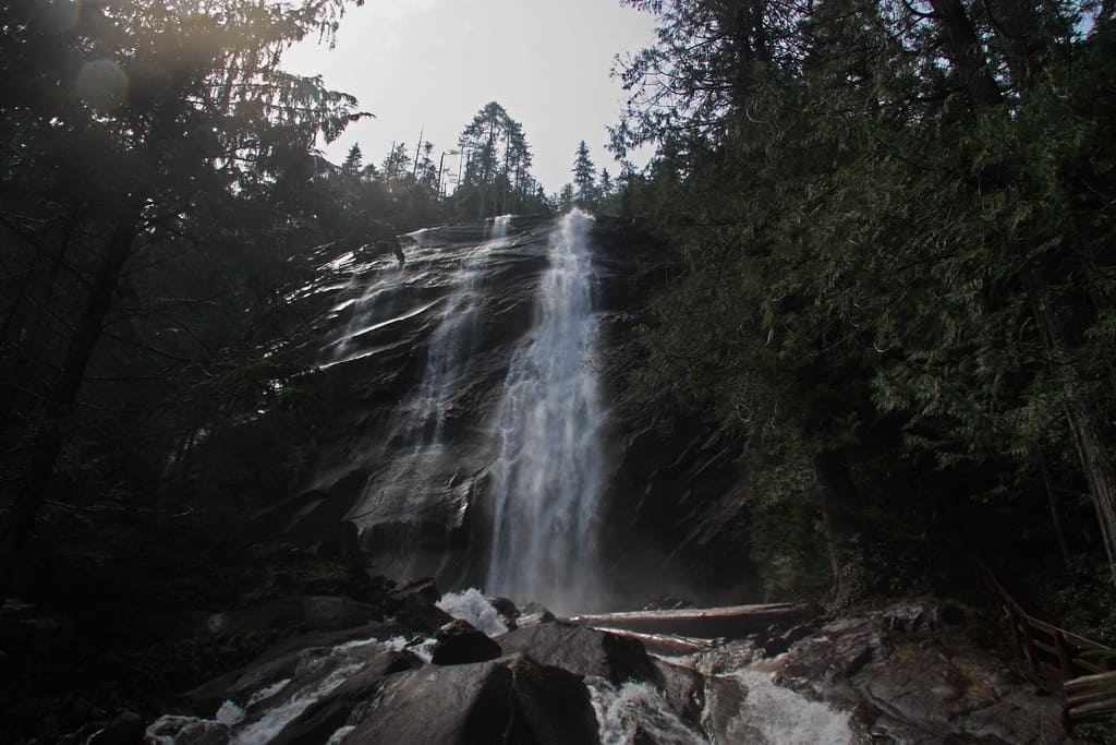
13. Franklin Falls

- Trail Length: 2 miles out and back
- Elevation Gain: 400 feet
- Difficulty: Easy
- Franklin Falls Features: Forest walks, accessible waterfall
- Trailhead Location: 47.4146018, -121.4464564
- Pass Required: Northwest Forest Pass
If you are just starting out your hiking journey, we think that Franklin Falls is the perfect hike for you!
It’s one of the best hikes near Seattle to hook anyone on hiking in the Pacific Northwest. There’s easy elevation gain, a short distance, and a huge payoff at the end!
Franklin Falls is a 70-foot tall waterfall that completely freezes over for one of the best winter adventures in Washington.
For the most powerful flow, visit in the spring and summer months. Come anytime between April and July to enjoy the powerful mist coming from Franklin Falls!
Read More: 19+ Amazing Washington Winter Hikes To Experience (See Franklin Falls Frozen!)
14. Lake Serene Trail and Bridal Veil Falls
- Trail Length: 8.2 miles out-and-back
- Elevation Gain: 2,000 feet
- Difficulty: Challenging
- Trail Features: Alpine Lake, Waterfall
- Trailhead Location: 47.8090185, -121.5739669
- Pass Required: Northwest Forest Pass
With both a waterfall and a gorgeous alpine lake, this is a hiking offer you won’t want to refuse!
The trail to Lake Serene and Bridal Veil Falls in Gold Bar, WA is a little bit harder than most day hikes near Seattle. However, it’s worth every step for the beautiful Washington photo spots at the path’s end!
Your first stop will be Bridal Veil Falls, at about 2.5-miles into the trail. This 1,328-foot cascading waterfall is the tallest accessible falls in Washington State. It glides down the rock cliff for some incredible scenery!
After a visit to the falls, continue on to the foot of Lake Serene, with great views of Mount Index in the distance.
15. Cherry Creek Falls

- Trail Length: 5.5 miles out and back
- Elevation Gain: 300 feet
- Difficulty: Easy
- Seattle Hiking Features: Waterfall
- Trailhead Location: 47.7455601, -121.9102601
- Pass Required: None
Cherry Creek Falls is an easy and fun trail near Duvall, Washington. It’s perfect for small children and people who want an easy hiking trail near Seattle!
This hidden spot in King County follows an old logging road that’s no longer in use. Because of this, you can expect the trail to be relatively flat and wide, with low elevation gain.
Once you reach the end, you can enjoy picturesque views of the 25-foot waterfall that plunges gracefully into a wide pool below!
Looking for hikes near Seattle with minimal driving time to the trailhead? I would definitely consider this trail to Cherry Creek Falls!
Read More: 16 More Waterfalls in Washington To Explore
16. Coal Creek Falls Trail

- Trail Length: 2.5 miles out and back
- Elevation Gain: 416 feet
- Difficulty: Easy
- Seattle Hiking Features: Waterfall, Old coal mines
- Trailhead Location: 47.5318661,-122.1152811
- Pass Required: None
Coal Creek Falls is located in Cougar Mountain Regional Wildlife Park in Issaquah. It’s a super convenient hike near Seattle because it’s just a 20-minute drive from the city!
This is an excellent trail option for people who have kids or pets. It’s a moderate grade with tons of features to see along the way, including old coal mines! You can’t go in them (they are blocked off) but they can look a bit spooky in the evenings.
17. Kendall Katwalk Trail
- Trail Length: 14.1 miles out and back
- Elevation Gain: 3,139 feet
- Difficulty: Challenging
- Seattle Hiking Features: Mountain views, old-growth forest
- Trailhead Location: 47.4277134, -121.4167152
- Pass Required: Northwest Forest Pass
Training for the Pacific Crest Trail? Or maybe you simply want a taste of the PCT, without having to do the entire thing. Kendall Katwalk Trail is the perfect section hike to take for a challenging hike near Seattle!
Located in Snoqualmie Pass, this epic trail takes you into the Alpine Lakes Wilderness on a 14.1-mile out and back adventure. The “catwalk” section is a narrow pathway blasted out of a steep section of rock face. It’s not for the faint of heart!
The best time to visit this trail is during the summer season, between July and September. Note that this trail takes on average 8 hours to complete. Plan to be out all day!
18. Soaring Eagle Regional Park

- Trail Length: 5 mile loop
- Elevation Gain: 370 feet
- Difficulty: Easy
- Seattle Hiking Features: forested trails, flora and fauna
- Trailhead Location: 47.6104807, -121.9942181
- Pass Required: None
Soaring Eagle Regional Park is a forested area accessible from the town of Sammamish. It’s one of the most convenient hikes near Seattle, but even more convenient for those living near Bellevue of Kirkland. There are more than 600-acres of recreational forest for people to enjoy!
Here, you’ll find a network of trails perfect for mountain biking, hiking, wildlife viewing, and birding. The trails are open year-round, with lots of variations of trail distances and difficulty. You’ll also find a lot of hiking and biking events take place here in the park.
For a complete circle around the park, trip Soaring Eagle Park Trail Loop. It will give you the most comprehensive adventure! The Pipeline Trail runs straight through the middle, which is another popular trail route.
19. The Grand Forest on Bainbridge Island
- Trail Length: 2.2 mile loop
- Elevation Gain: 269 feet
- Difficulty: Easy
- Seattle Hiking Features: quiet forests, bridge, streams
- Trailhead Location: 47.6561377,-122.5608772
- Pass Required: None
The Grand Forest on Bainbridge Island just barely makes our criteria for hiking trails in Seattle. It’s exactly 1 hour from the city! You’ll have to hop on the ferry Downtown to reach Bainbridge but once you’re on the island, there are tons to see and do.
The Grand Forest is a part in the center of the island, broken up into East, West, and North Grand Forest. Each have their own unique trails, but they all consist of some variation of winding, easy pathways shaded by the moss-covered trees.
The Grand Forest Park Trail West is a great, kid-friendly loop, perfect for an afternoon outing. This is also a perfect spot to go forest bathing, if you’d like to try that form of meditation!
Hiking Trails Near Seattle ( 1 Hour+ Drive Away)
20. The Stump House Trail


- Trail Length: 14.1 miles out and back
- Elevation Gain: 3,139 feet
- Difficulty: Challenging
- Seattle Hiking Features: birds, the Stump House,
- Trailhead Location: 47.6161029, -122.9112516
- Pass Required: Washington Discover Pass
The Stump House is a trail located in Kitsap County, in the Guillemot Cove Nature Preserve. The closest town is Seabeck, Washington and closest city is Silverdale.
This nature preserve is home to many seabirds and wildlife, which is a big draw for people who love birding. Here, there is saltwater beach access, hiking trails down into a wet cove, and the famous “Stump House”
The Stump House is a hollowed out tree, with a story about an infamous fugitive who supposedly hid here. He made a temporary home in the stump house, but now people of all ages get to enjoy it on the trail!
21. The Bluff Trail at Ebey’s Landing

- Trail Length: 1.2 miles out and back
- Elevation Gain: 52 feet
- Difficulty: Easy
- Seattle Hiking Features: Puget Sound views
- Trailhead Location: 48.2180237, -122.7608388
- Pass Required: Washington State Discover Pass
Located on Whidbey Island, Ebey’s Landing is one of the most stunning vistas in the Puget Sound! The Bluffs Trail starts at Fort Ebey and runs along the bluffs overlooking the Puget Sound. On a clear day, you can see straight across the water to the Olympic Mountains!
This is an out-and-back trail, meaning you can turn around whenever you wish. At the end half, the trail takes a few switchbacks to the beach just shy of Perego’s Lagoon. Here, you can explore the tides, driftwood, shells, and rocks that wash up on shore.
This is a wildlife lovers paradise. Here, you can spot waterfowl, pods of Orcas coming from the Strait of Juan de Fuca, and more sea life if you’re lucky!
MORE ADVENTURES NEAR SEATTLE
10 Amazing Weekend Getaways From Seattle to Book Now
The 16 Most Amazing Waterfalls In Washington State
How To Have a Dreamy 24 Hours At the Kalaloch Lodge on the Washington Coast
The Complete Guide To The Olympic National Park, Washington
The Ultimate Olympic Peninsula Road Trip Route (For a Long Weekend)
The 10 Best Washington Beaches To Explore On Your Next Trip To The Coast
The 20+ Best Instagram Spots In Washington State
46 Cheap, Fun, and Free Things To Do In Seattle, Washington