Post Summary: Diamond Creek Falls Hike In Oregon and What To Expect
Are your journeys taking you around Bend, Oregon? How about Eugene? Central Oregon?
If you’ve landed on this post because you’re going to be in these areas – it’s your lucky day!
We’re sharing this amazing (and short-ish!) hike to one of Oregon’s most incredible waterfalls. Diamond Creek Falls is an epic adventure nestled deep in the Cascade Mountains.
Easily accessible from many popular Oregon destinations, a Diamond Creek Falls hike is the perfect way to spend a Pacific Northwest afternoon.
In this post, we’re sharing the details of this hike, what to expect, and even a bonus falls to explore along the way!
Let’s get started.
How To Reach Diamond Creek Falls Hike In Oregon
Spending a lot of time in the area? This is one of many day trips from Eugene that we highlighted in this post. Click here to see more amazing adventures in the area to add to your Oregon itinerary.
Quick Facts About Diamond Creek Falls
- Trail Distance: ~3.5-mile loop trail
- Elevation Gain: ~550 Feet
- Difficulty: Easy to Intermediate
- Location: Willamette National Forest, Central Oregon
- Restrooms? Yes, at the trailhead parking lot with picnic tables
- Permits: Northwest Forest Pass ORz Sno-Park Pass (Winter Only)
- Dog-Friendly? Yes, on a leash
- Hiking Time: We allotted 2.5 hours for leisure strolling and photo taking
Where Is Diamond Creek Falls?
Diamond Creek Falls is located in the Willamette National Forest, in Lane County, Oregon. From Eugene, Oregon it’s a little over an hour’s drive, making it an incredible day trip from Eugene.
Here are the distances from the main cities around the area:
- Eugene, Oregon: 63 miles – 1 hour 10 minutes
- Bend, Oregon: 76 miles – 1 hour 30 minutes
- Oakridge, Oregon: 20 miles – 25 minutes
This area of the national forest is known for incredible mountain biking trails, tons of hiking opportunities, and lots of lake access. We think it’s the perfect area to spend a PNW summer weekend!
This area is a popular pit stop for the easy access to Salt Creek Falls, but we’re extending your quick break out of the car and encouraging you to take the short hike and explore Diamond Creek Falls.
Keep reading below to see how you can make the most of this amazing area!

Getting To The Diamond Creek Falls Trailhead
Located right off Highway 58, Diamond Creek Falls is the perfect pit stop on the way across the mountains either west to Eugene or eastbound towards Bend, Oregon.
If you’re using Google Maps or a similar navigation app, you’ll need to put in “Salt Creek Falls” as this is the parking lot you’ll need to reach to begin your hike.
Coming In the Winter? The gate to the parking lot is locked in winter months. You’ll have to park in the Sno-park area just up the road, and take the extra 0.6 mile walk to the trailhead.
Before setting off on your Diamond Creek Falls hike from the Salt Creek Falls parking lot, take some time and read the interpretive signs at the kiosk to learn a little more about the formation of the falls and the ecosystem in the area.
(But what about visiting Salt Creek Falls? Don’t worry, we’re going to cover that at the end of this post!)
Permit Notice: This trailhead requires a Northwest Forest Pass (for WA and OR national park areas). You can buy an annual one here for $30, or you can pay the $5 day-use fee on site. Remember to bring cash!
Along the Diamond Creek Falls Trail
Diamond Creek Falls trail is a 3.2-mile loop trail with cliffside views of the deep gorge below, lake access, and several waterfall viewpoints.
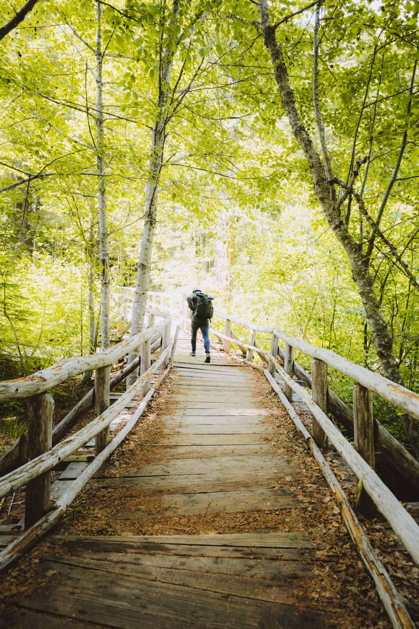
To reach the start of the trail, follow the trail to the left of the parking lot, pass by some picnic tables and walk 200 feet on a paved pathway.
The journey will begin by crossing a curved wooden bridge surrounded by alder trees. After crossing the bridge, stay to your right at the junction and hike up a slope. You’ll encounter your first viewpoint at the top of the first hill!

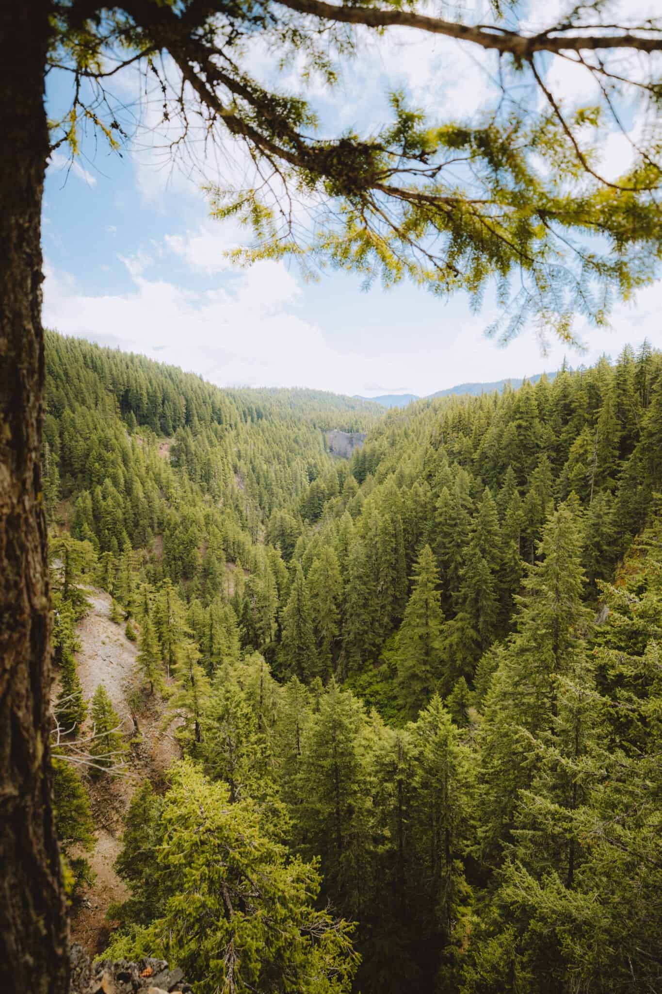
These photos below are from the first cliffside viewpoint into the gorge. They were taken in January on an oddly snow-less day!
From this viewpoint, you can look deep into the Salt Creek Canyon below. We loved seeing the uniform evergreen trees of the Pacific Northwest sloping down the cliffside.
Love Pacific Northwest Hikes? Check out these incredible hikes in Washington state, Oregon’s neighbor!

Shortly after this first viewpoint, you’ll encounter a small trail down to Too Much Bear Lake. This is a great stop if you want to dip your toes in and cool off, or even eat a packed lunch by the water.
The water is shallow and clear – perfect for a visit on a hot summer day.
We aren’t sure why it’s called Too Much Bear Lake. Maybe someone went down to see it and there were just too many bears? Ha!

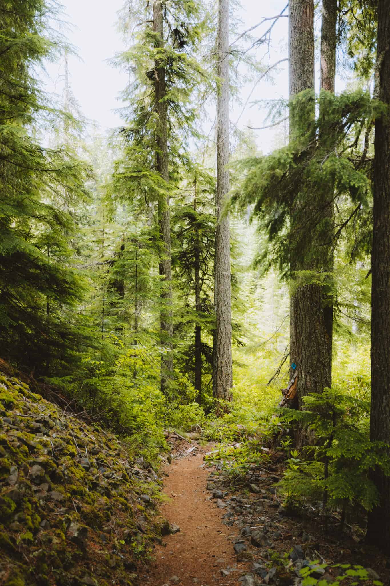
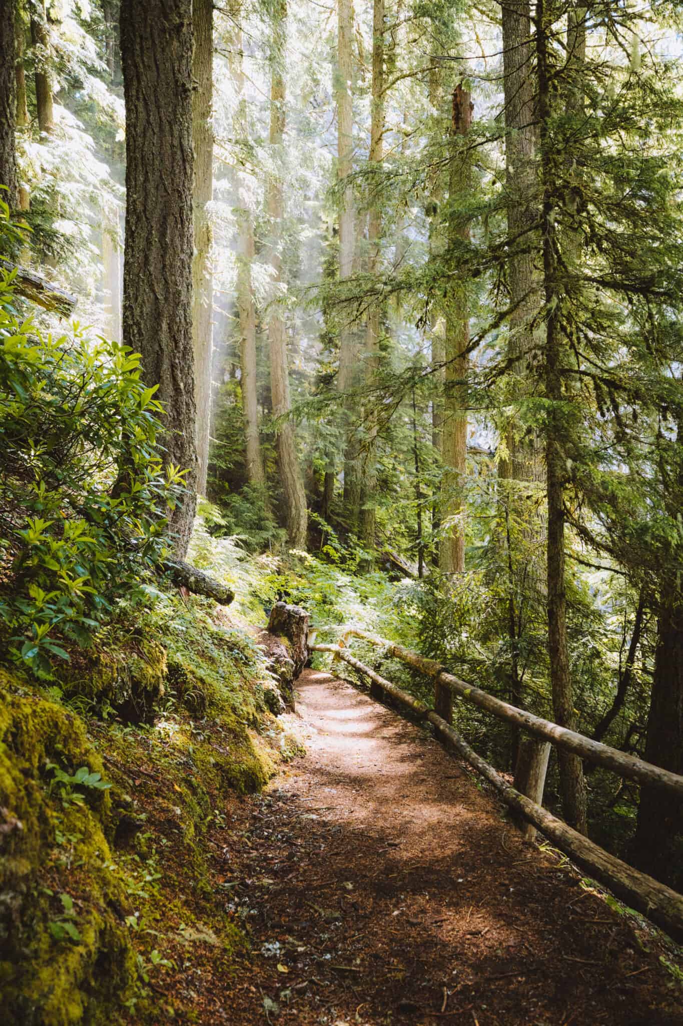
Continuing on the trail, you’ll wind through towering Douglas Fir and Western Hemlock trees, rhododendrons, and fallen logs in this lush, old-growth forest.
The trail is impeccably marked with blue diamonds posted on the trees every couple hundred feet. There is never a part of the trail where you can’t see a blue diamond, so it’s very hard to get lost!
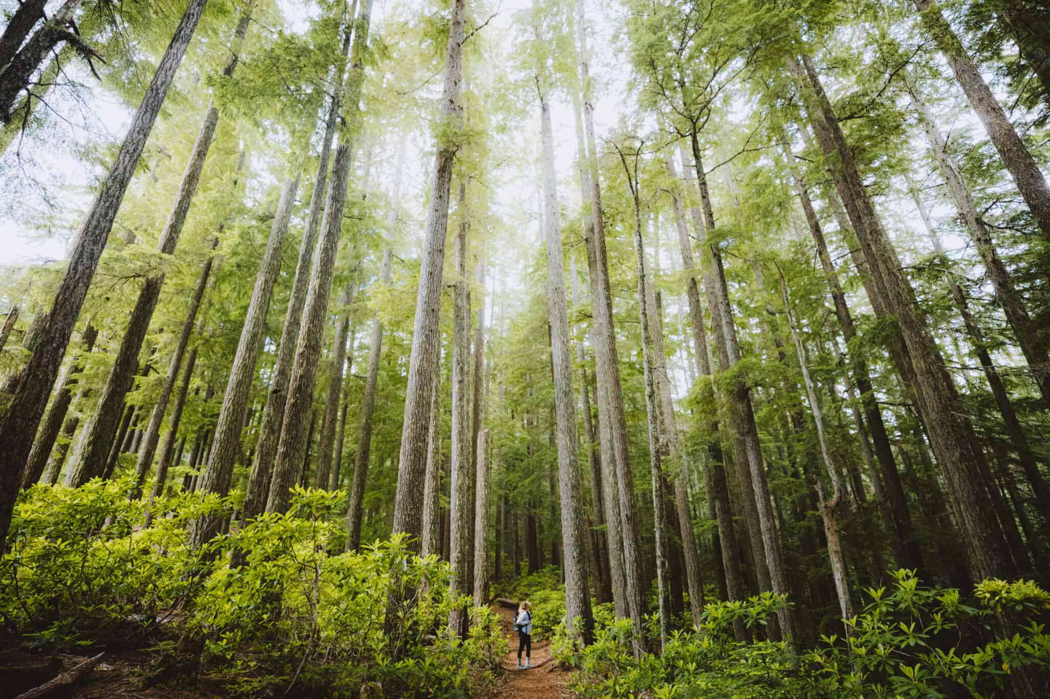
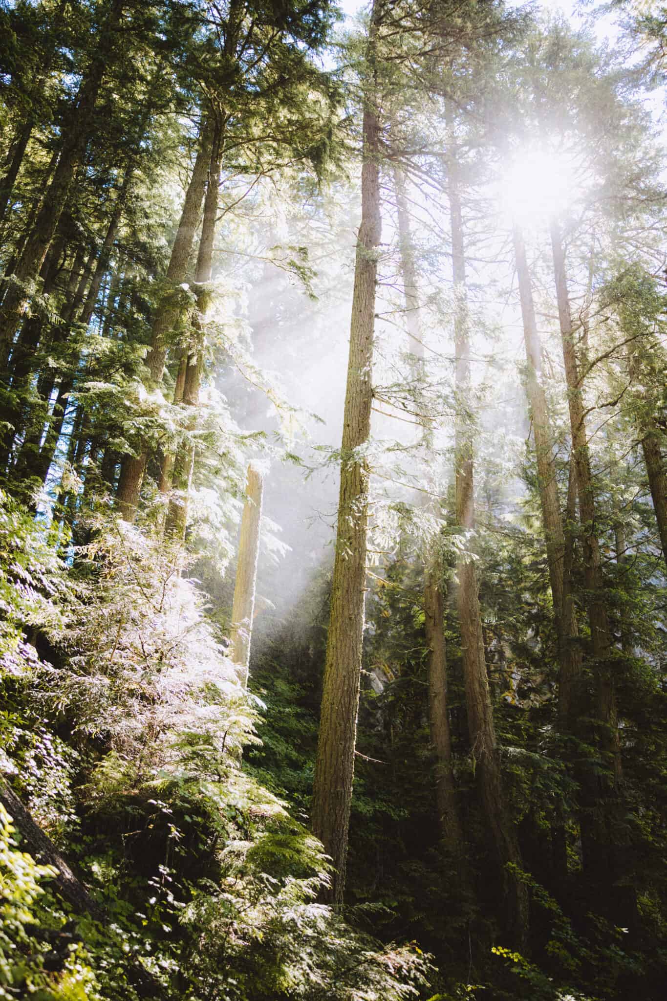
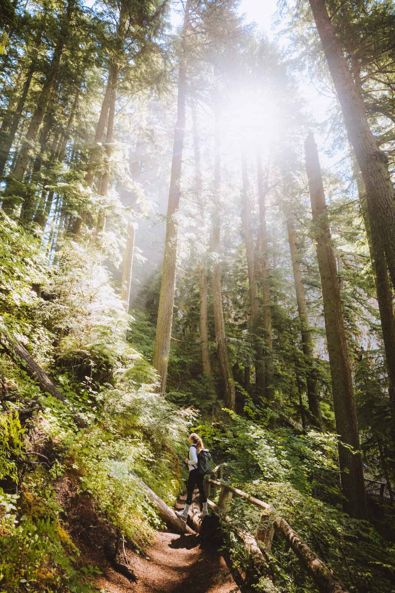
There’s a section of the trail that brings you through a very tall tree-lined walkway. It was an amazing place to snap a few photos!
For this image below, we used a wide Canon EF 16-35mm Mark III lens to capture the entire scene.
Another Tall, Ominous Tree Hike: Mount Storm King Hike In The Olympic National Park
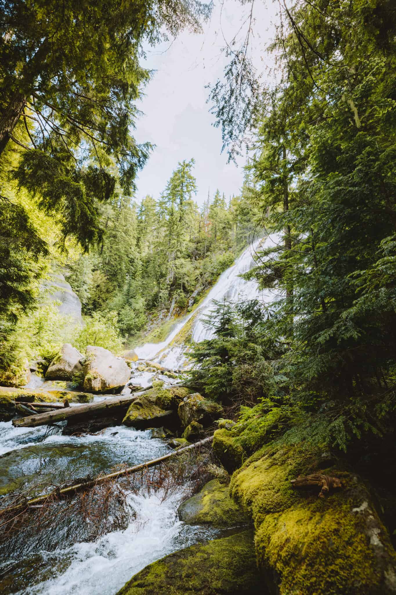
Continuing along the way, you’ll cross a wooden bridge with a stream underneath. There will also be more opportunities to view the deep gorge, and you’ll get a few glimpses of Lower Diamond Creek Falls (around 1.2-miles in the hike).
This is commonly mistaken as the main Diamond Creek Falls but it is in fact not.
The view of theses falls are just in a small section though – you get to see the first few tiers and hear the roar as you continue your journey to our post’s destination – UPPER Diamond Creek Falls.
Read More: The Perfect Oregon Coast Road Trip Itinerary (ALL The Best Stops!)
After a bit more trail through the lush Oregon forest, you’ll have two options to continue forward on your hike.
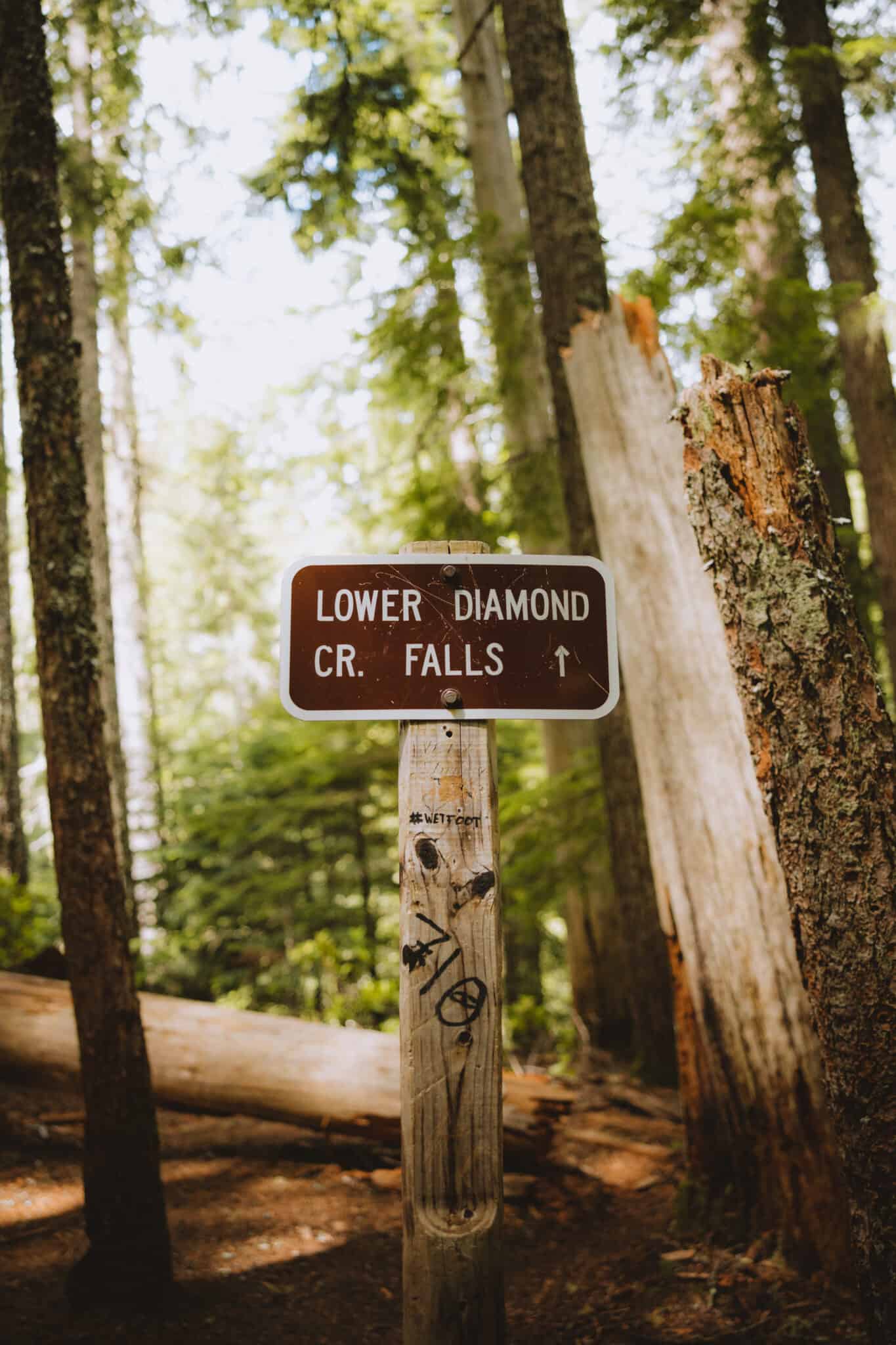
Once you encounter the sign “Lower Diamond Creek Falls” you have the option of taking the trail to the right down to the base of the falls or continuing up the current trail to see the falls from above.
There’s no wrong way to go first! For the sake of storytelling, we went to the upper viewpoint first, so that’s what we’re going to share below.
Note: This sign below is incorrect. It’s supposed to read “Upper Diamond Creek Falls” but all in all, it’s the direction you need to go. So no harm done…I guess?
It may actually be referring to the fact that you’re going to the lower portion of the falls.
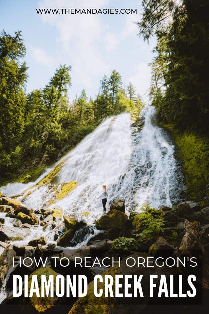
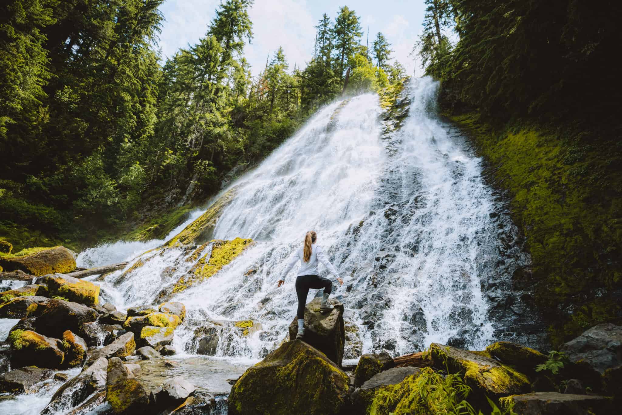
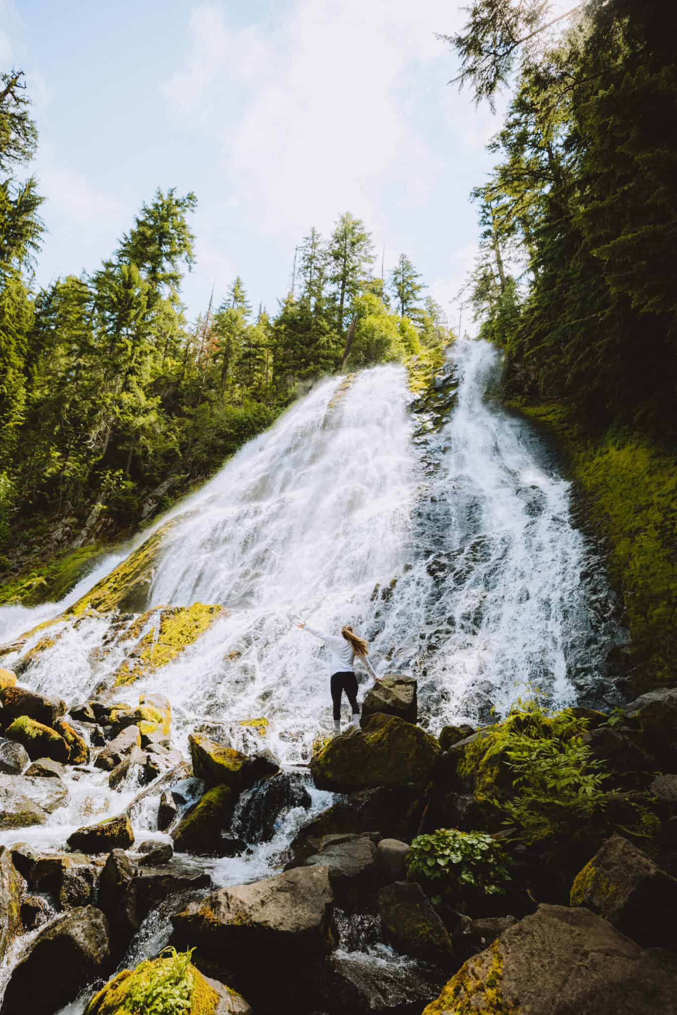
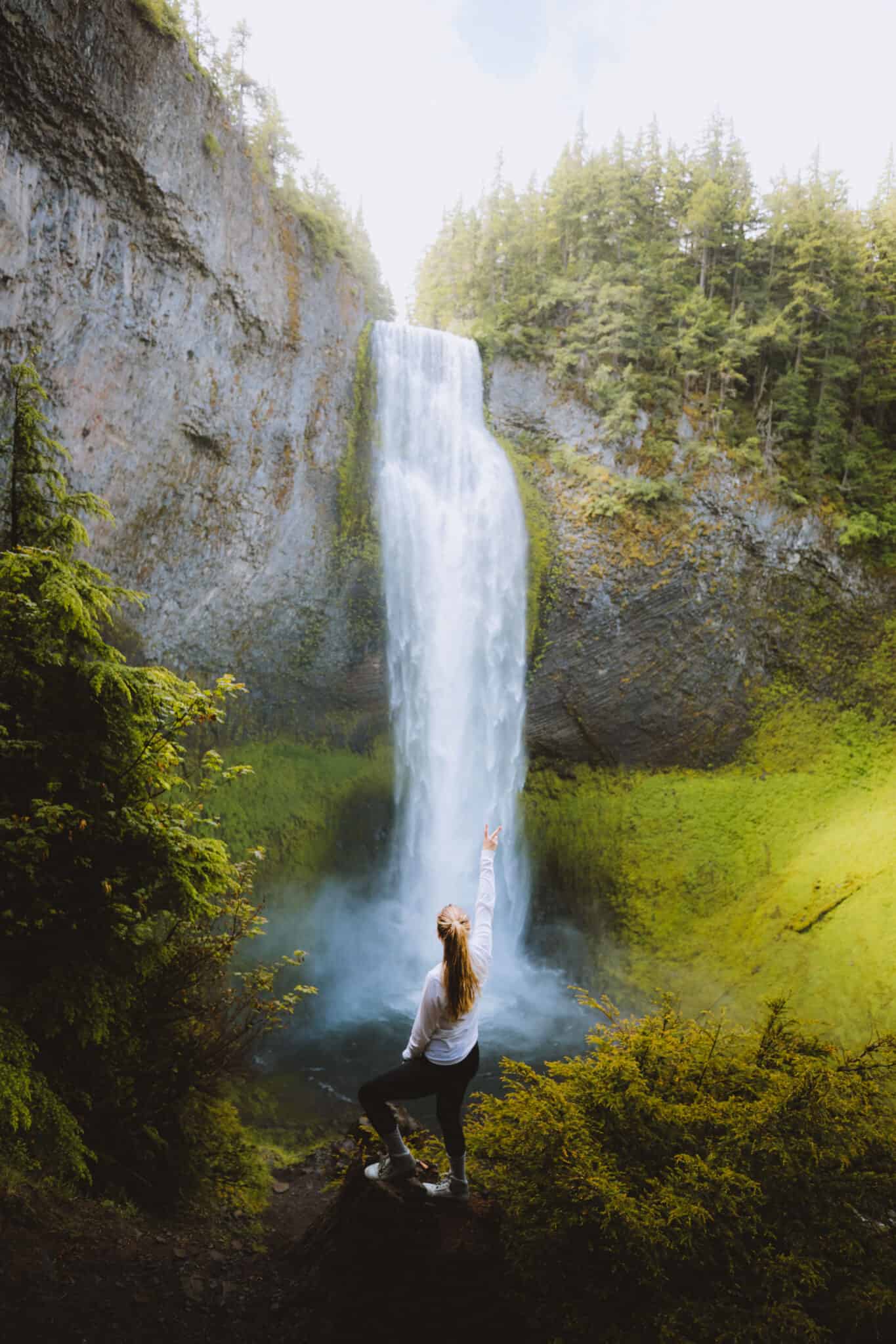
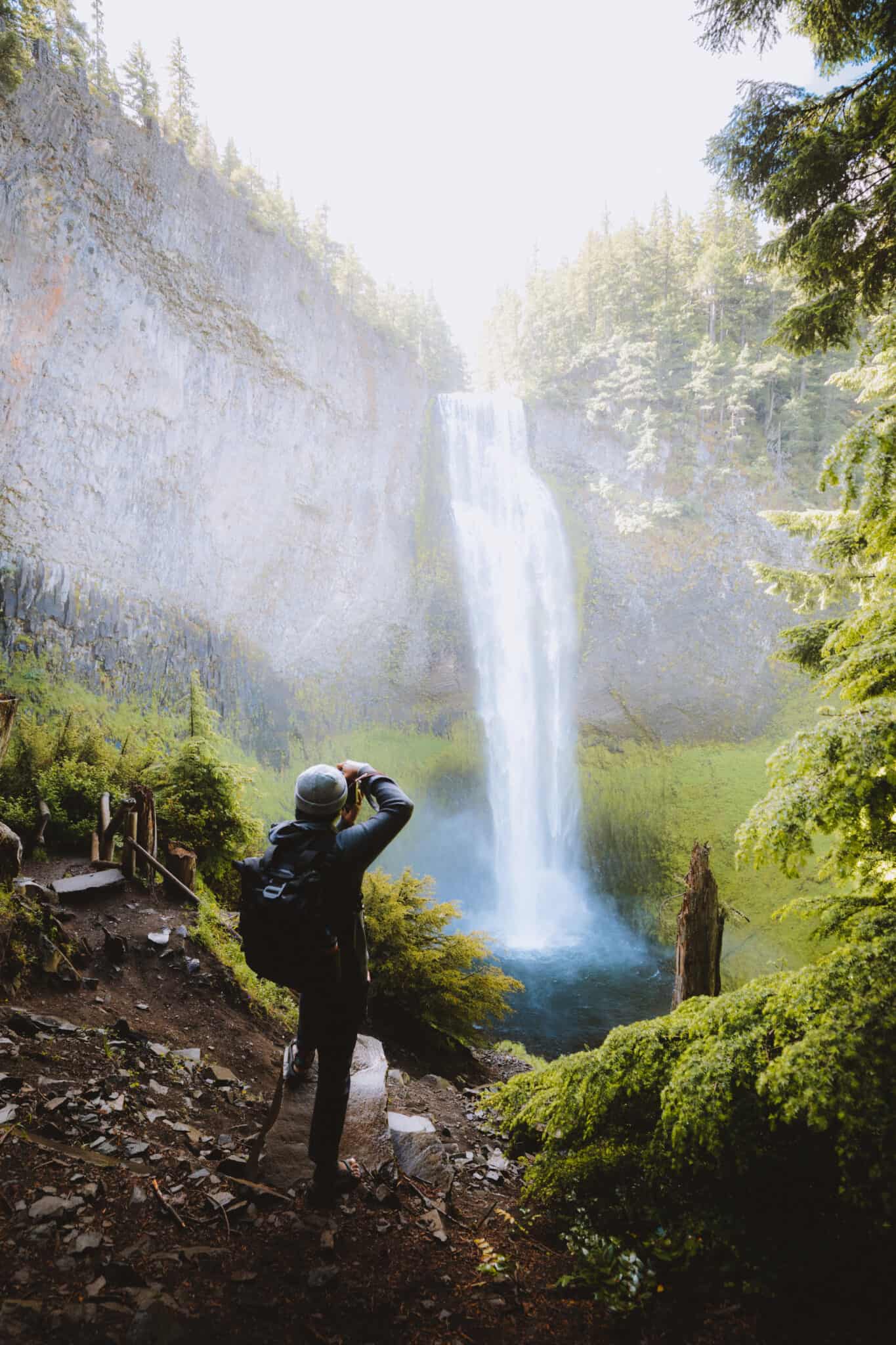
Reaching Diamond Creek Falls – Upper Viewpoint
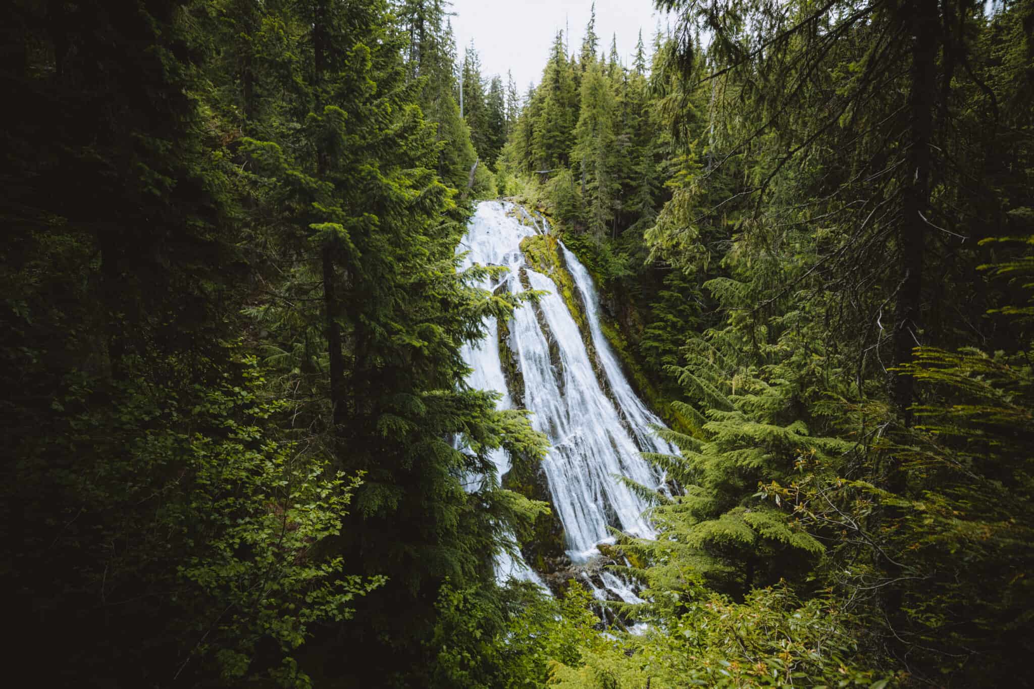
Continuing forward on the main trail, this is where you’ll get your first glimpse of Diamond Creek Falls! Just a short walk up from the “Lower Diamond Creek Falls” sign, you’ll come to a flat area that is a viewing platform.
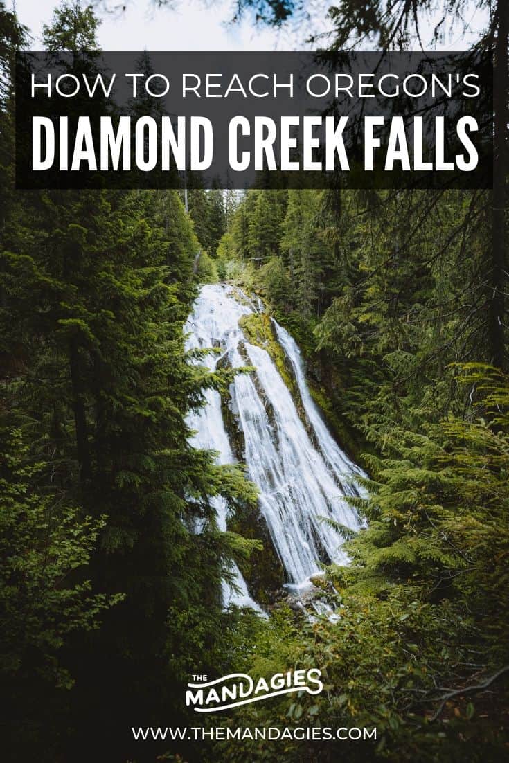
Diamond Creek Falls is commonly referred to as one of the prettiest waterfalls in Oregon, and arguably one of the best Oregon photography locations! This waterfall has a graceful fan shape that rolls down the cliffside.
Splitting off into sections and cascading down a 120-foot basalt face, this waterfall is almost unreal with its perfect forest framing and rich green surrounding landscape. Truly a beauty!

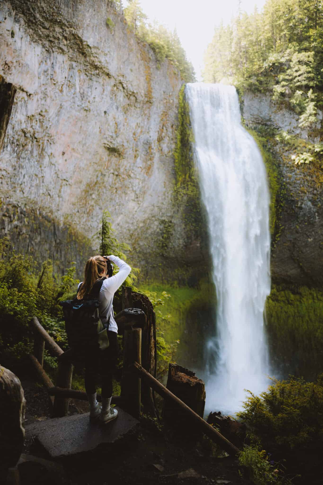
Diamond Creek Falls – Lower Falls Access
Want to get a closer view? The upper viewpoint is incredible, but wait until you see it from the base!
To reach the base of the falls, return to that “Lower Diamond Creek Falls” sign just down the trail and start taking the path down. The trail extends 0.2 miles to reach the bottom.
Discover An Old Growth Forest Trail In Oregon: Hike God’s Thumb Trail On The Oregon Coast

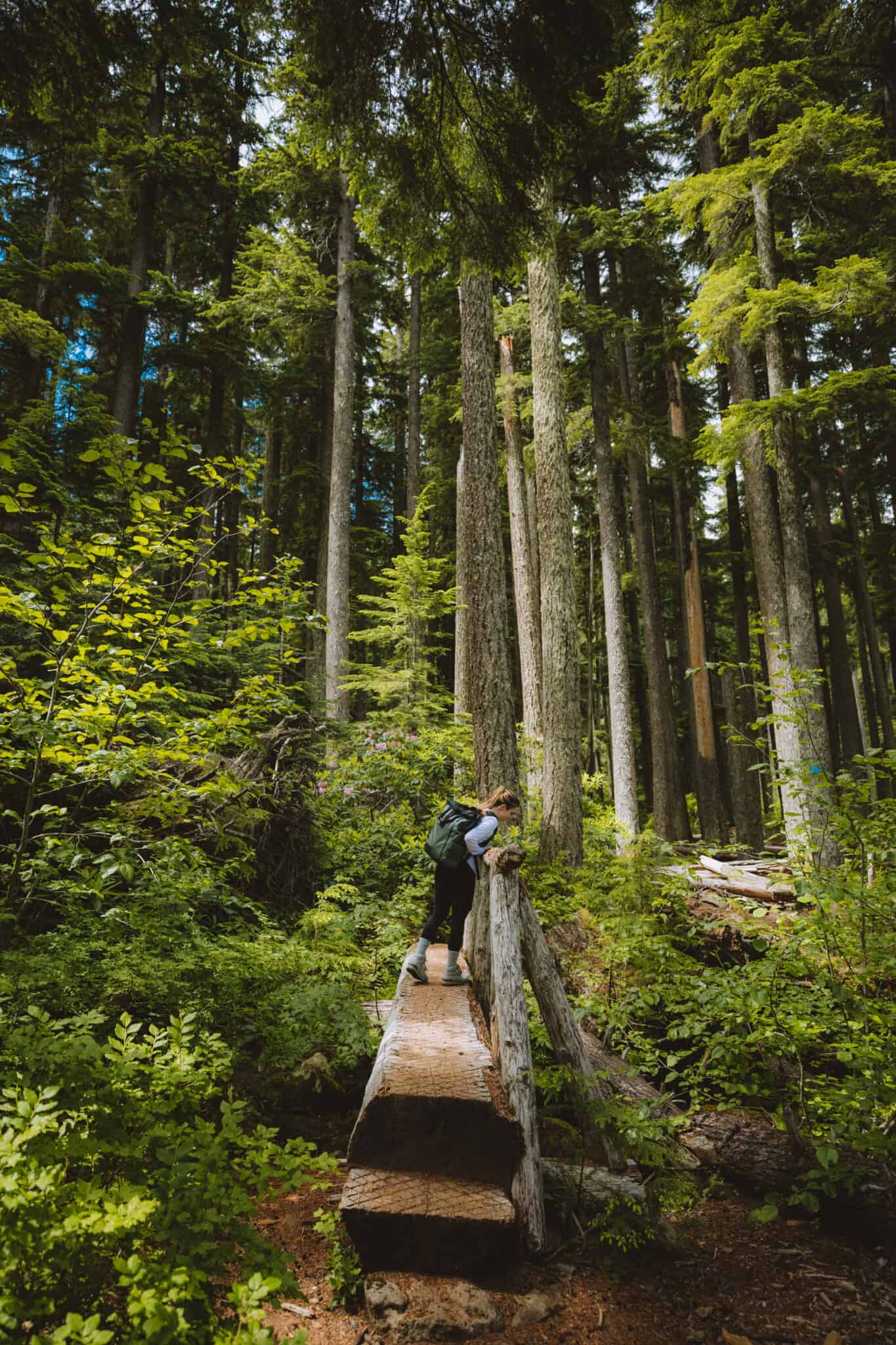
You’ll hike a switchback, and then climb down a carved log that acts as stairs. The log has notches built into it and a railing for ease of use, but be careful after heavy rain – it could be slippery.
Crossing a wet hillside (be careful – this part is steep!), you’ll descend all the way to the riverside, and then finally cross a wooden bridge to the other side.


Once you cross the bridge, take a quick trail to your left and you’ve finally reached the base of the falls!

This place is incredible, and a perfect spot to feel the waterfall’s power and mist. If you decide to climb around the rocks like us, take caution. They are incredibly slippery!
We recommend choosing a sturdy pair of water/hiking sandals if you are visiting in the summer. This way you can dip your toes in the water!
The Return Trip
To continue on your journey, you can opt to complete the loop through more winding forest trails, or choose to turn around the way you came.
We read that the rest of the loop consists of slopes up and down through more wooded areas in the forest.
If you want to extend your trip into a longer hike, we suggest continuing on the trail to Vivian Lake, which is a 7.3-mile out and back trail that extends from the Diamond Creek Falls trail.
Berty and I wanted to go back and see some of the viewpoints again, so we opted to return the same path we took up.
It’s your hike, so you can decide how you want to go!
Read More: 101 Adventurous Things To Do In The Pacific Northwest
Side Trail To Salt Creek Falls
If you didn’t stop and see the amazing falls before your Diamond Creek Falls hike, now is the time to check out Salt Creek Falls!
There are several wheelchair-accessible viewpoints, but we think the best place to see it is from below.
From the parking lot, (really, like 100 feet away) you have easy access to viewing Salt Creek Falls, one of Oregon’s highest waterfalls.
If you continue up to the viewpoint areas, you’ll find trail access from the highest point. Take the quick, 10-minute trail down to the bottom to get an up-close and unobstructed view of the falls.
Some time ago, the viewing platform at the bottom of the trail was washed away and left damaged pieces in its place. Be careful when walking around – the ground is steep and unstable in some parts.
Congratulations – you’re now looking at an impressive 286-foot single-drop falls deep into an Oregon canyon! It kind of reminded us of Falls Creek Falls in Washington – the giant single drop created so much mist!
Read More Waterfalls Nearby: Explore The Easy Trail to Sahalie and Koosah Falls

Hiking Tips For Diamond Creek Falls
Hikes in the Pacific Northwest can be an exciting way to get outside and experience the lush green forests (and practice forest bathing!), huge waterfalls, incredible rock formations, and so much more!
Here are some things to consider when taking the Diamond Creek Falls trail.
Wear Waterproof Shoes
If you’re talking Diamond Creek Falls trail on a hot summer day, you’ll definitely want to wear a pair of water shoes. This way, you can dip your toes in the fresh cool water at the base of the falls.
We love recommending Teva shoes because they have durable soles and velcro for a custom fit. They also dry really quickly!
Bring Plenty of Bug Spray
If you are hiking in the early morning or late afternoon, this is when the mosquitoes are the most active. Make sure to arm yourself with bug spray to keep them away!
We like wearing loose-fitting layers for protection and spraying bug spray on those areas that aren’t covered by clothing. (Neck, wrists, ankles, etc).
If you want to go the extra mile, check out this head net to keep the bugs away from your face!
Pack A Lightweight Raincoat
There’s always a chance of rain in the Pacific Northwest! We like to have a raincoat handy in case the weather turns for the worse.
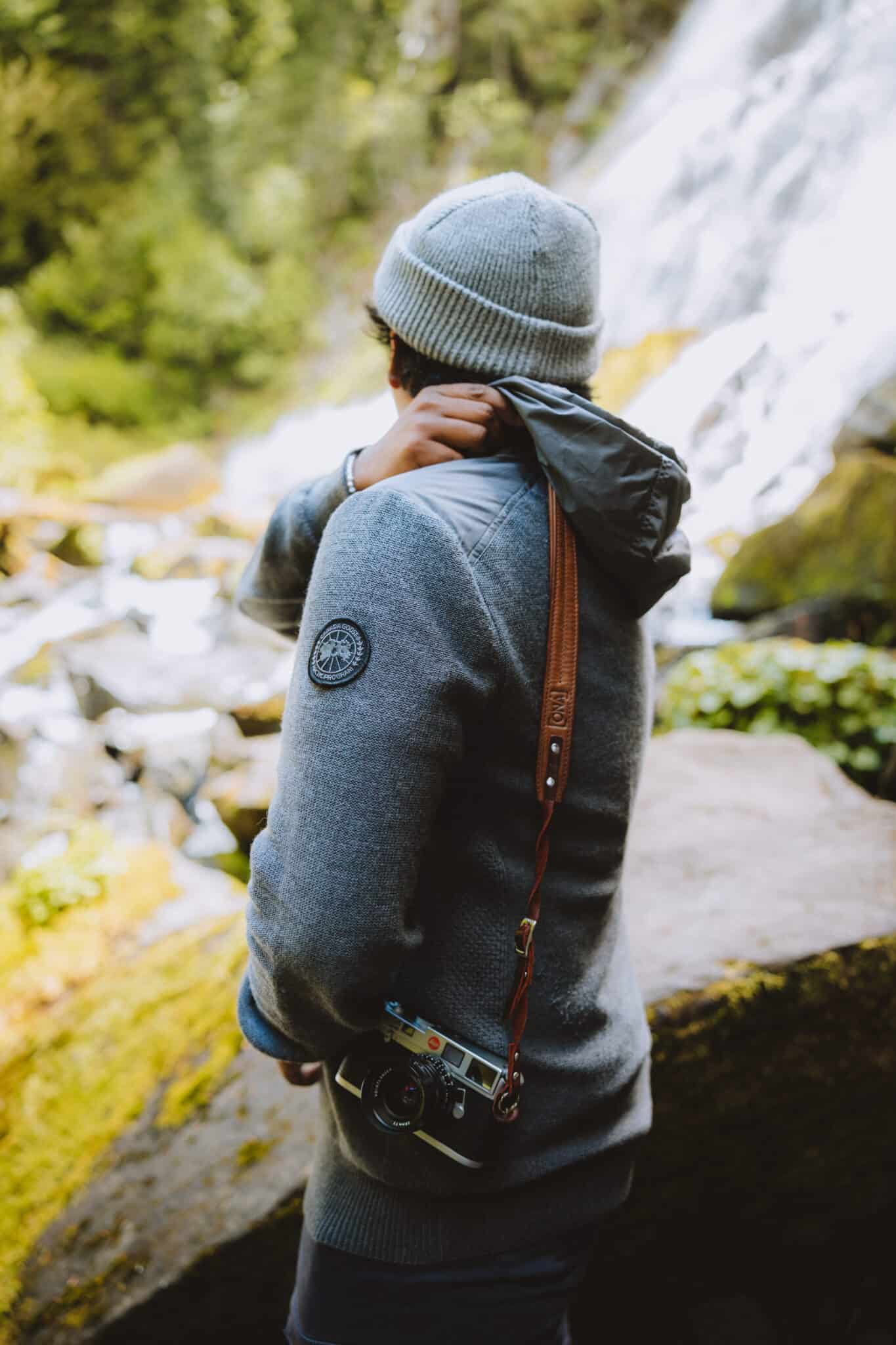
Love Photography?
We love hiking with our cameras! Berty and I want to share with you guys our favorite lenses for capturing big, dramatic scenes like these waterfalls. Here’s our go-to set up:
- Canon 5D Mark IV (body)
- Canon EOS R (body)
- Canon EF 35mm f/1.4 (for close up details)
- Canon EF 16-35mm f/2.8 (for wide shots – like those entire views of Diamond Creek Falls!)
Accessories we love:
- Peak Design Camera Clip (perfect for hands-free hiking and easy access to your camera)
- BlackRapid Camera Strap (over-the-shoulder fast access strap)
- ONA Sevilla Leather Camera Strap (for SLR and film cameras only)
Read More: Our Complete Travel Photography Gear List
Download an Offline Map
Once you pass the town of Oakridge, Oregon, cell service can be hit or miss! To keep navigation to the trailhead smooth and painless, we recommend downloading an offline map of the Diamond Creek Falls area from Google.
Not sure how to do that? Click here to watch a quick youtube tutorial on downloading offline maps.

Purchase a Northwest Forest Pass
If you see yourself hiking trails like Diamond Creek Falls in the future, it’s definitely time to invest in a Northwest Forest Pass.
What does the pass give you? This annual pass gives you access to any recreational site operated by the United States Forest Service in Washington and Oregon.
The majority of this area is National Forest, but it includes any site that requires a day-use fee.
If you are hoping to hike in additional areas, make sure to know who operates the land. Oregon State Parks and even National Parks require different permits!
Read More: A Complete Guide To Recreation Forest Passes in the Pacific Northwest
Not Ready To Go Home?
Did the Diamond Creek Falls trail whet your appetite for more Oregon adventures? There’s SO much more to explore in the area!
If you are staying in the area for a few more days, here’s what we suggest you explore nearby:
- Sahalie and Koosah Falls
- Take A Road Trip Down The Oregon Coast
- Awesome Day Trips From Eugene, Oregon
- Things To Do In Eugene, Oregon In Winter
- Explore The Umpqua National Forest (Including Toketee Falls)
- What To Expect at Umpqua Hot Springs
- See Crater Lake National Park
- Hike To Sweet Creek Falls
- Explore The Easy Hike To Proxy Falls
Have you ever hiked Diamond Creek Falls in Oregon? Share your experience with us on Instagram by tagging us in your photo with @themandagies or #themandagies!
More Oregon Adventures
Discover Sahalie and Koosah Falls
The Ultimate Pacific Coast Road Trip Route
Take The Amazing God’s Thumb Trail On The Oregon Coast
The Complete Oregon Coast Road Trip Itinerary
The Essential Guide To Hiking In The Pacific Northwest