If you’re looking for a new adventure on the Oregon Coast, drop everything and read this.
We’ve gone down the coast many times (even on an epic Pacific Coast road trip!), but for some reason, God’s Thumb remained hidden from us in plain sight.
Therefore, we made it a mission to explore this elusive place the next time we found ourselves on the Oregon Coast.
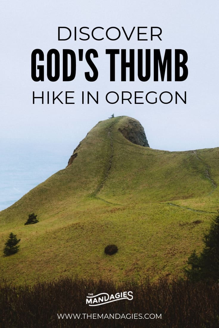
If you’re craving a new adventure in the Pacific Northwest, check out this rewarding hike to God’s Thumb in Lincoln City, Oregon.

Hiking To God’s Thumb in Lincoln City, Oregon
Trail Facts About God’s Thumb Hike In Lincoln City
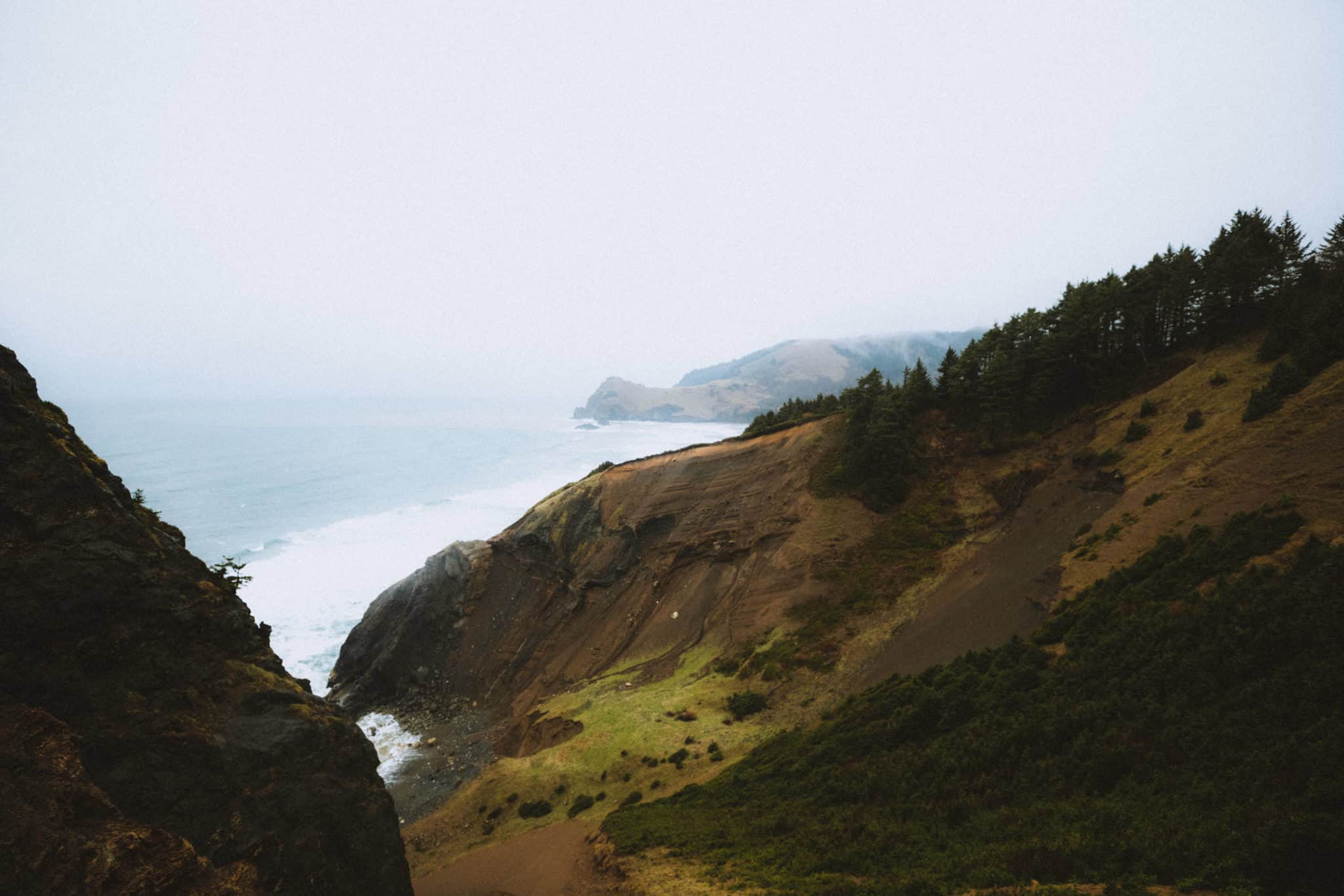
God’s Thumb is one of the prettiest (and muddiest!) Oregon Coast hiking trails that consist of crossing through meadows, moss-covered spruce forests, and incredible views of the Pacific Ocean.
The trail is often muddy, and we encourage you to check the weather report before embarking on this trail. We also highly suggest wearing a raincoat and rain boots!
Distance: 4.6 miles, out-and-back trail.
Elevation Change: 1025 feet.
Difficulty: Moderate. (Muddy areas, long distances uphill, and steep cliff edges)
Dog-Friendly: Yes! They must be on a leash at all times.

Where To Start God’s Thumb Trail
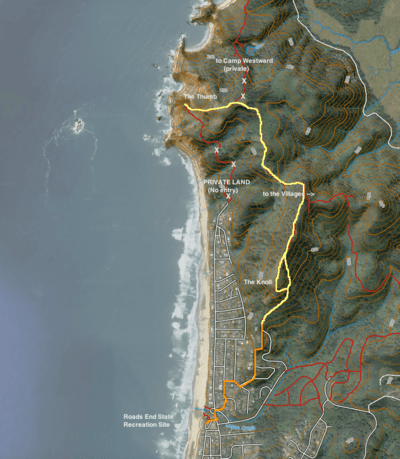
The trail to God’s Thumb isn’t as intuitive as other hikes in the Pacific Northwest. There are two very important things to know about this area before you embark:
1.) You must park your car at the Road’s End State Park Parking Lot.
If you attempt to park closer, there is a high chance your car will get towed. (And the many, many “No Parking” signs should warn you about this too).
The area surrounding the trailhead to God’s Thumb is private property, and residents are very adamant about reporting any violators.
2.) You must take the Road’s End Trailhead, at the end of Port Drive.
In the past, there has been a shorter trail which was located at the end of Logan Road. This has now become private property and no longer a legal trail to God’s Thumb.
It’s important to follow the correct trail because much of the land surrounding the park is private property, and it’s unlawful to trespass. For a step-by-step guide on how to reach the proper trailhead, read this post from OregonHikers.com.
Also, see the yellow line in the map below to see a visual of the correct path!
Beginning The Trail To God’s Thumb Hike
The beginning of this trail will include hiking up a grassy ridge, where you will eventually get a view of Devil’s Lake and Lincoln City below. This means you are entering The Knoll, which is a government-owned open space.
(Keep your eye out for elk because they often sleep here!)
After the clearing, you should drop back down into an alder field meadow, then finally after a while, break out into the opening of God’s Thumb.
For more step-by-step instructions, read Oregon Hiker’s post about God’s Thumb hike here.
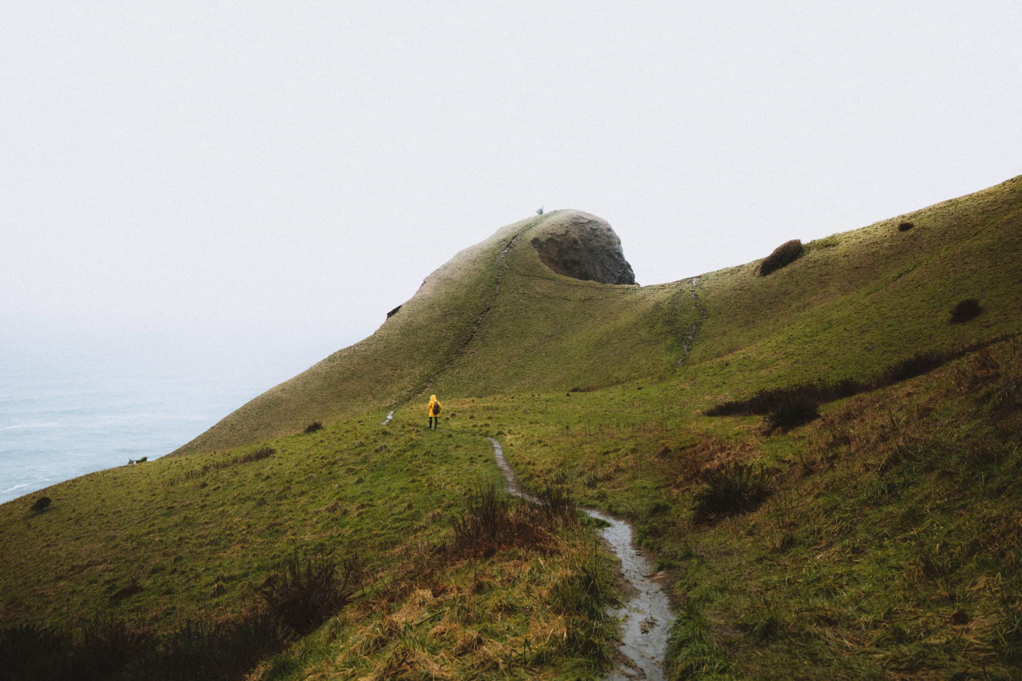
Arriving at God’s Thumb
The Thumb is easily recognizable by its dramatic upward curve in the meadow. You can opt to hike to the top of God’s Thumb, but keep in mind the meadow grass is fragile, so please stay on the trail.
Over time, the curve in the basalt form known as the “Thumb” will eventually become a sea stack over years of erosion from the crashing waves. You are one of the lucky ones who will be able to still walk to it!
Read More: The Complete Oregon Coast Road Trip Itinerary (15+ Stops!)


Best Viewpoints At God’s Thumb On The Oregon Coast
God’s Thumb hike is full of beautiful scenery and stunning land formations, like many other places on the Oregon Coast!
Below are some of our favorite places to snap pictures on the trail!
Don’t have a fancy camera? No need – just read our guide to editing photos on your phone!
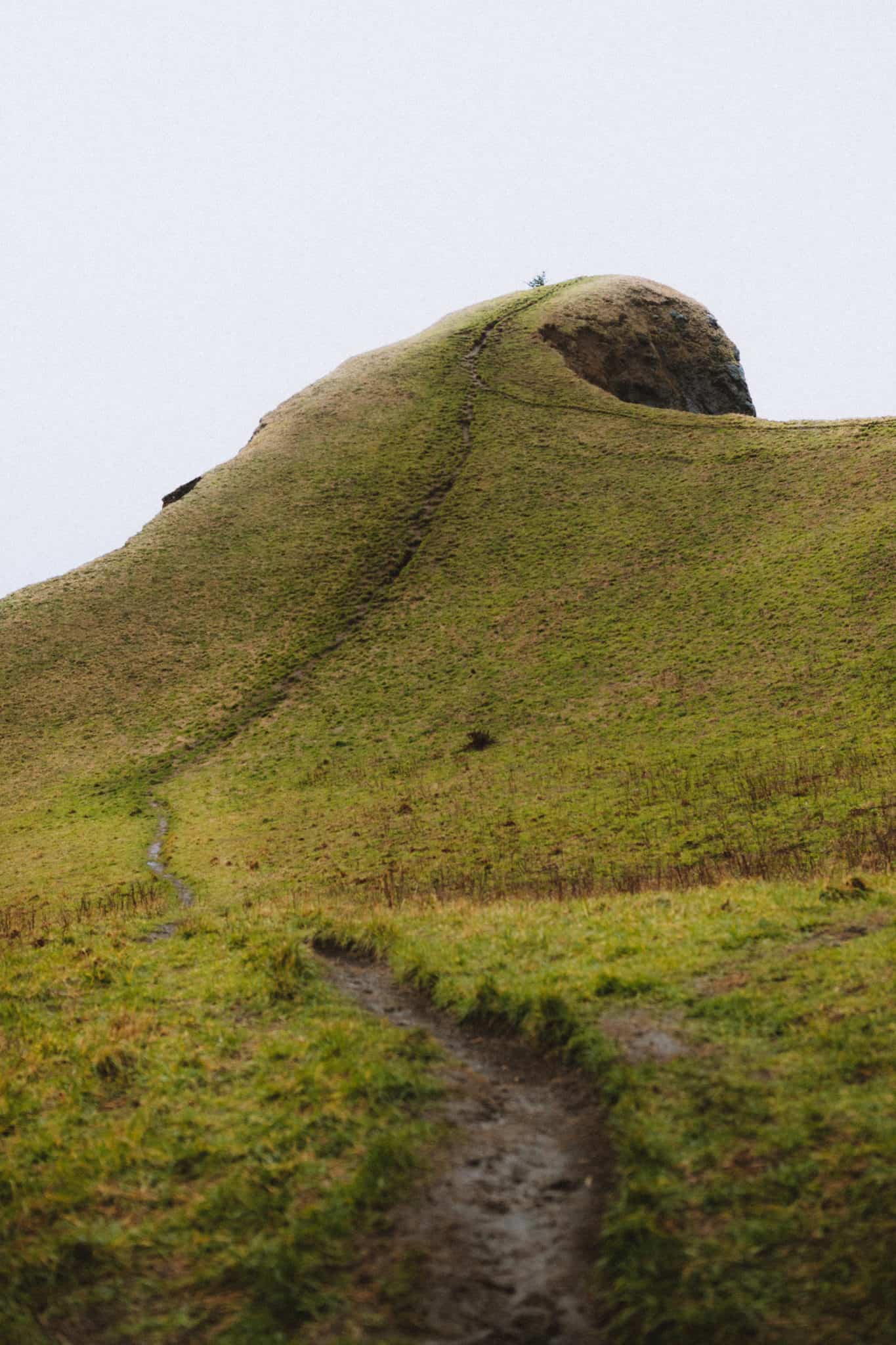
The Thumb
It’s no doubt that the “Thumb” is the main attraction of this hike. Its strange curve and the stunning view of the ocean is what makes this trail so popular.
Like stated above, you can climb to the top but take care to stay on the trail to preserve the fragile grass that surrounds it.
Also, remember to watch your footing, because the trail that parallels the ridge line is an extremely steep drop off to the small cove below.
Read More: Not Afraid of Heights? Try This Trail in Southern Utah


The Open Meadow
The area surrounding the cove has a unique dip in the landscape and open meadow. At the beginning of the hike, there is also an open space where you can see a view of Lincoln City below.
Spend some time enjoying the view from these high places, and if you stay still long enough, maybe you will spot an elk!
Pay Attention: The left side of the trail to the top of God’s Thumb is extremely steep. Make sure to watch your footing, and be extra cautious if it’s a windy day!

The Tall Spruce Trees
During God’s Thumb hike, you’ll walk through sheltered areas of mossy spruce trees and ferns. This is the part of the hike that really feels like the Pacific Northwest!
Rain, mud, moss, and damp foliage all come together in this temperate rainforest. Spend some time enjoying the unique landscape of this area of Oregon!
Read More: 10 Insanely Useful Tips For Hiking In The Pacific Northwest

Frequently Asked Questions About God’s Thumb Hike
Are Dogs Allowed On God’s Thumb Hike?
Yes! Dogs are allowed on this trail but must be kept on a leash at all times. Make sure to pick up after your pup (i.e. poop bags!) and be considerate of other hikers!
Can I access the trail to God’s Thumb via the north entrance of Logan Road?
Unfortunately no. After a lot of research, we discovered that this trail is no longer a valid access point. Please be considerate of private properties and make sure to use the correct trailhead entrance at the end of Port Road.
Where can I camp near God’s Thumb?
There are several Oregon Coast campgrounds to check out near Devil’s Punchbowl! The closest ones are Beverly Beach Campground, South Beach State Park, and Devil’s Lake State Recreation Area.
However, these campgrounds fill up FAST, especially in the summer and fall season. To get the dates you want, download an app called The Dyrt. They have a new feature called Dyrt Alerts (with the Dyrt PRO Membership) that will help you get reservations at sold-out National & State Parks across the US.
Dyrt Alerts work like this: you select a sold-out campground and the date you want to camp there, The Dyrt then scans every few minutes for cancellations and quickly sends you a Dyrt Alert when your campsite becomes available! Try PRO Dyrt Alerts for free, no strings attached — use our code “mandagies” to get 30 days free.

Other Adventurous Hikes Around God’s Thumb Trail
The Oregon Coast is full of adventure – so why not discover some other amazing places while you are nearby!
Click some more of our favorite hikes below to make the most of your time in Oregon.
- Cape Kiwanda (23 miles north, 35-minute drive)
- Drift Creek Falls (15 miles east, 40-minute drive)
- Hug Point State Recreation Area (83-miles north, 2-hour drive)
- Cannon Beach (84-miles north, 2-hour drive)
- Thor’s Well (51 miles south, 1 hour 15 minute-drive)
Have you ever hiked God’s Thumb in Lincoln City? Tag us in your photos with #themandagies on Instagram and share them with us!
MORE OREGON ADVENTURES
Stay Overnight at The Innkeeper’s House at Heceta Head Lighthouse!
Umpqua Hot Springs + Toketee Falls
The Ultimate Oregon Coast Road Trip
A Guide To The Painted Hills in Eastern Oregon
Explore the Southern Oregon Coast (Samula H Boardman and more!)
10+ Pacific Northwest Hot Springs You Must Experience
Like this Oregon Coast hike? Save in on Pinterest for your next trip inspiration!