Post Summary: The Best Hiking Apps To Elevate Your Next Hiking Adventure
Written by Adventure Contributor, Whitney Matthews
Yep, we said it: apps for adventuring.
You’re probably thinking, “Wait. Isn’t that the whole point of getting outside? To leave your phone at home, or at least, enjoy being disconnected for a while?” And yes! You’re 100% right!
Disconnecting for a bit is one of our favorite reasons to get outside. But hear us out…there are actually so many awesome hiking apps out there that can actually improve your experience in the outdoors, and not to mention, keep you safer.
Before we dig into some of our favorites, here are just a few of the reasons why you should consider using hiking apps for your next adventure:
Benefits of Some of the Best Hiking Apps
Safety On The Trail
A few of the best hiking apps we’ll talk about are centered around keeping you safe in the backcountry. From teaching you top survival skills to helping you plan and share your trip with loved ones, GPS hiking apps can allow people to track your location and check up on you.
Offline Navigation (GPS)
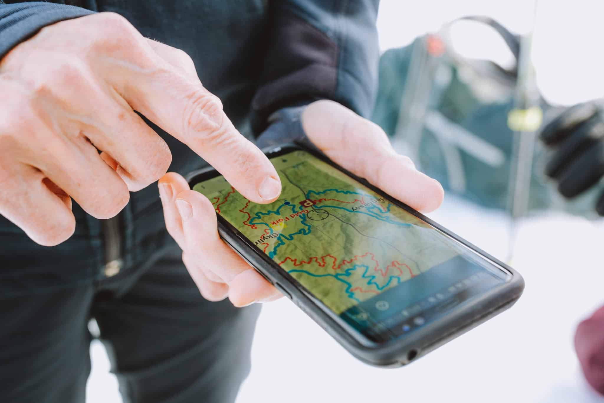
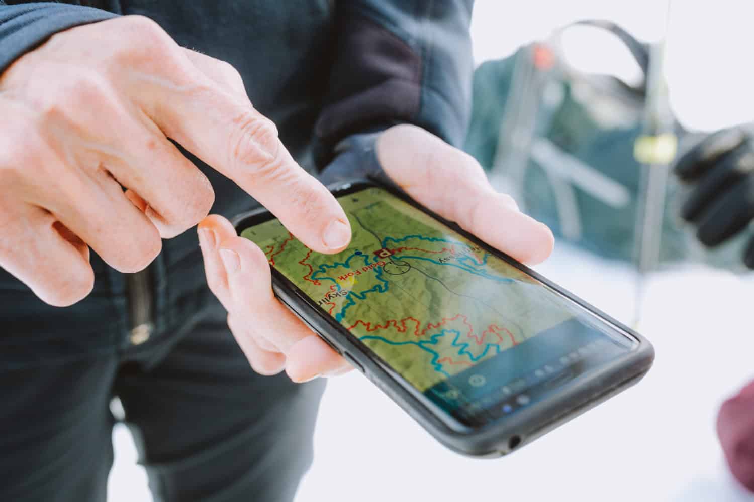
A lot of these GPS apps for hiking feature maps and images of trails to help minimize your risk of getting lost or taking a wrong turn. Many of them also feature downloadable maps that you can save to your phone and make available offline.
Discover New Trails
Some of the best hiking apps like AllTrails or MapMyHike (keep scrolling to learn about them specifically) allow you to filter hikes in your area by distance, difficulty, and end-point (a lake, a view, a waterfall (like Wallace Falls trail!), etc.).
Many of the trails on these apps come with reviews and photos from other hikers so you don’t have to guess what you’re getting yourself into.
Learn about the Nature and Wildlife Around You
Curious about the bushes, ferns, and trees you pass on your hike? Wondering if you can eat those tasty-looking berries along the trail? Or maybe you’re at the top of your hike and you’re wondering what mountain peaks surround you? There are hiking apps to help you answer all of those questions!
Don’t be afraid to bring your phone with you on your next hiking adventure! Our goal is to help you feel as prepared for your adventure as possible, and sometimes you just need the comfort of knowing you have a map or survival guide in your back pocket to set any worries at ease.
Wait! What if my phone battery dies using hiking apps??
A dead battery is no fun when you are relying on hiking apps for your next trail adventure.
This is why, in addition to the best hiking apps and phone navigation, we always recommend bringing a paper map, or a satellite communicator for longer more complex journeys.
Here are some ways to stretch your phone’s battery life, and backups to ensure you’ve got enough juice for the trail!
- Bring a portable power bank. We carry ultra-lightweight and slender ones from Biolite, to give us an extra boost when our battery is low.
- Solar chargers. Taking a much longer thru-hike or multi-day trip? You can produce your own energy from the sun, using this portable solar panel from Goal Zero!
- Turn off your phone when not in use, or when you don’t have service (If you’re still hoping to use your camera, just put it in airplane mode)
- Keep your battery warm. Stick it in an insulated pocket or in a pocket close to your skin/body heat
- Turn off / close apps running in the background.
Okay, so by now, hopefully, we’ve convinced you that bringing your phone on your adventure might actually be a good thing.
Keep scrolling for our list of the 10 best hiking apps to help take your adventure to the next level!
The 10 Best Hiking Apps To Take Your Adventure To the Next Level
Heads up, this post contains affiliate links!
Need some trail inspiration for your next hiking adventure? Read these posts too!
- All The Best Hikes In Glacier National Park
- 19 Washington Winter Hikes To Put On Your List This Coming Season
- The 30 Best Hikes In Washington State (Iconic Locations)
- 15 Super Convenient Hikes Near Seattle, Washington
- 20 Jaw-Dropping Hikes In The Pacific Northwest

AllTrails
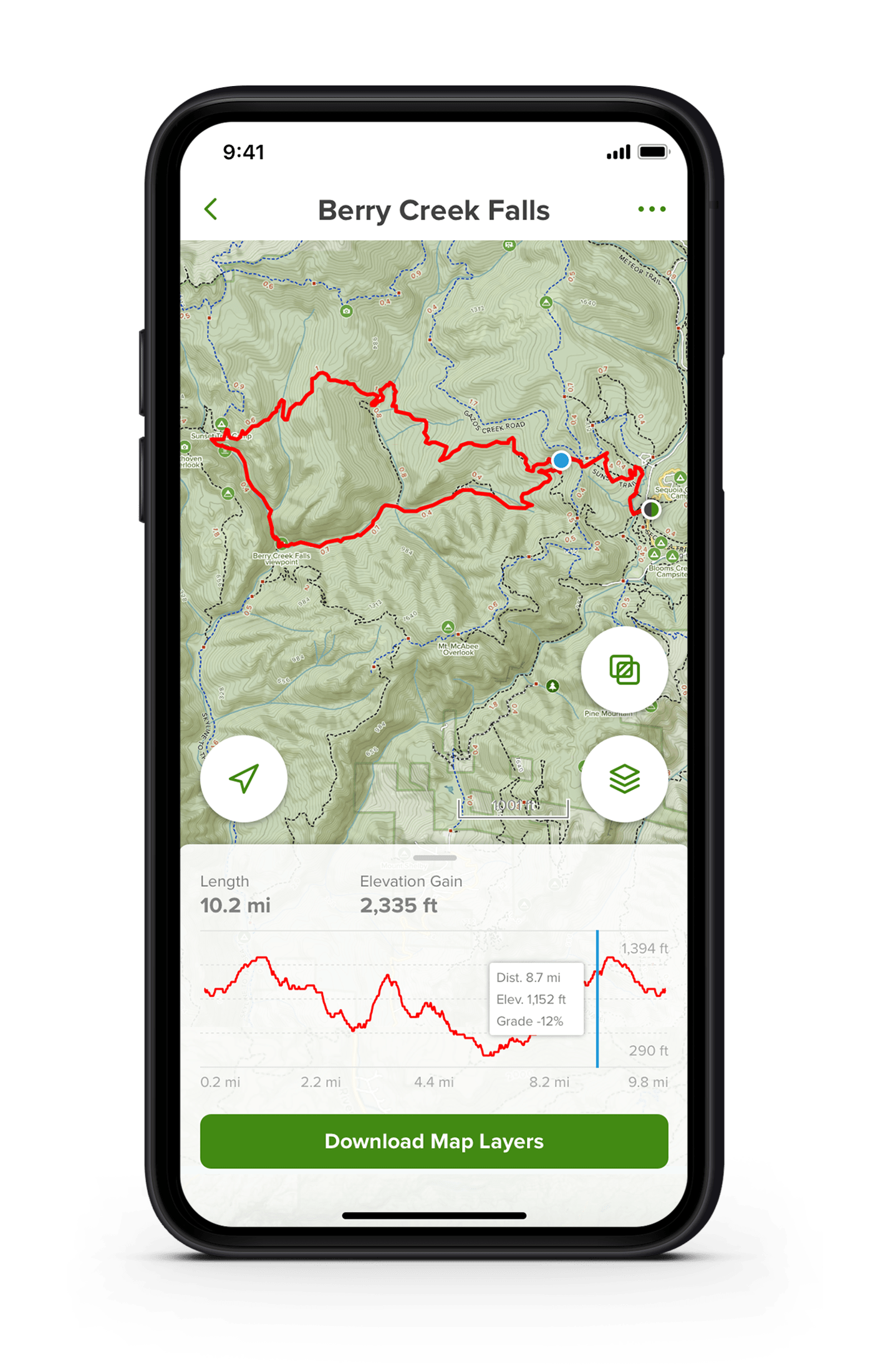
If you’re looking to download only one app from this list, let it be this one! It’s one of the best hiking apps for the sheer volume of trails it provides! The AllTrails database features over 100,000 trails that you can filter by length, difficulty, elevation gain, and amount of trail traffic.
We used AllTrails to save all of these epic hikes in Sedona, Arizona and these trails in Arches National Park so we could plan our desert trip to pack in as many trails as possible!
Once you choose your trail, you can read reports and reviews from other hikers, check the weather forecast, review the trail maps, and scroll through photos. And once you’re off on the trail, you can record your mileage and track the distance you travel.
The free version is great for trip planning at home, but if you want to unlock all the pro features (like offline maps and downloadable information) you’ll need to get a subscription!
Price: Free trial // $29.99 per month for Pro
Cairn
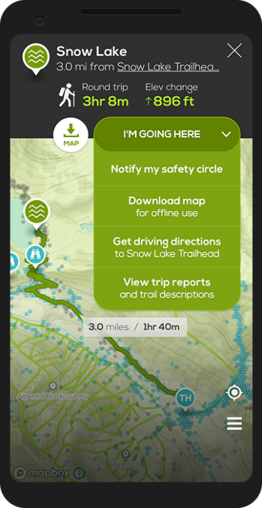
Cairn is all about your safety while you’re on the trails. One of the best features of this app is that it allows you to share a trip plan and timeline with your “safety circle” of friends and family.
If you don’t return by the time you said you would, the app automatically sends notifications to your circle with your exact GPS location so they can find you.
It will work even if your phone is off or broken. This is an especially important hiking app to have if you are a solo hiker, or someone who is exploring a new territory for the first time. We were hiking on BLM land in Idaho to Goldbug Hot Springs, and it’s nice to know that you are watched over, even in the wilderness!
Price: Free Trial // $4.99 a month, or $26.99 per year for Premium
Map My Run (By Under Armour)
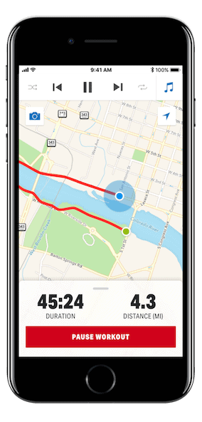
If you love trail running, Map My Run is for you! This is the perfect app for putting in miles on backcountry trails or just setting out on an afternoon walk through the park.
This app allows users to track their location and hike progress, while also tracking information like speed, distance, and even calories burned. We love that it acts as not only a GPS navigation tracker, but an analytics recorder – a personal essential for Pacific Northwest trails for running!
Map My Run has a large community of users, so you can share your hikes and runs with others or connect and complete challenges together.
Price: Free (with the option for in-app purchases)
Maps 3D PRO
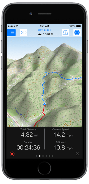
Maps 3D is one of the best hiking apps for people who want a really intuitive way to read traditional topographic maps.
You probably already guessed it, but Maps 3D PRO offers 3D mapping to bring contour lines, mountain peaks, and hills to life so you can visualize your endpoint and know exactly what awaits you on the trail. You can even download maps to be accessible offline.
We find topo maps extremely helpful to use, especially in rocky and desert terrain. When traveling on the Delicate Arch trail for sunrise in Arches NP, we wish we had some sort of augmented reality map to follow (kind of like this one from Maps 3D), because it is difficult to locate cairns in the dark!
Available on iOS only. Price: $3.99 or $13.99
Hiking Project from REI
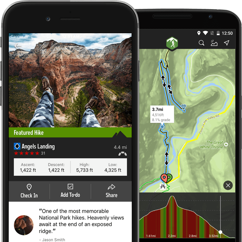
The Hiking Project app from REI is very community-driven. Users are encouraged to share their adventures and submit a report about a trail, vista, point of interest, etc. It is then reviewed by an in-house team to check for accuracy before being added to the app.
Think of this hiking app as a free guidebook to thousands of trails, photos, and trip reports!
REI also has a similar tool focused on sharing the best National Park hikes in the United States too, which can be incredibly helpful if you love iconic hikes – especially if you’re planning a Utah National Parks road trip!
Price: Free
SAS Survival Guide
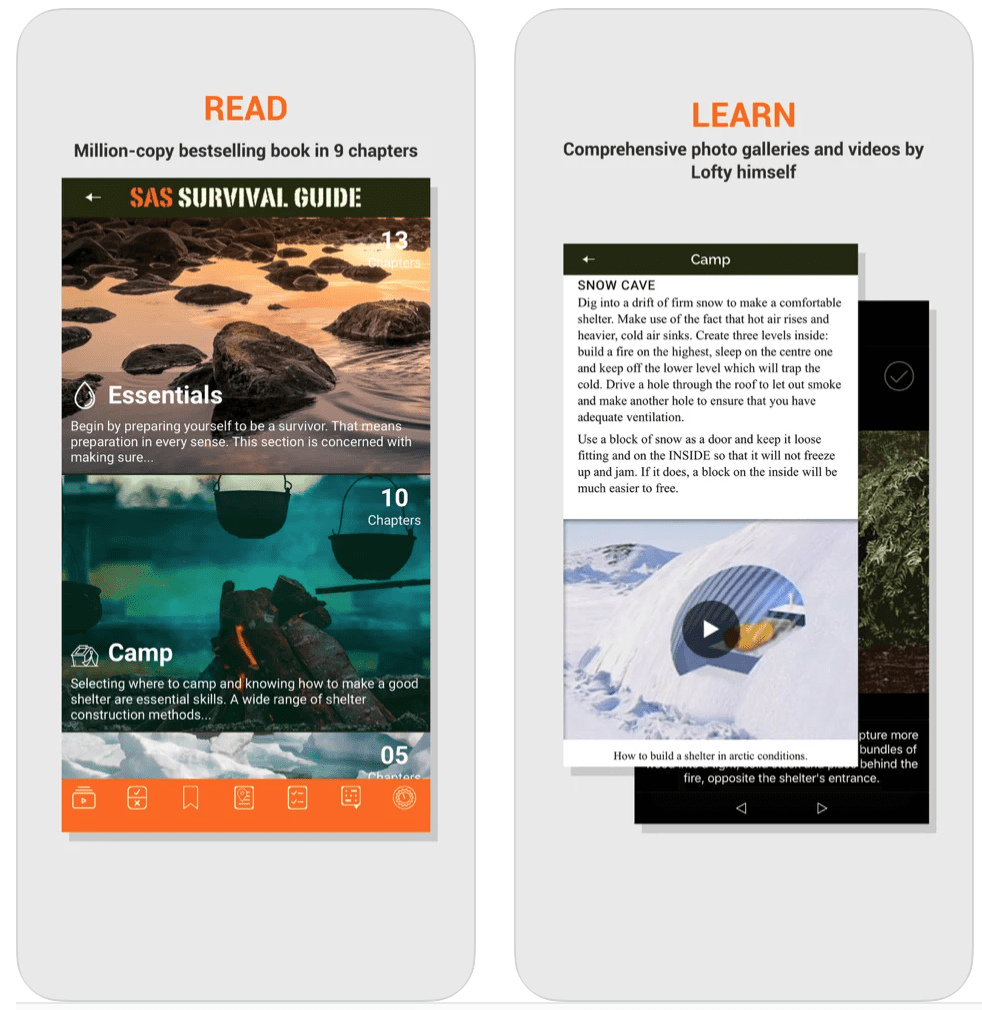
The SAS Survival Guide is the app-based version of the bestselling survival guide, SAS Survival Handbook by Joh “Lofty” Wiseman.
The app includes a wide variety of important outdoor survival skills that may become useful in serious situations, like how to build a fire, how to turn rainwater into drinking water, how to use the stars to navigate, and first aid help. The app also comes with a quiz so you can test your backcountry survival skill knowledge. Don’t forget your hiking snacks!
Price: $5.99
Backcountry Navigator
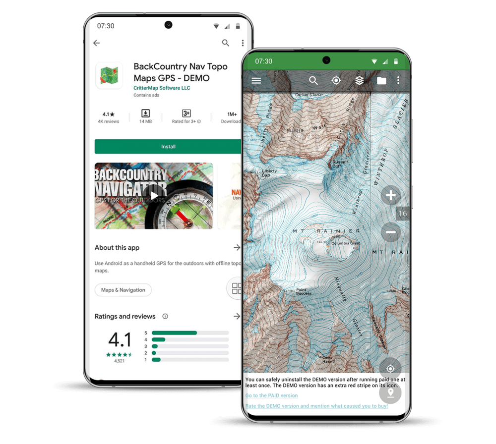
Backcountry Navigator Pro essentially turns your phone into a GPS device, like a Garmin In-Reach.
How it works: before your trip, download the topographic maps so that you have access to them offline. Then, when you’re out on the trails, Backcountry Navigator uses GPS running in the background to track your location, aka: you don’t need cell service.
Available only for Android users. (But stay updated, because their newest Backcountry Navigator XE is in beta (testing) for Apple users too)
Price: Free Trial // Flat cost of $15 gives you full access to the downloadable topography maps
Peak Visor
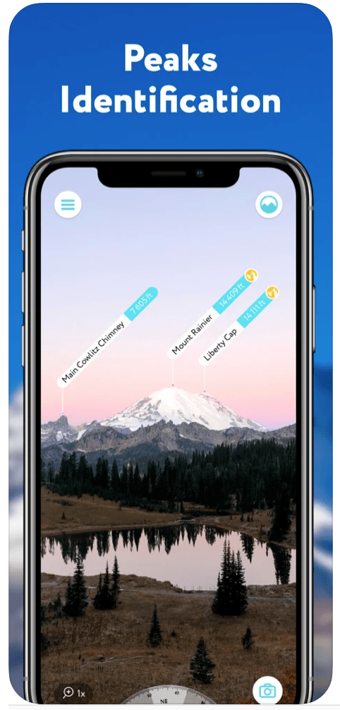
Have you ever gotten to the top of your hike and wondered which mountain peaks you’re looking at?
Using your phone’s camera, Peak Visor identifies which mountains are around you and tell you how tall they are. Go ahead, impress your friends with all your mountain peak knowledge. This app will also tell you about any mountain huts and viewpoints you see and what trails to take to get there.
When climbing the Mount Storm King Trail, we wish we knew of this kind of app, because from the top of this epic spot in the Olympic National Park, you could see several mountain peaks!
Peak Visor is also extremely useful if you love mountain sports. Partnering ski resorts will provide mountain schedules, lift information, ski runs and more. You can also explore their Topographic 3D Maps to help you better understand the terrain before your next trip.
Note: While this is available in North America, there is much more detailed information on European locations!
Price: $5.99
Gaia GPS
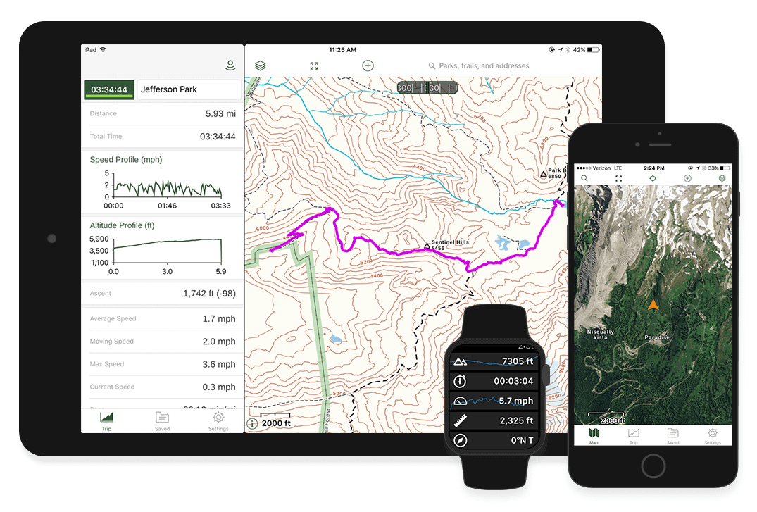
Gaia GPS uses modern topo maps to help you track your route, plan a hike, or find a camping spot along the way. It is compatible across several devices, so you can use it for everything from planning your route, tracking your route, and getting real-time data on a smartwatch.
If you pay for a membership ($20 / year), you can download maps to be available offline, record your adventures, and get map overlays like contour lines, slopes, and shading. This is one of the most popular GPS apps for hiking, and we highly recommend it!
Price: 1-Month Free Trial // $19.99 / year
FATMAP

One of the newer hiking apps on the market, FATMAP is especially great for mountain biking, skiing or snowboarding, and hiking. It can also be useful if you are looking to plan alpine hiking route – it gives incredible information about snowfall, depth, and more! It features detailed 3D maps from satellite imagery, overlaid with information about the terrain or resort.
FATMAP also has a mode for summer and winter, and the winter mode is complete with important information like avalanche reports. (Which is essential for safe winter hiking and mountain sports!)
Price: Free // $29.99 / year for Premium
Avenza Maps
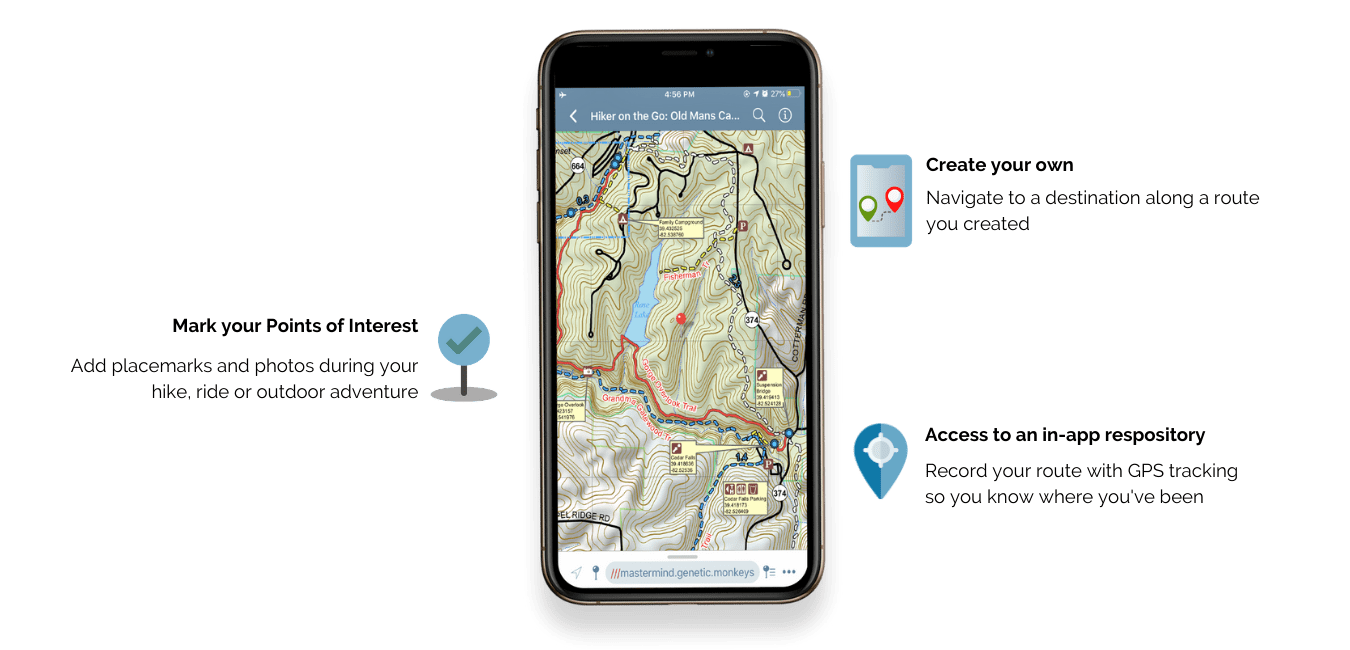
Avenza Maps is yet another incredible GPS app for hiking that uses offline mapping and navigation features to enjoy outdoor adventures in remote areas! We first downloaded this app because the Idaho Parks and Recreation Department made custom snowshoe maps for their Idaho backcountry yurt trails.
Since then, we’ve enjoyed using it for national park hiking (ex: Zion National Park’s iconic Angels Landing hike), and marking points of interest on the trail. This is especially useful for photographers like us, who need specific location scouting information to create stunning landscape images. If you are someone who love marking spots on Google maps to explore later, you might like trying Avenza Maps too!

So, which ones are the BEST hiking apps?
While we would LOVE to have a hiking app that has all the features listed in this blog post, the reality is – each one has its own focus and unique features to offer! From snow sports to trail running, analytics to exploration, there are so many reasons that people use hiking apps.
In order to find the right one for you, we recommend downloading one of these GPS hiking apps listed above, and test out which ones fit your active lifestyle!
We hope you were able to find one from among these best hiking apps to discover in this post, and we hope they enrich your experience on your next hike!
MORE HIKING POSTS
7 Types of Pacific Northwest Forest Passes You Should Have
The Best Oregon Coast Hiking Trails To Take Your Breath Away
101 Incredible Things To Do In The Pacific Northwest
10 Easy Hikes In Jasper National Park

