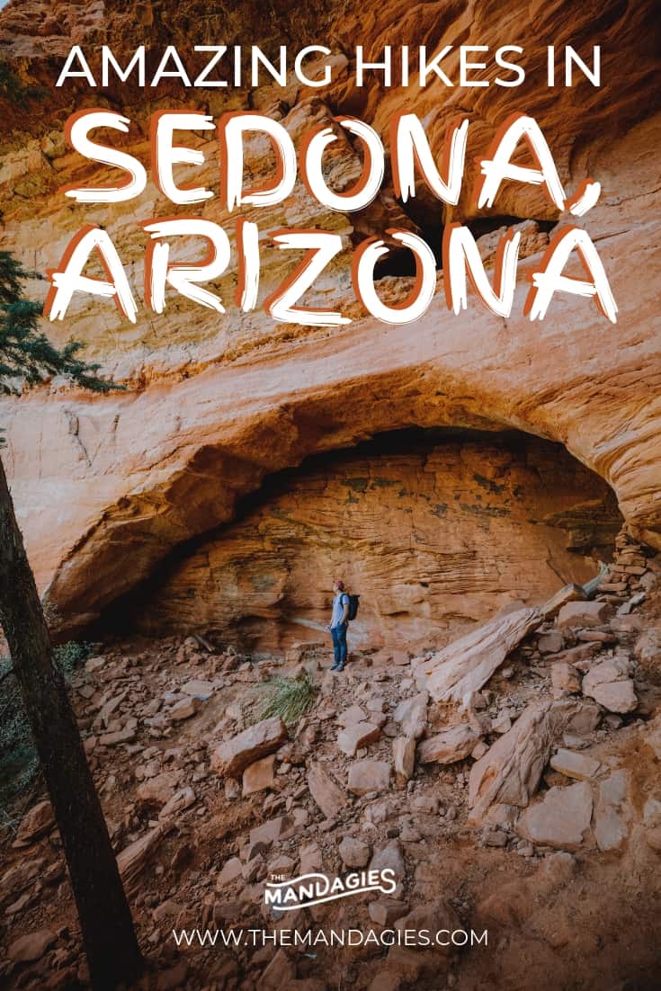
Post Summary: Epic Hikes In Sedona and Exactly Where To Find Them
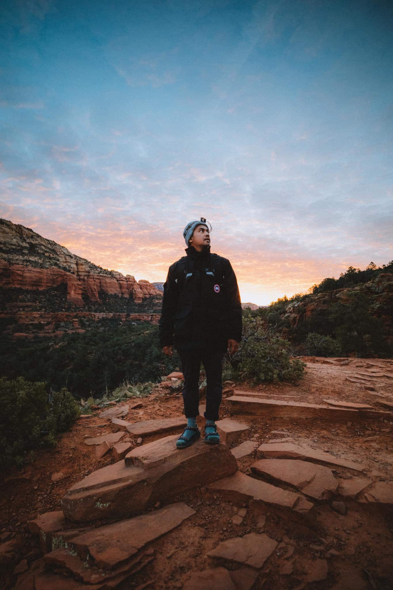
You’re coming to the land of red rocks and mystical hikes!
We’re so glad you stumbled upon this post because the hikes in Sedona blew our mind and we know they’ll blow yours too.
Literally, every single trail led us to some kind of secret cave, magical pool, or ethereal view…the list goes on.
We know that researching these beautiful Sedona trails takes time and effort, so we wanted to make this blog post to help you minimize your time planning and help you maximize your time outside.
In this post, we’re sharing some of the best hiking trails in Sedona, what you can expect, and beautiful pictures to inspire you to get outside this season!
We have exact coordinates, parking tips, a packing guide and more, so read on, my friends, and let’s get hiking!

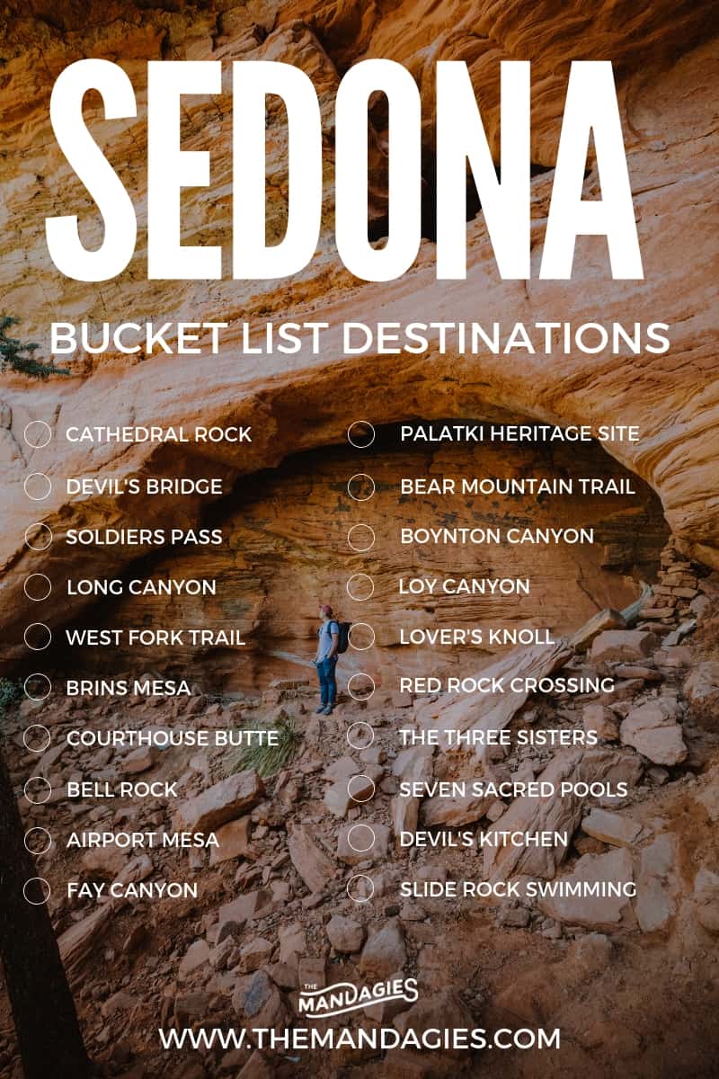
15 Jaw-Dropping Hikes In Sedona To Make You Want To Move To The Desert
- 15 Jaw-Dropping Hikes In Sedona To Make You Want To Move To The Desert
- 1. Cathedral Rock
- 2. Devils Bridge
- 3. The Birthing Cave
- 4. Soldiers Pass
- 5. Red Rock Crossing (Via the Baldwin Trailhead)
- 6. Sugarloaf Loop
- 7. Fay Canyon Trail
- 8. Airport Mesa Trail
- Other Amazing Sedona Hiking Trails To Consider
- Map of Popular Sedona Trails
- 7 Essential Tips For Sedona Hikes
- Pack These Things For Sedona Hikes
- MORE SOUTHWEST ADVENTURES
Note: This post may contain affiliate links in which we receive a commission if you decide to make a purchase. This is of no extra cost to you and we only share products we know would be helpful on the hiking trails in Sedona!
First, Where Exactly is Sedona?
The city of Sedona is located in Northern Arizona, just about an hour’s drive south of Flagstaff. This area is known as Red Rock Country for its incredible red sandstone cliffs and formations – all within driving distance of one another!
Sedona is a hub for adventure lovers, photographers, nature lovers, and people who just want to escape a busy life for a second.
Nearly everywhere you turn in Sedona, there are panoramic views of the gorgeous ancient mountains and cliffs!
This area is becoming increasingly popular for everything from its family-friendly hikes to difficult backcountry trails and climbing opportunities. No matter what brings you here, you’re sure to be planning your next trip before you leave.

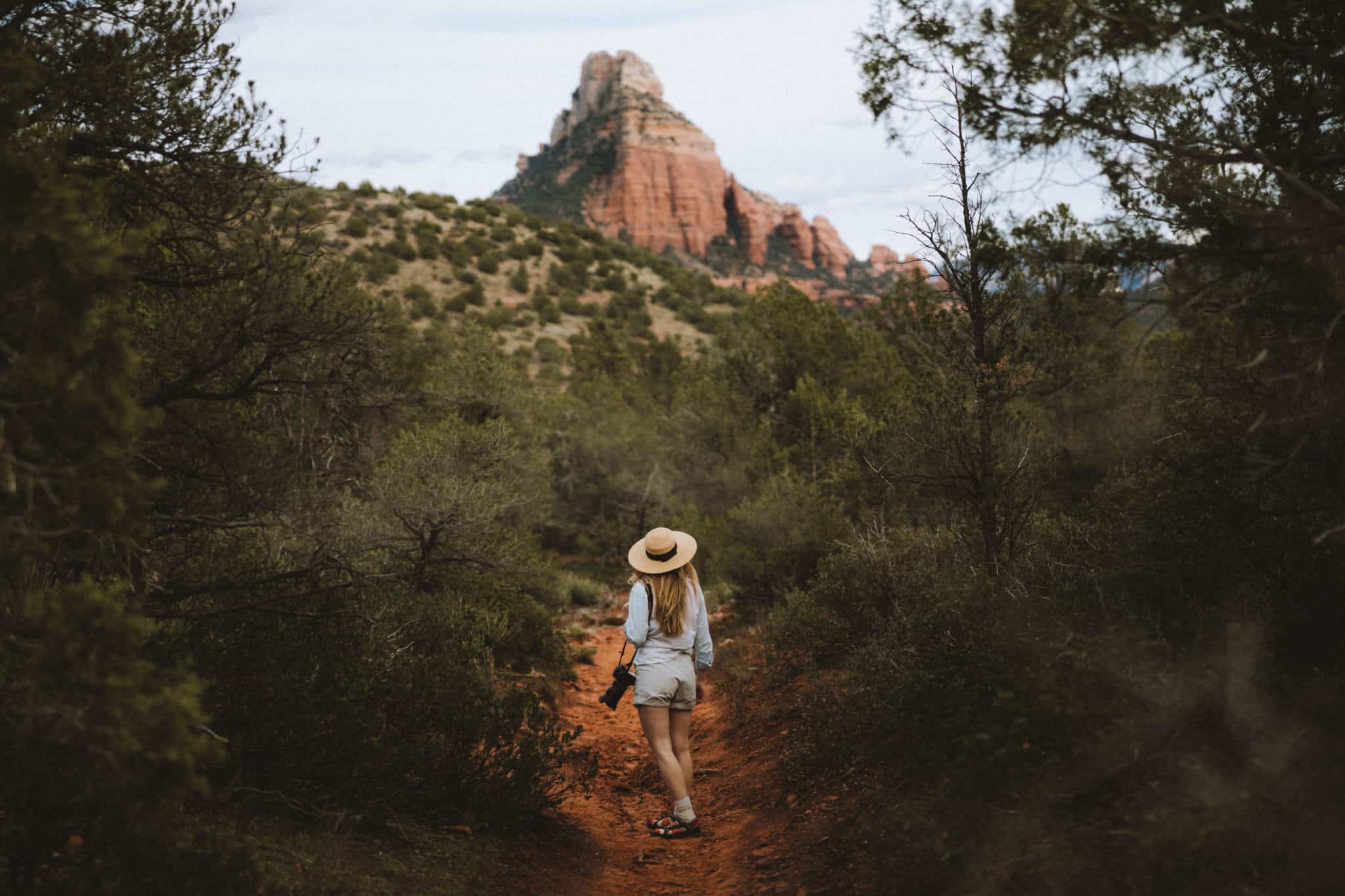
1. Cathedral Rock
- Trail Length: 1.4-mile out and back
- Elevation Gain: 645 feet
- Difficulty: Moderate (some parts of the trail require minor climbing on hands and knees)
- Cathedral Rock Features: Red rock pillars, best Sedona trail for sunset, beautiful Sedona views
- Trailhead Location: 34°49’30.7″N 111°47’18.3″W
What’s a blog post about trails in Sedona without a mention of Cathedral Rock? It’s one of the best hikes in Sedona for good reason – this place is GORGEOUS.
The trail begins at an easy pace. If you’re taking the main Cathedral Rock trailhead, you’ll cross a large wash, and then proceed to guess your way up a sandstone rock face. We say “guess” because there is no clear path since you are climbing up a rock pathway.
However, if you get lost you can follow others ahead of you OR the Red Rock State Park has also set up rock pillars (commonly referred to as cairns) to help guide you up the trail if you really lose your way.
There are a few places that require you to use your hands to help aid you up the rocks. Some sections of the trail require you to climb in a crevasse, but we found that there were many socially made ‘footholds’ and ‘handholds’ to help guide you up.
Remember, only one person can go up and down this feature at a time, so make sure to be aware of people that are climbing down.
Sedona Hiking Tips for Cathedral Rock:
- There is little to no shade on this trail. Make sure to pack plenty of water, head protection, and wear sunscreen to stay comfortable.
- Parking can be challenging since it’s one of the most popular hikes in Sedona. This area is also located in the Red Rock State Park Area, so make sure to purchase a $ 5-day pass, or a $15.00 week pass. Passes are available for purchase at a kiosk located at the trailhead.
Read More: Discover More Features and Photo Spots at Cathedral Rock In This Post

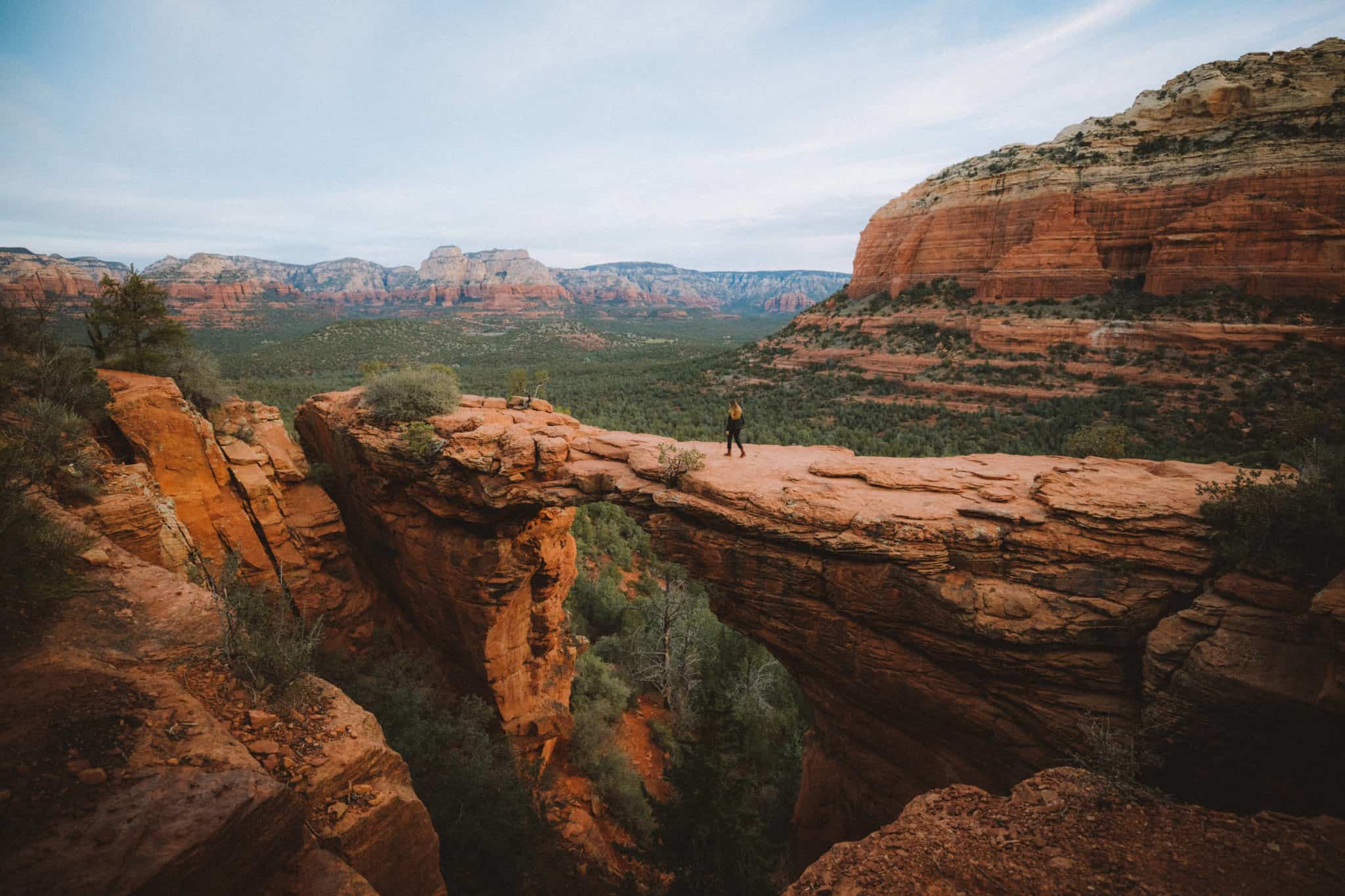
2. Devils Bridge
- Trail Length: 4.2 miles out-and-back
- Elevation Gain: 400 feet
- Difficulty: Moderate (if climbing to the top of the bridge)
- Sedona Features: Natural sandstone bridge, Sedona views, best Sedona trail for sunrise and sunset
- Trailhead Location: Dry Creek Road, Sedona, AZ 34.9028° N, 111.8138° W
Devil’s Bridge is one of the most popular hiking trails in Sedona. This is because several factors make it incredibly accessible for most hikers. The trailhead is easy to reach, the path is easy, and the hike itself is fairly short.
On top of all that, Sedona spoils visitors on this hike with little work for a huge reward. You’ll see the largest natural sandstone arch in the area and get amazing views of Sedona from the top!
…
The first part of this Sedona hiking trail is on a dirt road/wash for 0.75-miles, and the path is easy and wide. If you have a high-clearance 4-wheel drive vehicle, you can actually drive down this road and park closer to the bridge.
You will see many iconic pink Sedona tour Jeeps zipping past you on the flat trail – make sure to stay on the side of the trail to let them pass.
After the three-quarters of a mile, you’ll see a fork in the path and likely a few jeeps and cars parked to the side. This is the beginning of the inclined part of the trail.
The incline starts gradual but slowly gets steeper as you get closer to Devil’s Bridge. At the end of the trail, there are two viewing areas for Devils Bridge.
The first is the lower viewpoint, where you can walk to the base of the sandstone arch to look up.
The second requires a bit of an uphill climb on some sandstone stairs to arrive at the top of the bridge. The trail is short but steep, and the views from the top and worth it!
According to the USDA Forest Service, walking on the natural bridge IS allowed, but take caution nonetheless. The bridge is wide but still poses a huge risk of falling, so stay away from the edge.
Trail Traffic + Parking At Devil’s Bridge
Because of the beauty of the natural sandstone arch, this trail is incredibly popular.
If you are hoping for a quieter hike, we suggest taking this trail in the early morning for sunrise.
Devil’s Bridge is a popular location for photographers at sunset, so you’re likely to find fewer people on the trail in the morning. (And don’t worry, we think the light is just as beautiful then, too!)
Read More Iconic Hikes: Attempt Angels Landing In Zion National Park
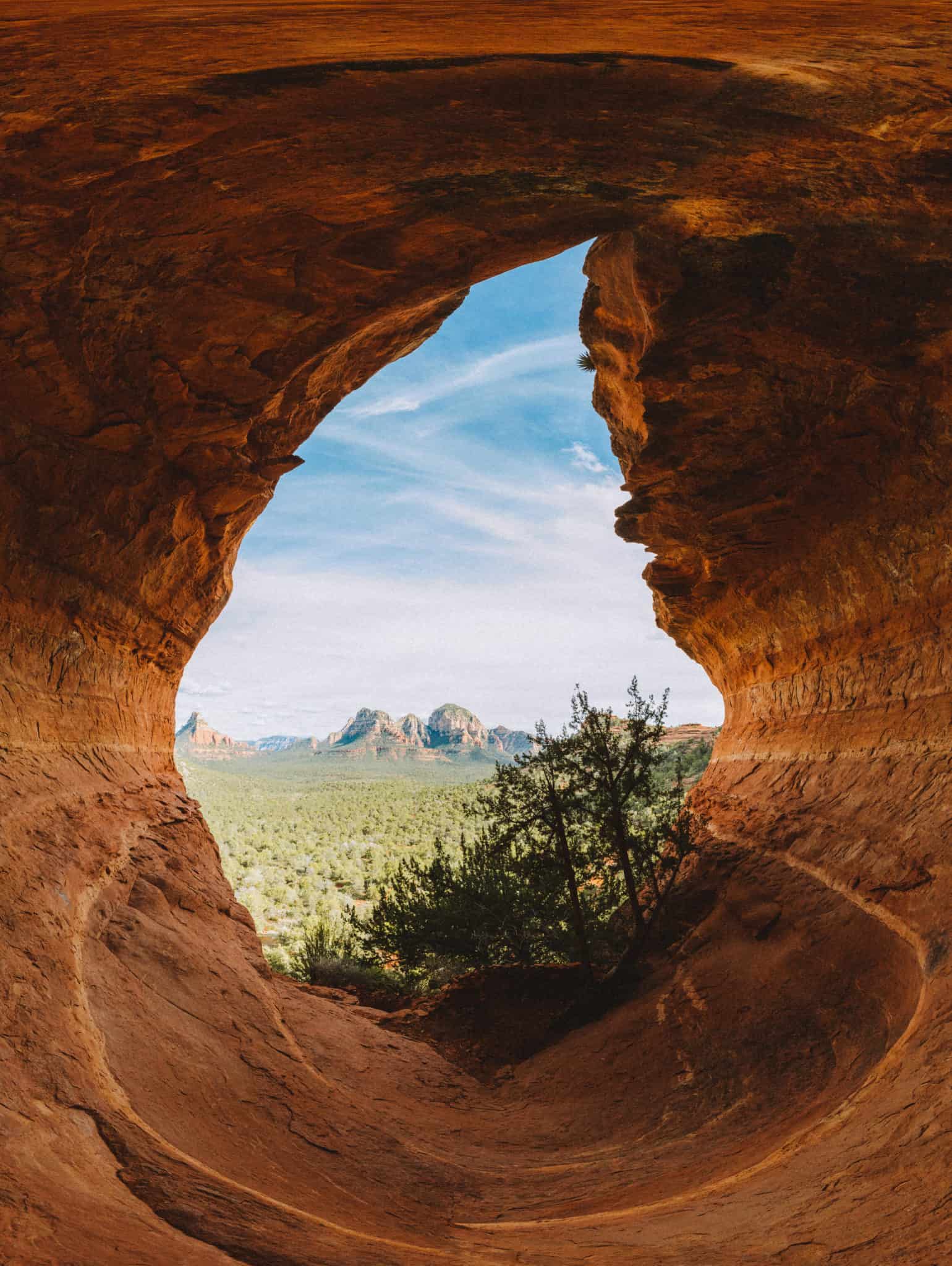
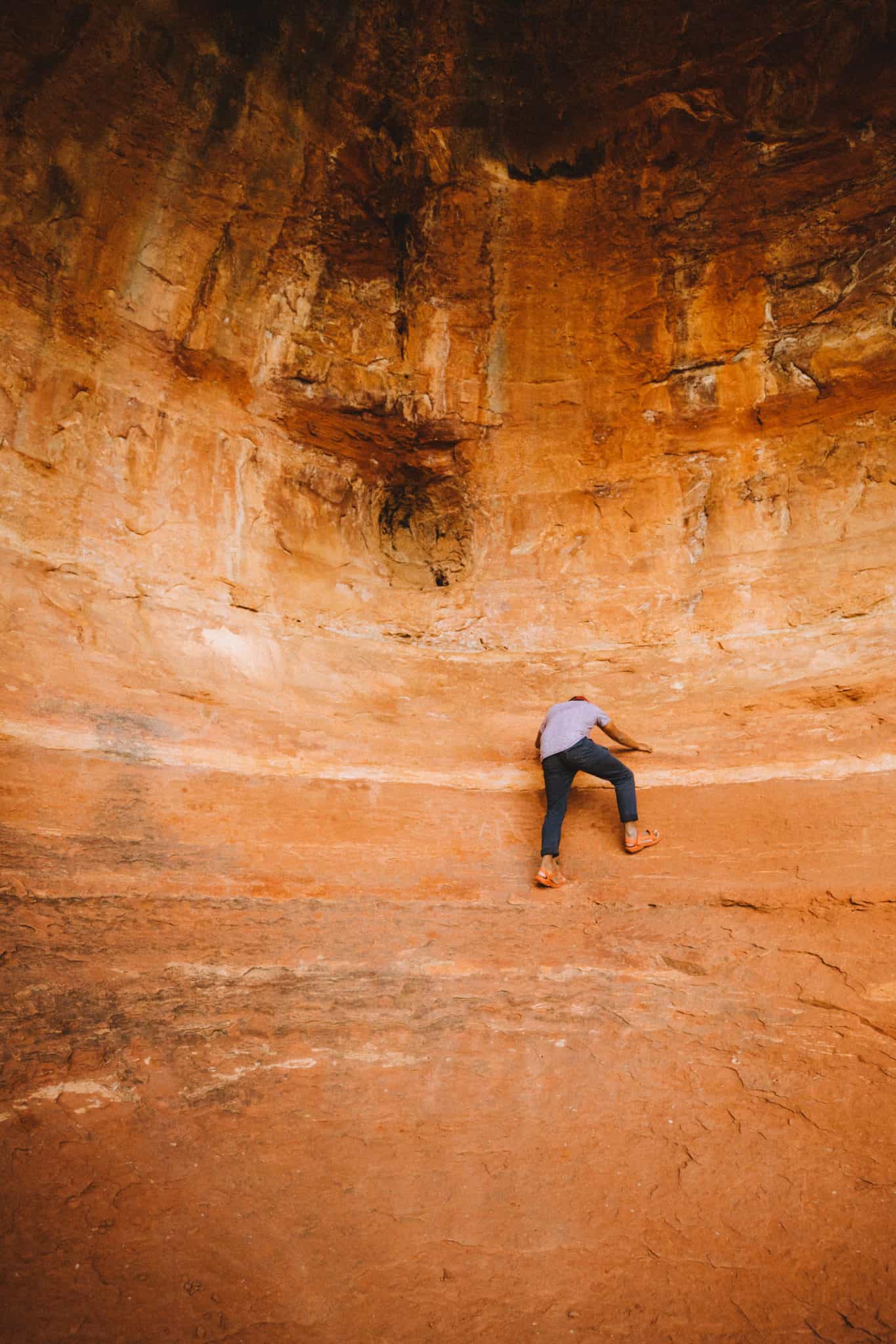
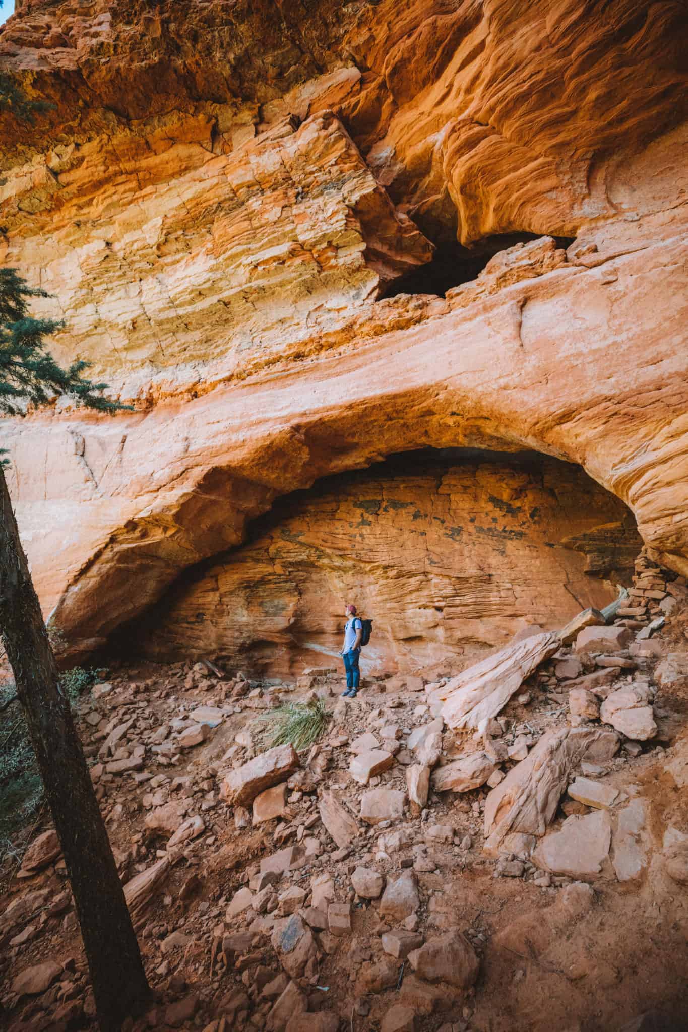
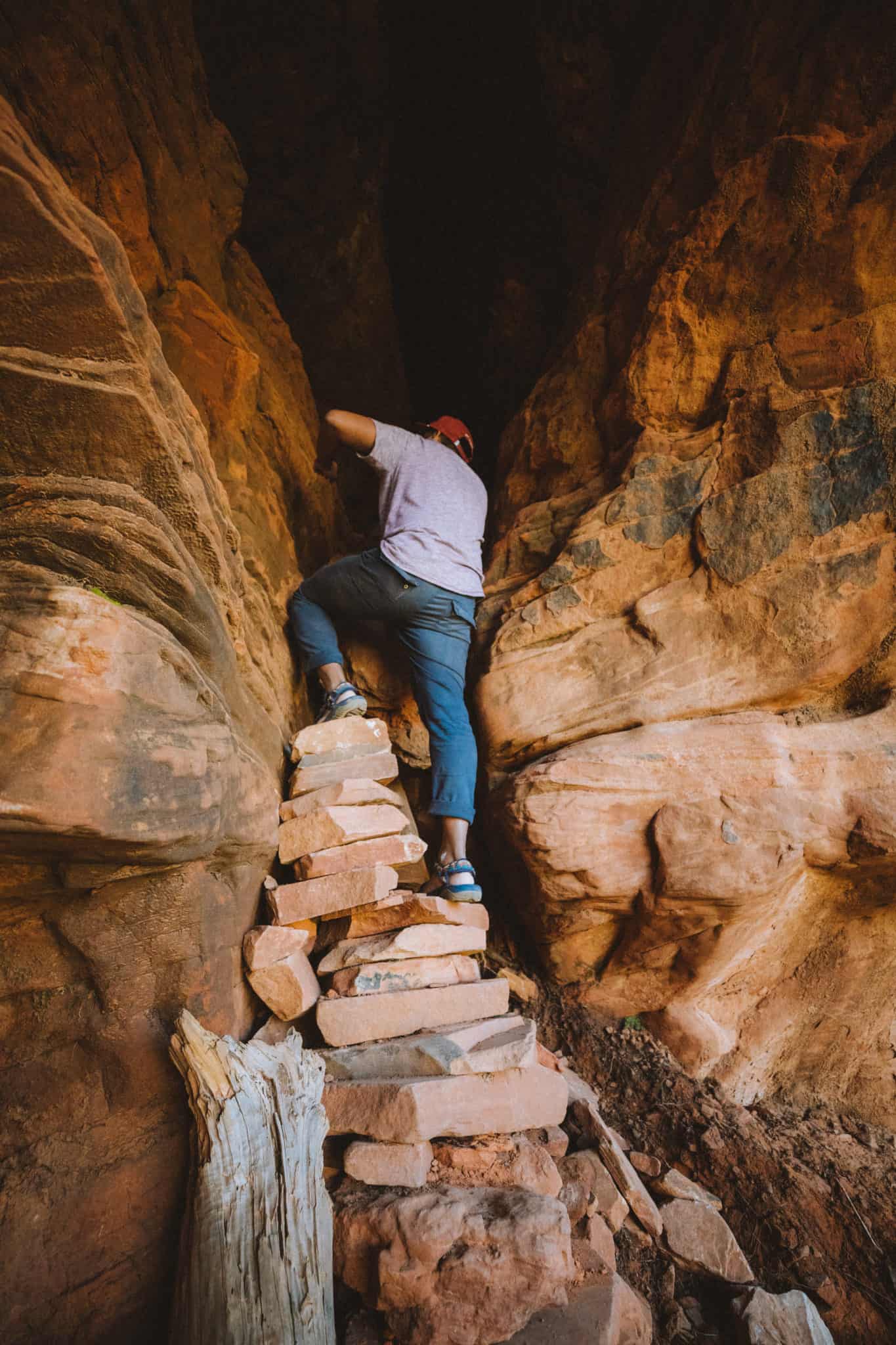
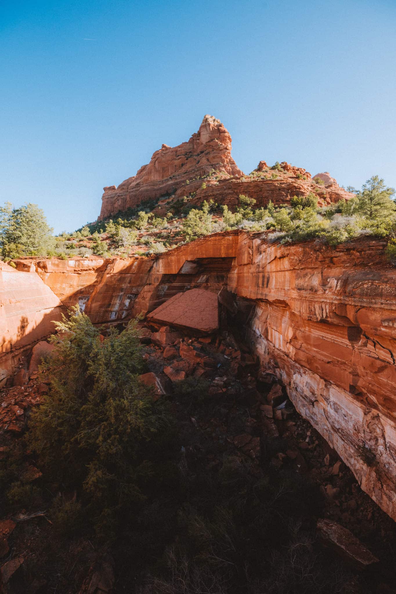
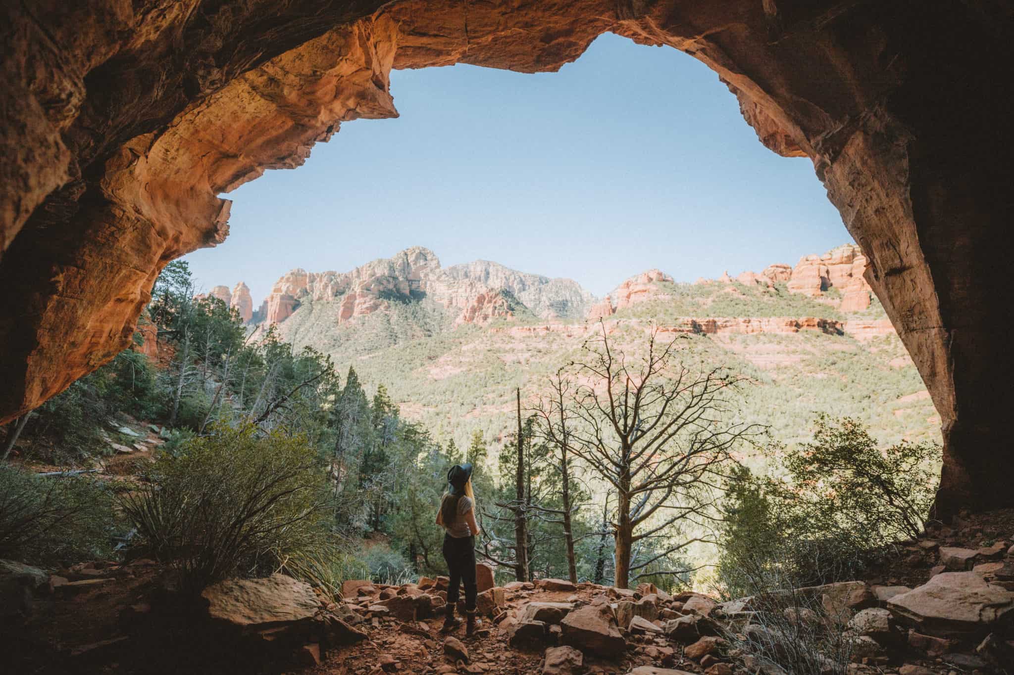
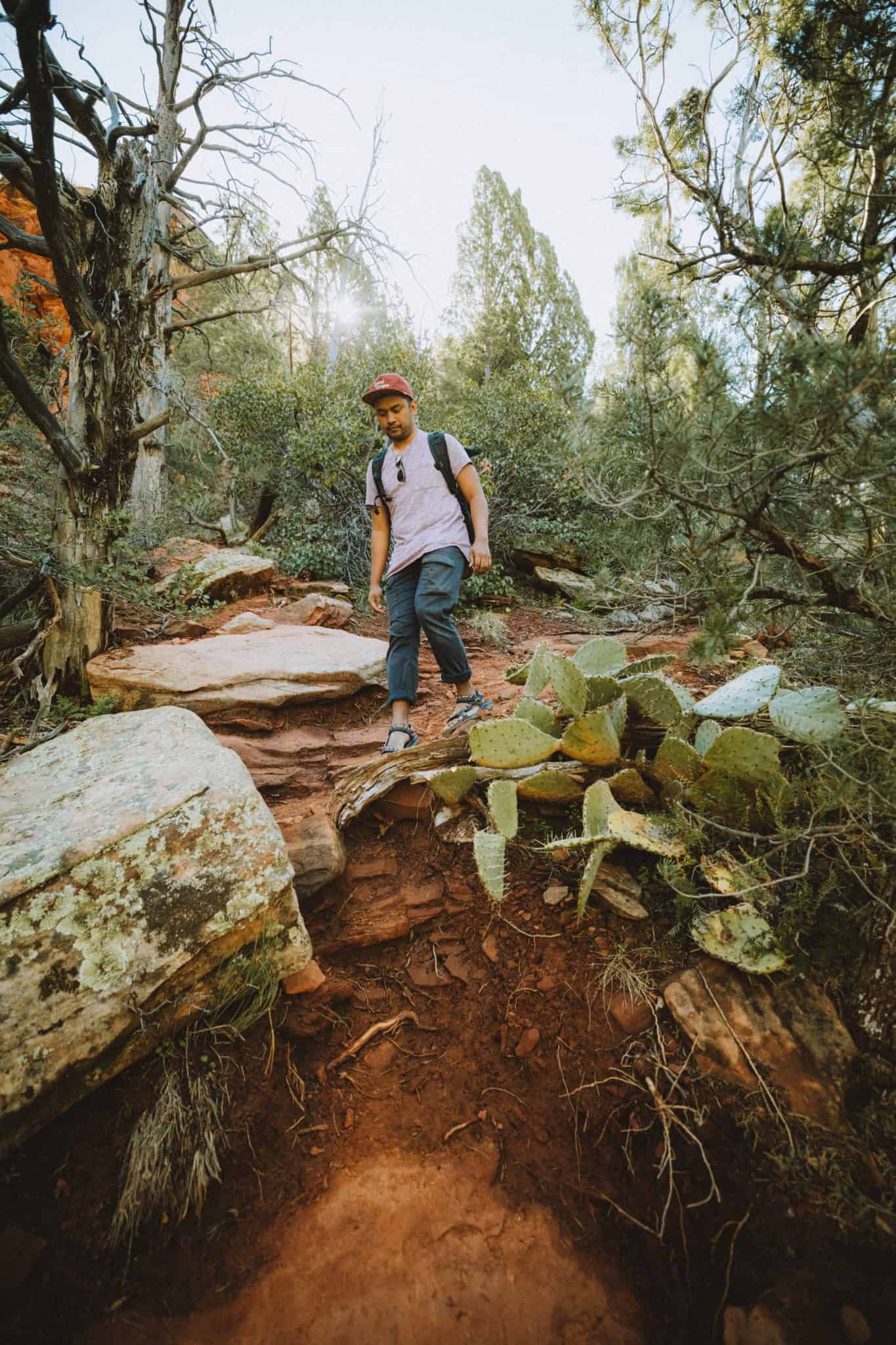
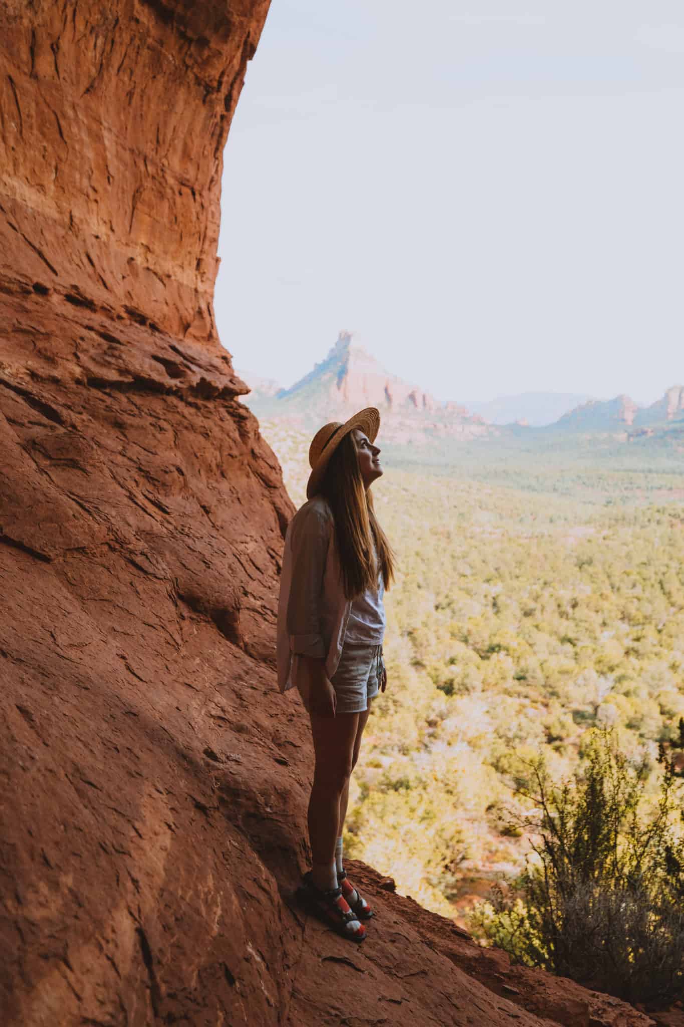
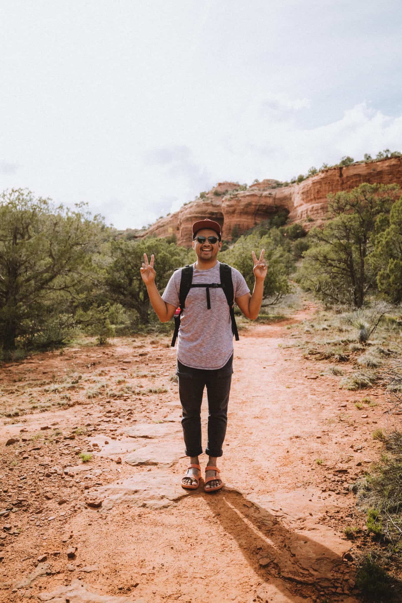
3. The Birthing Cave
- Trail Length: 2-miles out and back
- Elevation Gain: ~400 feet
- Difficulty: Easy
- Sedona Features: Sedona Caves, Wilderness Trail, Shares Trail With Mountain Bikes
- Trailhead Coordinates: Long Canyon Trailhead 34°54’24.0″N 111°49’27.5″W
Weird name, we know. (If you want a more in-depth guide to this trail, read our super-detailed guide on the Birthing Cave Trail.)
This was a spur of the moment hike for us – we saw a photo of this cave on a wall at a restaurant and knew we had to find it. Here are our tips and tricks to reaching this amazing Sedona cave:
We started our journey at Long Canyon Trailhead No. 122. There is no parking lot, just cars parked along the side of the road. There are dirt spaces to easily fit cars, just find a big enough space to park off of the main road. *Red Rock State Park Pass is Required Here*
The Long Canyon trail is flat and wide, and we shared it with a few mountain bikers. Walk for about 0.6 miles until you reach a fork. Take the left trail (which is smaller and less used) towards the tall red rock cliffs.

Once you see a depression in the cliff wall, keep your eye out for an even smaller path that forks to the right. That’s the cave! You’ll then hike a steep incline from here until the base of the cave.
Once inside, soak in the view of the Sedona valley below! You can also climb around inside and even reach the smaller depression (known as the “belly button”) to sit and relax for a bit.
The hike back is easy and leisurely. The entire trip (getting there and back) took us only 1.5 hours.
Photographer’s Note: The Birthing Cave is HUGE. We clearly didn’t bring a wide enough lens (we had a Canon 16-35mm) to capture the entire scene, so the photo you see above of the inside of the cave is about 20 photos stitched together in Adobe Lightroom.
The inside of the Birthing cave is shallow and round (like a womb? lol) and it required us to look in all directions to see it in its entirety!
Love Adventure? Read Our Top Hikes To Take In Arches National Park

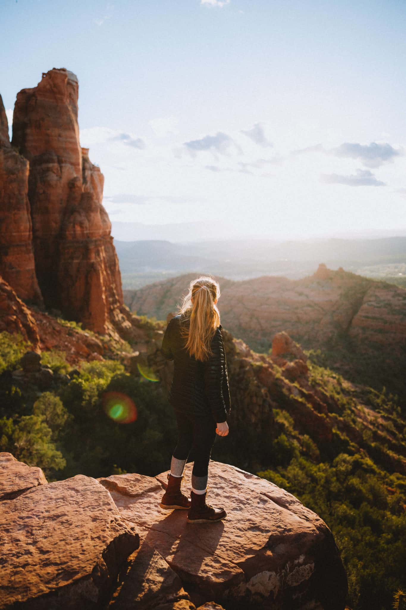
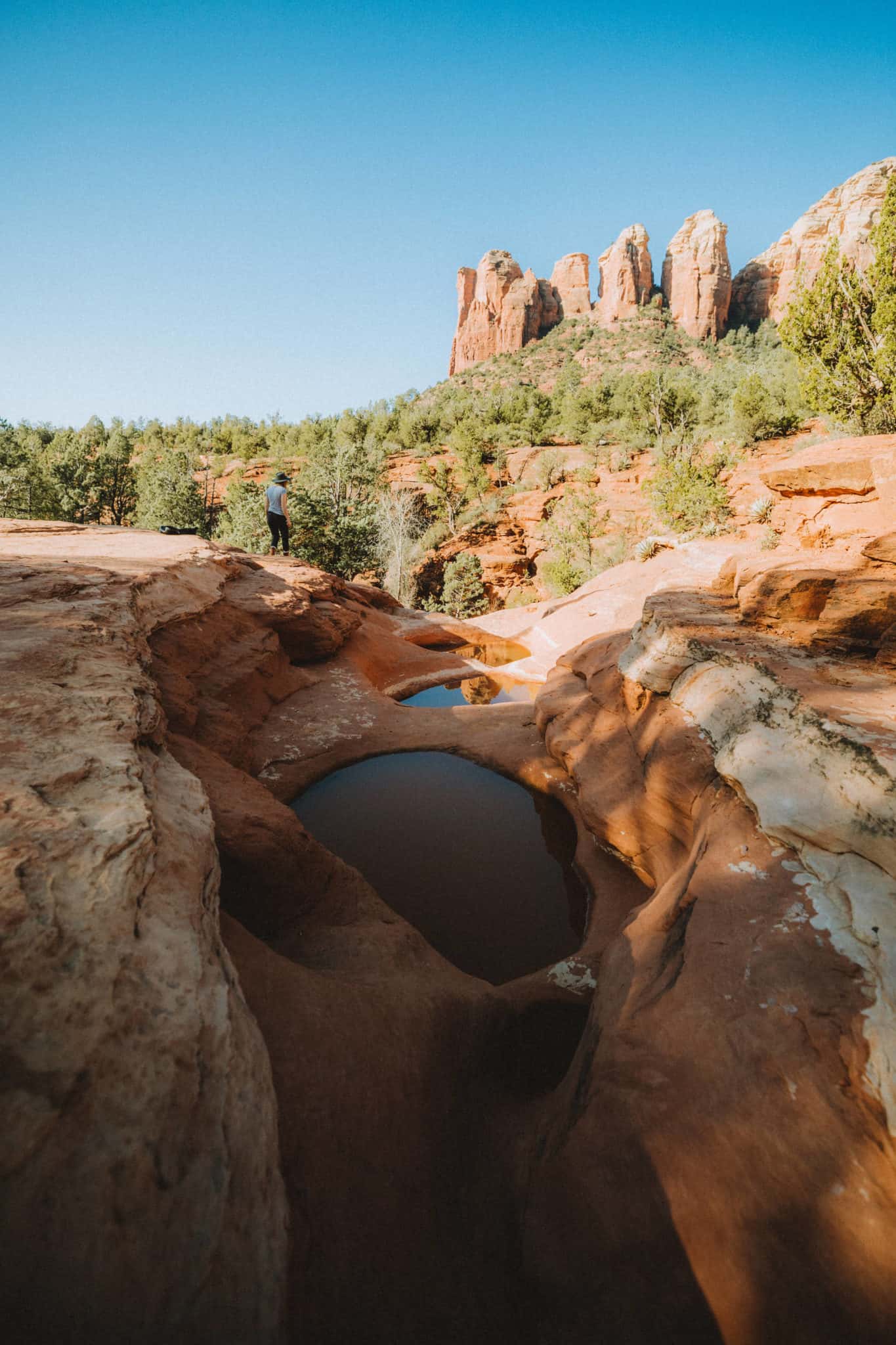
4. Soldiers Pass
- Trail Length: 4.5-miles out-and-back
- Elevation Gain: 650 feet
- Difficulty: Moderate (Difficult when climbing up into the cave)
- Trail Traffic: Heavy Use
- Sedona Features: Seven Sacred Pools, Sinkhole, Caves, Sedona wilderness trails
- Trailhead Location: Rim Shadows Drive Sedona, AZ 86336 / 34°53’03.4″N 111°47’01.8″W
Soldiers Pass trail is the hike to take if you want to be entertained the entire way. That’s probably why it’s a popular Sedona day hike for many families and tourists. Really, you won’t go 15 minutes without seeing features like sinkholes, caves, pools, or epic views of the Sedona desert!
This beginning part of Soldiers Pass Trail is a winding trail through trees, paired with busy back and forth foot traffic. You’ll also be sharing the space with Jeeps and off-road permitted vehicles taking tourists to-and-from these beautiful Sedona photography locations.
In the first mile of the trail, you’ll reach two trail attractions: Devil’s Kitchen Sinkhole and The Seven Sacred Pools. Here’s a little background information on these incredible Sedona viewpoints:
Devil’s Kitchen Sinkhole:
- This active sinkhole was created by the collapse of an underground cave. The latest major formation of the cave was in 1898 when the north side fell in, increasing the hole by 40%!
- The rain slowly dissolves the limestone walls, creating unstable conditions for the caves below – thus more collapses! It is currently 150 feet wide and 50 feet deep and still growing.
Seven Sacred Pools:
- The Seven Sacred pools look their best after a fresh bout of rain. After a heavy rain, the pools turn into cascading waterfalls that drop into the wash below.
After these attractions, if you’re looking for some more peace and quiet on the trail, continue on to the Red Rock Mountain Secret Wilderness Area.
Want to reach the cliff caves? Make sure to pay attention during this part of the trail, because we got a little bit lost at first!
Once you reach the sign that says “Entering Red Rock Secret Mountain Wilderness Area” take a left towards the cliffs on a trail that looks like it’s been blocked off with fallen branches and rocks.
From here, the trail gets steeper and rockier as you approach the red rock cliffs to Brins Mesa. All around are scenic views of Sedona and the contrasting red rocks and green landscapes.
Read More: Discover The Secret Caves of Soldiers Pass Trail In Sedona
Soldier’s Pass trail is probably one of the most interesting hikes in Sedona! We found this one to be our favorite because it felt like there was something new to see around every corner. We’d recommend putting this one on any Sedona weekend itinerary!
Parking Tip: The Soldiers Pass Trailhead No. 66 is a day-use only hiking trail in Sedona. The gate to the parking lot opens from 8:00 am – 6:00 pm and parking is limited to only 16 spaces. YIKES.
We highly suggest coming before 8:00 am to wait in line for the gate to open to secure your chances of getting a spot. They fill up within the first 15 minutes of opening.
Out Of Parking? Don’t fret! There are several Sedona hiking trails that interlink to Soldiers Pass. You can opt to park at a less-trafficked trailhead and extend your trail to see more of the amazing Sedona desert and still reach Soldiers Pass.
Park at these trailheads for an easier time but longer trail lengths:
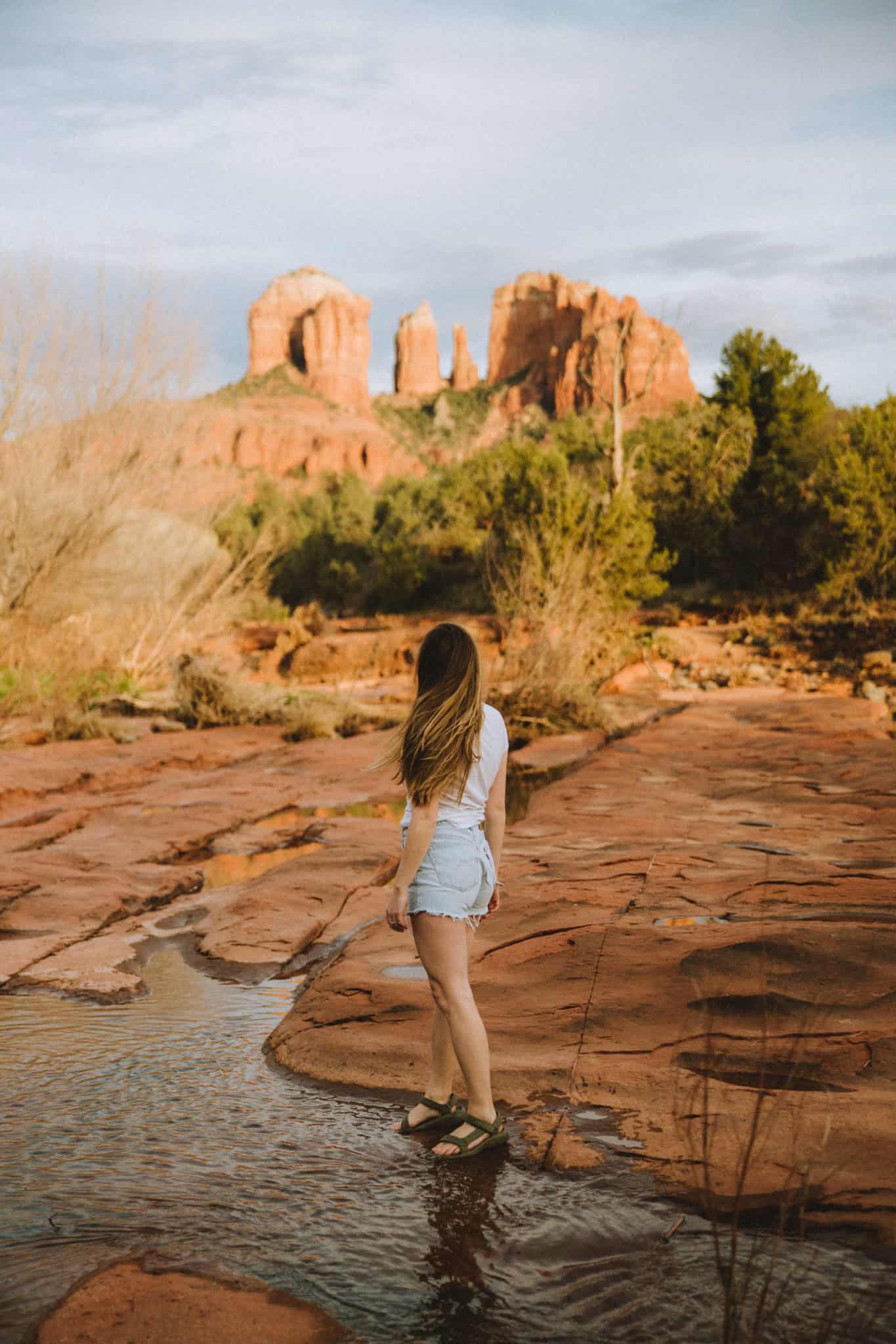
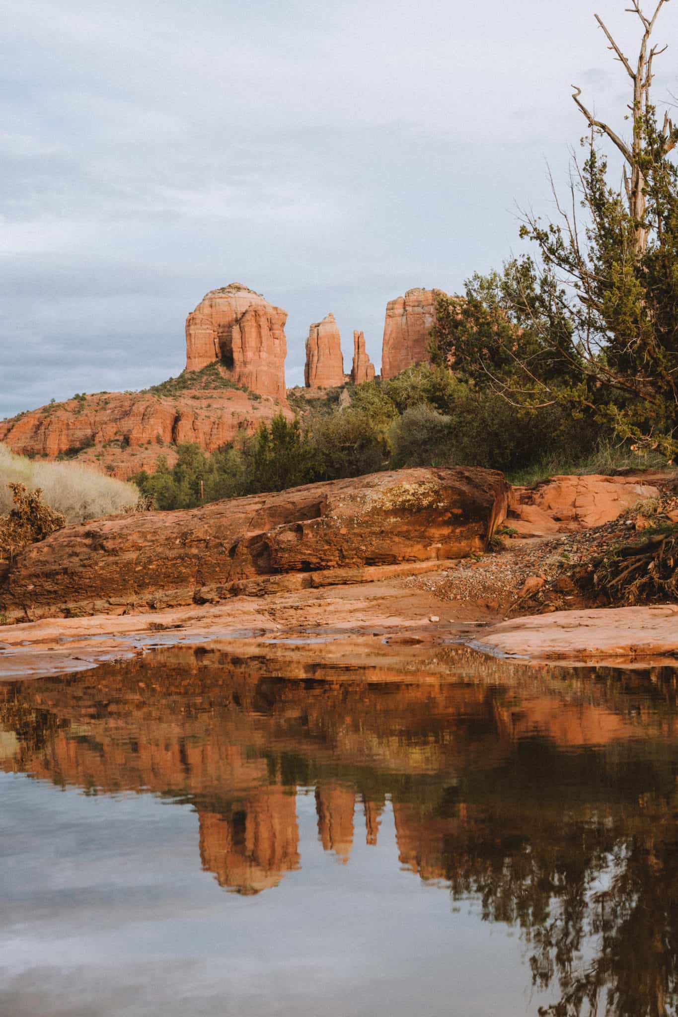
5. Red Rock Crossing (Via the Baldwin Trailhead)
- Trail Length: 0.2-miles out and back
- Elevation Gain: None / ~50 feet
- Difficulty: Easy (with an additional river crossing requiring skill + knowledge)
- Sedona Features: River Access, Views of Cathedral Rock, Easy Parking with Connections To Longer Sedona Hiking Trails
- Trailhead Location: Baldwin Trailhead / 34°49’18.8″N 111°48’29.0″W
Red Rock Crossing is a small section of Oak Creek riverfront with incredible views of Cathedral Rock in Sedona.
This place can get very busy during sunset for photographers, as the light hits the iconic rocks and is perfectly framed by the trees in the foreground.
The most common way to reach this easy Sedona trail is to park at the Crescent Moon Day Use Site (more on that below).
HOWEVER, the cheapskates we are, we chose to avoid the $10 day-use fee and park across the river instead.
Park at the Baldwin Trailhead (included in the Red Rock State Park Pass) and walk to the end of the road. You’ll see a small opening for a trail that will lead you down to the river. It’s a very short walk to the water.
At the river’s edge, we came across tons of desert tide pools and a huge raging river. Unfortunately, this made the river impassable, but we stayed for sunset anyways because we had an unobstructed view of Cathedral Rock!
Springtime Caution: If you are taking hikes in Sedona during the spring, expect the river levels to be high and impassable. If we would have known this information beforehand, we would have just sucked it up and parked at the Day Use area for easier access and tons more beautiful perspectives of Cathedral Rock during sunset.
How To Easily Get To Red Rock Crossing: The easiest way to reach this amazing Sedona viewpoint is to park at the Crescent Moon Day Use Site.
This place requires a $10 fee and is not included in your Red Rock Pass. This is a CASH ONLY and pay-on-site parking area, so come prepared with the correct amount.

6. Sugarloaf Loop
7. Fay Canyon Trail
8. Airport Mesa Trail

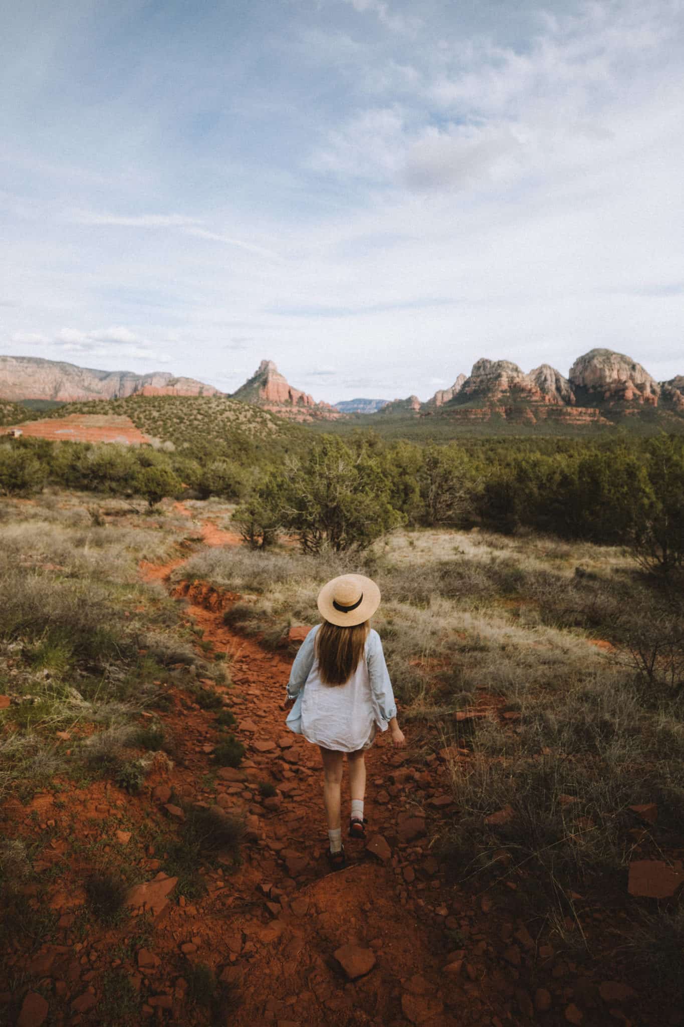
Other Amazing Sedona Hiking Trails To Consider
Berty and I have spent plenty of time in Sedona (see our guide to 3 days in Sedona) but that’s still not enough time to hike all the amazing trails here! There are enough trails and secret hidden gems that could easily occupy someones itinerary for a week or more.
Below, we’ve listed other popular hikes in Sedona and their trail distances, which we will plan to explore next time we visit Red Rock Country.
Easy Hikes In Sedona
- Palatki Ruins – 0.5-miles out and back (ancient cliff dwellings and cave markings)
- Fay Canyon Trail – 2.4-miles out and back (waterfalls, caves, natural bridge/arch)
Moderate Hikes In Sedona
- Boynton Canyon Trail – 6.1-mile out and back (vista views of Sedona, nature trails)
- Courthouse Butte Loop / Bell Rock Pathway – 3.9-mile loop (little to no shade, great views)
- Airport Mesa Trail – 3.2-miles round trip (view of iconic rocks)
- Brins Mesa Trail – (alternative route to Soldier’s Pass and red cliffs)
- Wilson Canyon Trail – 2.7-mile out and back (trail running, shaded, next to a stream)
Difficult / Long Hikes In Sedona
- Loy Canyon Trail to Loy Butte – 9.8-miles out and back (caves, ruins, climbing)
- Bear Mountain Trail – 4.3-miles out and back (high elevation gain, views of Sedona)
- West Fork Trail – 7.2-miles out and back trail (shaded by trees, river access)
Map of Popular Sedona Trails
Lucky for you, many of the best Sedona hiking trails are located near the center of all the action in Sedona. This is why many of the Sedona trails are popular – accessibility and outdoor opportunities are in abundance here!
Click the map of Sedona hiking trails below to discover directions to each location.
7 Essential Tips For Sedona Hikes
1. Carry Lots Of Water
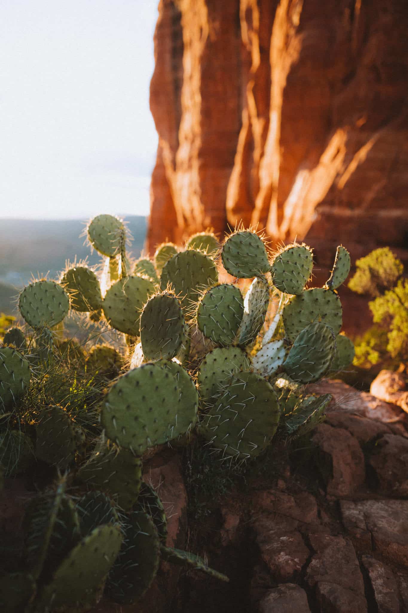
Sedona, Arizona is located in the desert.
The general rule (from The Green Belly Blog) is to bring a half-liter of water for every 1 hour of hiking. This will ensure you have plenty of water for the trail to keep yourself happy and hydrated.
Summers can be sweltering hot, and many of the hikes in Sedona provide little shade. Avoid dehydration by bringing a large enough water bottle, like this one from Nalgene.
2. Wear Sunscreen + Sun Protection
We all know the feeling of getting sunburnt on day 2 of your vacation – the rest of the time, your skin is miserable and feels painful!
Avoid that feeling altogether and make sure to pack plenty of sunscreen. We don’t like dealing with messy lotions, so our go-to way of slathering up is an easy application spray can of sunscreen like this mineral one from Sun Bum .
3. Consider Hiking During Sunrise or Sunset
Like stated above, hikes in Sedona can be super hot during the day. If you wish to avoid the heat, consider hiking before the sun rises or just before the sun sets! Make sure to pack a headlamp to find your way in the dark.
Best Sedona hikes for sunrise and sunset:
- Devils Bridge
- Cathedral Rock
- Red Rock Crossing
- Bear Mountain
4. Should You Bring Your Drone To Sedona?
There are specific rules and regulations about where you can fly drones in Sedona.
Make sure to brush up on all of the available information to avoid hefty fines or even jail time (yes, it’s that serious).
Here are some important things to remember about flying drones in Sedona:
- Comply with all FAA Regulations
- Call to make sure no temporary flight restrictions are in place.
- UAS have to be flown under 400 feet
- You cannot take off or land in designated wilderness areas.
- Never launch/land near or approach wildlife.
- Fly at least 5 miles away from any airstrip or airport.
- Don’t fly on private property.
The rules and regulations for flying drones in Sedona change, so make sure to call the local number at 928-282-1046 or the FAA 480-419-0111 to make sure your plans are safe and appropriate.
Sedona Recreations Flying Information can be found here.
5. Watch Out For Dangerous Sedona Wildlife
Most of the time, you’ll come across non-dangerous wildlife like a desert jackrabbit, some ravens, and beautiful buzzing hummingbirds.
But occasionally, you may spot a snake or scorpion on the trail. There’s no need to fret though – many times they are more afraid of you than you are of them!
The deeper in the backcountry you explore, the higher your chances are of encountering dangerous wildlife. Make sure to stop by the Red Rock Visitors Center to ask questions about specific trails or areas for a more accurate account of animal activity.
Rattlesnakes, scorpions and even bees are the most common dangerous occurrence on Sedona hikes. Make sure to educate yourself on the potential hazards of your trail, and know the basic emergency procedures if you encounter such danger.
6. Remember To Leave No Trace!
This is a rule not just earmarked for Sedona hiking trails, but trails everywhere in the world! The general basics of this simply this: leave no trace of your existence on a trail.
This means packing your trash out, staying on trails, not taking anything with you (like rocks, dirt or plants), and leaving as little impact on your surroundings as possible.
If you are unfamiliar with the Leave No Trace principles, click here to read more about outdoor ethics and practices to be a good steward of the Earth.
7. Keep In Mind The High Elevation In Sedona
Little known fact, but Sedona, Arizona sits 4,350 feet above sea level! This is much higher than many other major US cities.
Many people don’t experience altitude sickness until between 5,000 and 10,000 feet, but it’s still good to be aware of how your body handles elevation change when visiting Sedona.
You’ll mostly feel like your lungs and heart are working just a bit harder on Sedona hikes. Be aware of how you are feeling and take plenty of breaks if you get tired.

Pack These Things For Sedona Hikes
Want a more complete list? Read our complete Sedona packing list, for season by season specifics!
1. Sturdy Shoes For Hikes In Sedona
Sedona is Red Rock Country, and rocks = ankle twisters.
When hiking around Sedona, it’s super important to wear sturdy shoes or sandals on the trails. We recommend brands like Teva (waterproof and strappy), Salomon Mid Rise Hiking Boots, or even Keens sandals that have a closed-toe front.
Sandals that secure to your feet as especially important on Sedona hikes with water, where you could be crossing over and through streams and rivers. You want to make sure your shoes stay on your feet!
2. Water Bottle
As stated above, it’s important to stay hydrated on hiking trails in Sedona, especially in the hot summer season!
To keep your drink extra cold, go with a Hydroflask, which is vacuum-sealed and keeps your liquids cold for up to 24 hours. Choose this kind that has a built-in straw, and bring it to your favorite coffee shop to fill it up with icy goodness.
3. Trail Snacks For Hikes In Sedona
Some of the trails we suggested are day-long hikes, and it’s important to bring some food for an energy boost during your expedition!
This can look like taking a few Ziploc bags of trail mix, packing sandwiches, or
Want to pack your own snacks? Check out 10+ quick and easy meals to make while on the road!
4. Sunscreen + Sun Protection
Again, we will repeat the importance of sunscreen. Not only that but wearing protective layers and clothing can go a long way in making your trip comfortable and fun!
These hiking hats from Outdoor Research come in tons of colors and protect your neck and face from the sun. We also recommend wearing sunglasses to protect your eyes!
5. Sweat-Wicking Clothes
Taking these amazing hikes in Sedona will bring you to some amazing places, but not without working up a sweat!
Make sure to choose moisture-wicking clothing (aka NOT cotton), to pull the sweat away from your body and stay cool and dry while hiking.
6. Light Jacket For Morning or Winter Hikes In Sedona
Hiking in the early morning or late in the evening? Nights can get cold in the Sedona desert so it’s important to bring layers!

What are some of your favorite Sedona hikes? Leave some suggestions for more Sedona hiking trails we should add to our list next time we return for an Arizona adventure!
MORE SOUTHWEST ADVENTURES
10 Destinations You Must See In The American Southwest
The Ultimate Utah National Parks Road Trip
Hiking Angels Landing in Zion National Park
Love hikes in Sedona? You’ll like these 10 Amazing Hikes In Arches National Park
Hike Delicate Arch Trail During Sunrise
How To Find the Movie Road In Alabama Hills, California
Spend a Sunset In Canyonlands National Park
Pin These Incredible Hikes in Sedona for later!


This post is awesome ! How many days did you spend in Sedona to be able to do all these hikes ??
Hi! It took us about 3 days! It was a long, but very fun weekend trip! I wish we had more time in Sedona!
Hi Emily and Berty. You inspire me with your stories! That’s an adventure experience that I never touched. I’m taking with my friends after reading your blog with a new plan to visit an adventure world like hiking in Sedona. How long did you spend time there? So, I can make a good plan. I’m very excited with this trip.
Hi Alice! I’m so glad our post inspired you to Visit Sedona! This last trip, we spent 3 nights in Sedona, this is plenty of time to see a lot of places!
I write a lot about hiking and love this article. I’ve been working on an AZ itinerary and was thinking that Sedona was okay to skip since it’s so popular, but OMG, I need to do all the hikes and take all the photos. Beautiful pics too. 🙂
Hi Rob! I’m so glad this article changed your mind about Arizona! We totally think Sedona is worth a visit and we hope you get a chance to visit someday!
I’ve always wanted to go to Sedona… I loooove the red rock so much! I’ve been down to Arches and area with my family a few times, but haven’t made it to Sedona yet. It’s definitely high on my list of places to go. The hikes look absolutely amazing. 😀
Same Sam! We love the red rocks too, and it was so refreshing to see in Arizona!